
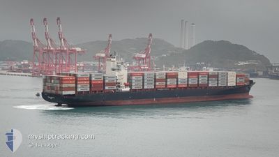
MERKUR ARCHIPELAGO
Container Ship
Current Trip
ABIDJAN
| Time Travelled | 2 days |
|---|---|
| Remaining Time | --- |
| Distance Travelled | 1093.61 nm |
| Remaining Distance | --- |
| AVG Speed | 15.5 Noeuds |
| MAX Speed | 18.4 Noeuds |
| AVG Wind | 9.9 knots |
| MAX Wind | 15.5 knots |
| MIN Temp | 23.8°C / 74.84°F |
| MAX Temp | 29.4°C / 84.92°F |
| Tirant d eau | 12.4 m |
| Position reçue | 11 d depuis |
Current Position
| Longitude | -13.35300° |
|---|---|
| Latitude | 28.09884° |
| Etat | Under way using engine |
| Vitesse | 18.4 Noeuds |
| Parcours | 214.9° |
| Zone | North Atlantic Ocean |
| Station | T-AIS |
| Position reçue | 11 d depuis |
Info
Information
The current position of MERKUR ARCHIPELAGO is in North Atlantic Ocean with coordinates 28.09884° / -13.35300° as reported on 2024-04-22 03:56 by AIS to our vessel tracker app. The vessel's current speed is 18.4 Noeuds
The vessel MERKUR ARCHIPELAGO (IMO: 9456977, MMSI: 636091883) is a Container Ship that was built in 2009 ( 15 Age ). It's sailing under the flag of [LR] Liberia.
In this page you can find informations about the vessels current position, last detected port calls, and current voyage information. If the vessels is not in coverage by AIS you will find the latest position.
The current position of MERKUR ARCHIPELAGO is detected by our AIS receivers and we are not responsible for the reliability of the data. The last position was recorded while the vessel was in Coverage by the Ais receivers of our vessel tracking app.
The current draught of MERKUR ARCHIPELAGO as reported by AIS is 12.4 meters
Weather
| Temperature | 23.8°C / 74.84°F |
|---|---|
| Wind Speed | 16 knots |
| Direction | 337° NNW |
| Pressure | 1008.8 hPa |
| Humidity | 79.1 % |
| Cloud Coverage | --- |
Featured Company
Last Port Calls
| Port | Arrival | Departure | Time In Port |
|---|---|---|---|
| 2024-04-28 23:10 | 2024-04-30 18:58 | 1 d | |
| 2024-04-19 21:32 | 2024-04-20 16:51 | 19 h | |
| 2024-04-19 02:56 | 2024-04-19 12:59 | 10 h | |
| 2024-04-09 06:43 | 2024-04-10 19:16 | 1 d | |
| 2024-03-31 17:30 | 2024-04-01 08:38 | 15 h | |
| 2024-03-18 09:56 | |||
| 2024-03-09 22:38 | 2024-03-10 12:32 | 13 h |
Most Visited Ports (Last year)
| Port | Arrivals | |
|---|---|---|
| 8 | ||
| 7 | ||
| 6 | ||
| 5 | ||
| 5 | ||
| 5 |
Last Trips
| Origin | Departure | Destination | Arrival | Distance | |
|---|---|---|---|---|---|
| 2024-04-20 18:51 | 2024-04-28 23:10 | 2717.70 nm | |||
| 2024-04-19 13:59 | 2024-04-19 23:32 | 50.79 nm | |||
| 2024-04-10 19:16 | 2024-04-19 03:56 | 2847.13 nm | |||
| 2024-04-01 08:38 | 2024-04-09 06:43 | 2783.90 nm | |||
| 2024-03-18 09:56 | 2024-03-31 17:30 | 2971.30 nm | |||
| 2024-02-24 05:51 | 2024-03-09 23:38 | 3875.94 nm |
Events
| Heure | Evenement | Détails | Position/ Destination | Info |
|---|---|---|---|---|
| 2024-04-30 18:58 | PORT DE DEPART |
|
5.24594 / -3.99673
ABIDJAN
|
Vitesse: 9.2 kn Parcours: 125° |
| 2024-04-30 18:38 | Démarrage |
5.27323 / -4.02790
[CI] ABIDJAN
|
Vitesse: 5.1 kn Parcours: 148° |
|
| 2024-04-28 23:46 | Arret |
5.28257 / -4.01845
[CI] ABIDJAN
|
Vitesse: 0.1 kn Parcours: 4° |
|
| 2024-04-28 23:10 | Port d'arrivée |
|
5.25135 / -4.00536
[CI] ABIDJAN
|
Vitesse: 10.5 kn Parcours: 308° |
| 2024-04-28 22:51 | Démarrage | 6.23 nm, South East of ABIDJAN |
5.22098 / -3.98506
ABIDJAN
|
Vitesse: 3.2 kn Parcours: 352° |
| 2024-04-28 22:23 | Arret | 6.4 nm, South East of ABIDJAN |
5.21885 / -3.98251
ABIDJAN
|
Vitesse: 0.3 kn Parcours: 296° |
| 2024-04-28 19:52 | Démarrage |
4.90179 / -4.01971
ABIDJAN
|
Vitesse: 5.3 kn Parcours: 49° |
|
| 2024-04-27 19:45 | Arret |
4.74500 / -4.25833
ABIDJAN
|
Vitesse: Parcours: -1° |