

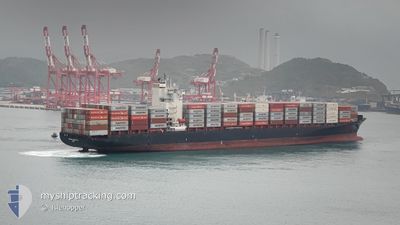
MERKUR ARCHIPELAGO
Container Ship

Current Trip
| Time Travelled | 15 days |
|---|---|
| Remaining Time | --- |
| Distance Travelled | 2184.86 nm |
| Remaining Distance | 8.30 nm |
| AVG Speed | 10.9 Knopen |
| MAX Speed | 20.3 Knopen |
| AVG Wind | 14.5 knots |
| MAX Wind | 27.8 knots |
| MIN Temp | 14.4°C / 57.92°F |
| MAX Temp | 28°C / 82.4°F |
| Diepgang | 11.2 M |
| Positie ontvangen | 3 d geleden |
Current Position
| Lengtegraad | --- |
|---|---|
| Breedtegraat | --- |
| Status | Under way using engine |
| Snelheid | 9.9 Knopen |
| Koers | 196.4° |
| Gebied | South China Sea |
| Station | T-AIS |
| Positie ontvangen | 3 d geleden |
Information
The current position of MERKUR ARCHIPELAGO is in South China Sea with coordinates 20.57905° / 106.89989° as reported on 2025-02-14 16:06 by AIS to our vessel tracker app. The vessel's current speed is 9.9 Knopen and is heading at the port of VUNG TAU. The estimated time of arrival as calculated by MyShipTracking vessel tracking app is 2025-02-18 18:30 LT
The vessel MERKUR ARCHIPELAGO (IMO: 9456977, MMSI: 636091883) is a Container Ship that was built in 2009 ( 16 Jaar oud ). It's sailing under the flag of [LR] Liberia.
In this page you can find informations about the vessels current position, last detected port calls, and current voyage information. If the vessels is not in coverage by AIS you will find the latest position.
The current position of MERKUR ARCHIPELAGO is detected by our AIS receivers and we are not responsible for the reliability of the data. The last position was recorded while the vessel was in Coverage by the Ais receivers of our vessel tracking app.
The current draught of MERKUR ARCHIPELAGO as reported by AIS is 11.2 meters
Weather
| Temperature | 25.6°C / 78.08°F |
|---|---|
| Wind Speed | 12 knots |
| Direction | 106° ESE |
| Pressure | 1011.5 hPa |
| Humidity | 79.6 % |
| Cloud Coverage | 13 % |


Featured Company
Most Visited Ports (Last year)
| Port | Arrivals | |
|---|---|---|
| 9 | ||
| 8 | ||
| 1 | ||
| 1 | ||
| 1 | ||
| 1 |
Last Trips
| Origin | Departure | Destination | Arrival | Distance | |
|---|---|---|---|---|---|
| 2025-01-30 23:37 | 2025-02-03 06:39 | 1481.86 nm | |||
| 2024-12-21 11:33 | 2025-01-29 17:49 | 11636.67 nm | |||
| 2024-12-16 13:18 | 2024-12-20 14:33 | 1036.22 nm | |||
| 2024-12-09 17:06 | 2024-12-14 12:10 | 563.13 nm | |||
| 2024-11-16 15:36 | 2024-12-09 05:14 | 9714.97 nm |
Events
| Tijd | Evenement | Details | Positie / Bestemming | Info |
|---|---|---|---|---|
| 2025-02-18 11:23 | Stop beweging | 1.75 nm, South West of CAI MEP |
10.51532 / 107.01300
VUNG TAU
|
Snelheid: Koers: 28° |
| 2025-02-14 16:08 | Status Changed | Default Under way using engine |
20.57227 / 106.89819
VUNG TAU
|
Snelheid: 9.9 kn Koers: 196.4° |
| 2025-02-14 16:06 | Buitenbereik |
20.57905 / 106.89989
South China Sea
VUNG TAU
|
Snelheid: 9.9 kn Koers: 196.4° |
|
| 2025-02-14 16:04 | Status Changed | Under way using engine Default |
20.58437 / 106.90156
VUNG TAU
|
Snelheid: 9 kn Koers: 171° |
| 2025-02-14 15:47 | Status Changed | Default Under way using engine |
20.62670 / 106.89977
VUNG TAU
|
Snelheid: 6.6 kn Koers: 253.8° |
| 2025-02-14 15:29 | Status Changed | Under way using engine Default |
20.64319 / 106.94688
VUNG TAU
|
Snelheid: 15.1 kn Koers: 181° |
| 2025-02-14 15:29 | Binnenbereik |
20.64080 / 106.93679
South China Sea
VUNG TAU
|
Snelheid: 13.1 kn Koers: 255.6° |
|
| 2025-02-14 14:38 | Status Changed | Default Under way using engine |
20.77247 / 106.92973
VUNG TAU
|
Snelheid: 5.7 kn Koers: 148.8° |
| 2025-02-14 14:30 | Start beweging | 11.08 nm, South East of HAI PHONG |
20.78726 / 106.91923
VUNG TAU
|
Snelheid: 5.7 kn Koers: 148.8° |
| 2025-02-14 14:30 | Buitenbereik |
20.78726 / 106.91923
South China Sea
VUNG TAU
|
Snelheid: 5.7 kn Koers: 148.8° |