
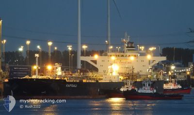
KAPSALI
Crude Oil Tanker
Current Trip
| Time Travelled | --- |
|---|---|
| Remaining Time | --- |
| Distance Travelled | 4793.52 nm |
| Remaining Distance | --- |
| AVG Speed | 10.9 Knop |
| MAX Speed | 16 Knop |
| AVG Wind | 8.4 knots |
| MAX Wind | 24.8 knots |
| MIN Temp | 20.9°C / 69.62°F |
| MAX Temp | 29.1°C / 84.38°F |
| Djupgående | 9 m |
| Position mottagen | 21 d sen |
Current Position
| Longitud | --- |
|---|---|
| Latitude | --- |
| Status | Under way using engine |
| Fart | 10.4 Knop |
| Kurs | 321.5° |
| Område | Laccadive Sea |
| Station | T-AIS |
| Position mottagen | 21 d sen |
Info
Information
The current position of KAPSALI is in Laccadive Sea with coordinates 7.89639° / 76.78345° as reported on 2025-12-13 06:31 by AIS to our vessel tracker app. The vessel's current speed is 10.4 Knop and is heading at the port of MUMBAI.
The vessel KAPSALI (IMO: 9587312, MMSI: 538008333) is a Crude Oil Tanker that was built in 2011 ( 15 År gammal ). It's sailing under the flag of [MH] Marshall Is.
In this page you can find informations about the vessels current position, last detected port calls, and current voyage information. If the vessels is not in coverage by AIS you will find the latest position.
The current position of KAPSALI is detected by our AIS receivers and we are not responsible for the reliability of the data. The last position was recorded while the vessel was in Coverage by the Ais receivers of our vessel tracking app.
The current draught of KAPSALI as reported by AIS is 9 meters
Weather
| Temperature | 21.7°C / 71.06°F |
|---|---|
| Wind Speed | 6 knots |
| Direction | 282° WNW |
| Pressure | 1017.8 hPa |
| Humidity | 66.8 % |
| Cloud Coverage | --- |
Featured Company
Last Port Calls
Most Visited Ports (Last year)
| Port | Arrivals | |
|---|---|---|
| 2 | ||
| 2 | ||
| 1 | ||
| 1 | ||
| 1 | ||
| 1 |
Last Trips
| Origin | Departure | Destination | Arrival | Distance |
|---|
Events
| Tid | Event | Detaljer | Position / Dest | Information |
|---|---|---|---|---|
| 2026-01-02 15:10 | STOPPAR förflyttning | 10.38 nm, East of KHORFAKKAN |
25.37100 / 56.55226
MUMBAI
|
Fart: Kurs: 349° |
| 2025-12-30 10:16 | STARTAR förflyttning | 3.34 nm, South of MUMBAI |
18.93108 / 72.88728
MUMBAI
|
Fart: 7.7 kn Kurs: 240° |
| 2025-12-28 13:15 | STOPPAR förflyttning | 3.11 nm, South East of MUMBAI |
18.93733 / 72.89382
MUMBAI
|
Fart: Kurs: 57° |
| 2025-12-28 06:36 | STARTAR förflyttning |
19.13237 / 72.51722
MUMBAI
|
Fart: 4.3 kn Kurs: 232° |