
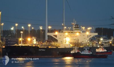
KAPSALI
Crude Oil Tanker
Current Trip
| Time Travelled | 45 days |
|---|---|
| Remaining Time | --- |
| Distance Travelled | 6177.62 nm |
| Remaining Distance | --- |
| AVG Speed | 11.6 Knots |
| MAX Speed | 15.6 Knots |
| AVG Wind | 7.7 knots |
| MAX Wind | 23 knots |
| MIN Temp | 22.9°C / 73.22°F |
| MAX Temp | 30.9°C / 87.62°F |
| Dybgang | 9 m |
| Position Modtaget | 1 m siden |
Current Position
| Longitude | --- |
|---|---|
| Latitude | --- |
| Status | At anchor |
| Fart | |
| Kurs | 129° |
| Område | Gulf of Oman |
| Station | T-AIS |
| Position Modtaget | 1 m siden |
Info
Information
The current position of KAPSALI is in Gulf of Oman with coordinates 25.29398° / 56.50536° as reported on 2024-11-23 13:36 by AIS to our vessel tracker app. The vessel's current speed is 0 Knots
The vessel KAPSALI (IMO: 9587312, MMSI: 538008333) is a Crude Oil Tanker that was built in 2011 ( 13 år gamle ). It's sailing under the flag of [MH] Marshall Is.
In this page you can find informations about the vessels current position, last detected port calls, and current voyage information. If the vessels is not in coverage by AIS you will find the latest position.
The current position of KAPSALI is detected by our AIS receivers and we are not responsible for the reliability of the data. The last position was recorded while the vessel was in Coverage by the Ais receivers of our vessel tracking app.
The current draught of KAPSALI as reported by AIS is 9 meters
Weather
| Temperature | 27.3°C / 81.14°F |
|---|---|
| Wind Speed | 6 knots |
| Direction | 178° S |
| Pressure | 1013.3 hPa |
| Humidity | 56.9 % |
| Cloud Coverage | 100 % |
Featured Company
Most Visited Ports (Last year)
| Port | Arrivals | |
|---|---|---|
| 1 | ||
| 1 | ||
| 1 | ||
| 1 | ||
| 1 | ||
| 1 |
Last Trips
| Origin | Departure | Destination | Arrival | Distance | |
|---|---|---|---|---|---|
| 2024-09-01 00:54 | 2024-10-08 16:46 | 6036.37 nm |
Events
| Tid | Hændelsen | Detaljer | Position / Dest | Info |
|---|---|---|---|---|
| 2024-11-23 10:54 | Status er ændret | At anchor Default |
25.29360 / 56.50515
AE FJR
|
Fart: Kurs: 111° |
| 2024-11-23 10:48 | Status er ændret | Default At anchor |
25.29349 / 56.50518
AE FJR
|
Fart: Kurs: 111° |
| 2024-11-23 09:36 | Status er ændret | At anchor Under way using engine |
25.29373 / 56.50503
AE FJR
|
Fart: 0.3 kn Kurs: 126° |
| 2024-11-23 09:31 | STOP Sejllads | 8.7 nm, South East of KHORFAKKAN |
25.29351 / 56.50545
AE FJR
|
Fart: 0.3 kn Kurs: 121° |
| 2024-11-23 06:54 | START Sejllads | 12.41 nm, East of KHORFAKKAN |
25.39582 / 56.58641
AE FJR
|
Fart: 3.1 kn Kurs: 96° |
| 2024-11-23 06:54 | Status er ændret | Under way using engine At anchor |
25.39586 / 56.58623
AE FJR
|
Fart: 2.5 kn Kurs: 101° |
| 2024-11-23 06:54 | Destination er ændret | AE FJR AE KLF |
25.39619 / 56.58494
AE FJR
|
Fart: 2.5 kn Kurs: 101° |
| 2024-11-23 06:54 | ETA er ændret | 2024/11/23 09:00 2024/11/05 04:00 |
25.39619 / 56.58494
AE FJR
|
Fart: 2.5 kn Kurs: 101° |
| 2024-11-23 06:14 | Status er ændret | At anchor Default |
25.39732 / 56.58476
AE KLF
|
Fart: 0.1 kn Kurs: 93° |
| 2024-11-23 06:11 | Status er ændret | Default At anchor |
25.39725 / 56.58490
AE KLF
|
Fart: 0.1 kn Kurs: 92° |