
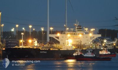
KAPSALI
Crude Oil Tanker
Current Trip
| Time Travelled | 34 days |
|---|---|
| Remaining Time | 4 days |
| Distance Travelled | 7227.70 nm |
| Remaining Distance | 1390.12 nm |
| AVG Speed | 10.7 Knots |
| MAX Speed | 14.5 Knots |
| AVG Wind | 12.2 knots |
| MAX Wind | 33 knots |
| MIN Temp | 4.5°C / 40.1°F |
| MAX Temp | 29°C / 84.2°F |
| Draught | 9 m |
| Position Received | 7 h, 40 m ago |
Current Position
| Longitude | --- |
|---|---|
| Latitude | --- |
| Status | Under way using engine |
| Speed | 12.8 Knots |
| Course | 284.9° |
| Area | Malacca Strait |
| Station | T-AIS |
| Position Received | 7 h, 40 m ago |
Info
Information
The current position of KAPSALI is in Malacca Strait with coordinates 1.22133° / 103.46175° as reported on 2025-02-17 02:29 by AIS to our vessel tracker app. The vessel's current speed is 12.8 Knots and is heading at the port of GALLE. The estimated time of arrival as calculated by MyShipTracking vessel tracking app is 2025-02-21 22:41 LT
The vessel KAPSALI (IMO: 9587312, MMSI: 538008333) is a Crude Oil Tanker that was built in 2011 ( 14 years old ). It's sailing under the flag of [MH] Marshall Is.
In this page you can find informations about the vessels current position, last detected port calls, and current voyage information. If the vessels is not in coverage by AIS you will find the latest position.
The current position of KAPSALI is detected by our AIS receivers and we are not responsible for the reliability of the data. The last position was recorded while the vessel was in Coverage by the Ais receivers of our vessel tracking app.
The current draught of KAPSALI as reported by AIS is 9 meters
Weather
| Temperature | 27.9°C / 82.22°F |
|---|---|
| Wind Speed | 9 knots |
| Direction | 325° NW |
| Pressure | 1008.6 hPa |
| Humidity | 74.5 % |
| Cloud Coverage | 76 % |
Featured Company
Last Port Calls
| Port | Arrival | Departure | Time In Port |
|---|---|---|---|
| 2025-01-13 07:47 | 2025-01-14 06:19 | 22 h | |
| 2024-12-21 02:09 | 2024-12-24 07:35 | 3 d |
Most Visited Ports (Last year)
| Port | Arrivals | |
|---|---|---|
| 2 | ||
| 2 | ||
| 1 | ||
| 1 | ||
| 1 | ||
| 1 |
Last Trips
| Origin | Departure | Destination | Arrival | Distance | |
|---|---|---|---|---|---|
| 2024-12-24 10:35 | 2025-01-13 11:47 | 530.52 nm | |||
| 2024-10-09 15:50 | 2024-12-21 05:09 | 4371.03 nm |
Events
| Time | Event | Details | Position / Dest | Info |
|---|---|---|---|---|
| 2025-02-17 02:37 | Status Changed | Default Under way using engine |
1.22961 / 103.43513
GALLE
|
Speed: 12.8 kn Course: 284.9° |
| 2025-02-17 02:29 | Change Sea Area | Malaysian part of the Malacca Strait Malaysian part of the Singapore Strait |
1.22133 / 103.46175
Malacca Strait
GALLE
|
Speed: 12.8 kn Course: 284.9° |
| 2025-02-17 02:29 | OUT of Coverage |
1.22133 / 103.46175
Malacca Strait
GALLE
|
Speed: 12.8 kn Course: 284.9° |
|
| 2025-02-17 02:28 | Status Changed | Under way using engine Default |
1.21981 / 103.46734
GALLE
|
Speed: 12.9 kn Course: 285° |
| 2025-02-17 02:09 | Status Changed | Default Under way using engine |
1.20202 / 103.53097
GALLE
|
Speed: 12 kn Course: 281.9° |
| 2025-02-17 01:56 | Change Sea Area | Malaysian part of the Singapore Strait Indonesian part of the Singapore Strait |
1.19272 / 103.57572
Singapore Strait
GALLE
|
Speed: 11.7 kn Course: 276.1° |
| 2025-02-17 00:56 | Change Sea Area | Indonesian part of the Singapore Strait Singaporean part of the Singapore Strait |
1.13925 / 103.72744
Singapore Strait
GALLE
|
Speed: 8.9 kn Course: 287.2° |
| 2025-02-16 23:15 | START Moving | 3.99 nm, East of SINGAPORE |
1.26652 / 103.92029
GALLE
|
Speed: 3.1 kn Course: 112° |
| 2025-02-16 23:10 | Destination Changed | GALLE SG SIN |
1.26549 / 103.91812
GALLE
|
Speed: 0.5 kn Course: 48° |
| 2025-02-16 23:10 | ETA Changed | 2025/02/22 03:00 2025/02/15 07:00 |
1.26549 / 103.91812
GALLE
|
Speed: 0.5 kn Course: 48° |