
JILL-F
Other Type
Current Trip
MAASBRACHT
| Time Travelled | 27 days |
|---|---|
| Remaining Time | --- |
| Distance Travelled | 133.97 nm |
| Remaining Distance | --- |
| AVG Speed | 5.6 Knop |
| MAX Speed | 10.1 Knop |
| AVG Wind | 4.7 knots |
| MAX Wind | 17.8 knots |
| MIN Temp | 0.9°C / 33.62°F |
| MAX Temp | 8.4°C / 47.12°F |
| Djupgående | 2.3 m |
| Position mottagen | 6 d sen |
Current Position
| Longitud | --- |
|---|---|
| Latitude | --- |
| Status | Moored |
| Fart | |
| Kurs | --- |
| Område | North Sea |
| Station | T-AIS |
| Position mottagen | 6 d sen |
Info
Information
The current position of JILL-F is in North Sea with coordinates 50.97886° / 5.76009° as reported on 2025-02-13 12:13 by AIS to our vessel tracker app. The vessel's current speed is 0 Knop
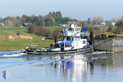
The vessel JILL-F (MMSI: 244690969) is a Other Type It's sailing under the flag of [NL] Netherlands.
In this page you can find informations about the vessels current position, last detected port calls, and current voyage information. If the vessels is not in coverage by AIS you will find the latest position.
The current position of JILL-F is detected by our AIS receivers and we are not responsible for the reliability of the data. The last position was recorded while the vessel was in Coverage by the Ais receivers of our vessel tracking app.
The current draught of JILL-F as reported by AIS is 2.3 meters
Weather
| Temperature | 0.7°C / 33.26°F |
|---|---|
| Wind Speed | 8 knots |
| Direction | 352° N |
| Pressure | 1021.5 hPa |
| Humidity | 78.3 % |
| Cloud Coverage | 100 % |
Featured Company
Last Port Calls
| Port | Arrival | Departure | Time In Port |
|---|---|---|---|
| 2025-01-23 14:31 | 2025-01-23 15:51 | 1 h | |
| 2025-01-09 12:00 | 2025-01-23 14:10 | 14 d | |
| 2025-01-01 15:17 | 2025-01-02 05:06 | 13 h |
Most Visited Ports (Last year)
| Port | Arrivals | |
|---|---|---|
| 53 | ||
| 19 | ||
| 5 | ||
| 4 | ||
| 3 | ||
| 2 |
Last Trips
| Origin | Departure | Destination | Arrival | Distance | |
|---|---|---|---|---|---|
| 2025-01-23 15:10 | 2025-01-23 15:31 | 1.24 nm | |||
| 2025-01-02 06:06 | 2025-01-09 13:00 | 281.42 nm | |||
| 2024-11-27 08:19 | 2025-01-01 16:17 | 452.56 nm |
Events
| Tid | Event | Detaljer | Position / Dest | Information |
|---|---|---|---|---|
| 2025-02-13 12:13 | UTANFÖR täckningsområde |
50.97886 / 5.76009
North Sea
|
Fart: Kurs: 200.7° |
|
| 2025-02-12 16:30 | Status ändrad | Moored Under way using engine |
50.97905 / 5.76026
MAASBRACHT
|
Fart: Kurs: 511° |
| 2025-02-12 15:55 | Status ändrad | Under way using engine Moored |
50.97375 / 5.75758
MAASBRACHT
|
Fart: 0.3 kn Kurs: 511° |
| 2025-02-12 13:44 | Status ändrad | Moored Under way using engine |
50.97338 / 5.75903
MAASBRACHT
|
Fart: Kurs: 511° |
| 2025-02-12 13:24 | STOPPAR förflyttning | 4.39 nm, North of ITTEREN |
50.97339 / 5.75904
MAASBRACHT
|
Fart: 0.2 kn Kurs: 511° |
| 2025-02-12 13:22 | STARTAR förflyttning | 4.44 nm, North of ITTEREN |
50.97430 / 5.75889
MAASBRACHT
|
Fart: 6.1 kn Kurs: 213.5° |
| 2025-02-12 13:15 | STOPPAR förflyttning | 4.55 nm, North of ITTEREN |
50.97583 / 5.76070
MAASBRACHT
|
Fart: 0.2 kn Kurs: 511° |
| 2025-02-12 12:22 | STARTAR förflyttning | 0.87 nm, South of ITTEREN |
50.89090 / 5.71268
MAASBRACHT
|
Fart: 4.9 kn Kurs: 24.6° |
| 2025-02-12 12:20 | STOPPAR förflyttning | 0.98 nm, South of ITTEREN |
50.88918 / 5.71185
MAASBRACHT
|
Fart: 0.3 kn Kurs: 511° |
| 2025-02-12 12:18 | STARTAR förflyttning | 0.96 nm, South of ITTEREN |
50.88935 / 5.71190
MAASBRACHT
|
Fart: 3.3 kn Kurs: 288.7° |