
JILL-F
Other Type
Current Trip
MAASBRACHT
| Time Travelled | 2 days |
|---|---|
| Remaining Time | --- |
| Distance Travelled | 1.27 nm |
| Remaining Distance | --- |
| AVG Speed | 5.1 Noeuds |
| MAX Speed | 7 Noeuds |
| AVG Wind | 10.2 knots |
| MAX Wind | 10.8 knots |
| MIN Temp | 5.9°C / 42.62°F |
| MAX Temp | 7.1°C / 44.78°F |
| Tirant d eau | 2.3 m |
| Position reçue | 2 d depuis |
Current Position
| Longitude | 5.68968° |
|---|---|
| Latitude | 50.78761° |
| Etat | Under way using engine |
| Vitesse | 7.2 Noeuds |
| Parcours | 190° |
| Zone | North Sea |
| Station | T-AIS |
| Position reçue | 2 d depuis |
Info
Information
The current position of JILL-F is in North Sea with coordinates 50.78761° / 5.68968° as reported on 2024-04-25 21:48 by AIS to our vessel tracker app. The vessel's current speed is 7.2 Noeuds
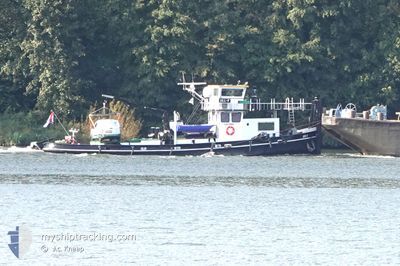
The vessel JILL-F (MMSI: 244690969) is a Other Type It's sailing under the flag of [NL] Netherlands.
In this page you can find informations about the vessels current position, last detected port calls, and current voyage information. If the vessels is not in coverage by AIS you will find the latest position.
The current position of JILL-F is detected by our AIS receivers and we are not responsible for the reliability of the data. The last position was recorded while the vessel was in Coverage by the Ais receivers of our vessel tracking app.
The current draught of JILL-F as reported by AIS is 2.3 meters
Weather
| Temperature | 5.9°C / 42.62°F |
|---|---|
| Wind Speed | 10 knots |
| Direction | 199° SSW |
| Pressure | 1003.8 hPa |
| Humidity | 68.6 % |
| Cloud Coverage | 100 % |
Featured Company
Last Port Calls
| Port | Arrival | Departure | Time In Port |
|---|---|---|---|
| 2024-04-25 17:40 | 2024-04-25 18:16 | 36 m | |
| 2024-04-25 08:46 | 2024-04-25 09:08 | 22 m | |
| 2024-04-23 13:12 | 2024-04-23 13:55 | 42 m | |
| 2024-04-23 04:51 | 2024-04-23 05:13 | 21 m | |
| 2024-04-22 10:04 | 2024-04-22 10:25 | 20 m | |
| 2024-04-19 15:40 | 2024-04-19 16:17 | 36 m | |
| 2024-04-19 09:37 | 2024-04-19 09:57 | 20 m | |
| 2024-04-17 06:43 | 2024-04-17 08:25 | 1 h | |
| 2024-04-17 05:44 | 2024-04-17 06:22 | 38 m | |
| 2024-04-16 13:13 | 2024-04-16 13:23 | 9 m |
Most Visited Ports (Last year)
| Port | Arrivals | |
|---|---|---|
| 96 | ||
| 13 | ||
| 11 | ||
| 2 | ||
| 1 | ||
| 1 |
Last Trips
| Origin | Departure | Destination | Arrival | Distance | |
|---|---|---|---|---|---|
| 2024-04-25 11:08 | 2024-04-25 19:40 | 40.49 nm | |||
| 2024-04-23 15:55 | 2024-04-25 10:46 | 51.56 nm | |||
| 2024-04-23 07:13 | 2024-04-23 15:12 | 29.86 nm | |||
| 2024-04-22 12:25 | 2024-04-23 06:51 | 22.30 nm | |||
| 2024-04-19 18:17 | 2024-04-22 12:04 | 3.43 nm | |||
| 2024-04-19 11:57 | 2024-04-19 17:40 | 23.80 nm | |||
| 2024-04-17 10:25 | 2024-04-19 11:37 | 58.84 nm | |||
| 2024-04-17 08:22 | 2024-04-17 08:43 | 2.72 nm | |||
| 2024-04-16 15:23 | 2024-04-17 07:44 | 2.74 nm | |||
| 2024-04-12 13:09 | 2024-04-16 15:13 | 101.15 nm |
Events
| Heure | Evenement | Détails | Position/ Destination | Info |
|---|---|---|---|---|
| 2024-04-25 21:48 | Hors de la zone couverte |
50.78761 / 5.68968
North Sea
|
Vitesse: 7.2 kn Parcours: 190° |
|
| 2024-04-25 21:46 | Démarrage | 0.55 nm, South West of WAOLENWIERT |
50.79160 / 5.69060
MAASBRACHT
|
Vitesse: 5.5 kn Parcours: 188.5° |
| 2024-04-25 21:44 | Etat Changé | Under way using engine Moored |
50.79349 / 5.69083
MAASBRACHT
|
Vitesse: Parcours: 511° |
| 2024-04-25 21:39 | Etat Changé | Moored Under way using engine |
50.79366 / 5.69083
MAASBRACHT
|
Vitesse: 3.5 kn Parcours: 186.6° |
| 2024-04-25 21:39 | Arret | 0.47 nm, South West of WAOLENWIERT |
50.79366 / 5.69083
MAASBRACHT
|
Vitesse: Parcours: 511° |
| 2024-04-25 20:44 | Démarrage | 0.41 nm, West of WAOLENWIERT |
50.79798 / 5.69139
MAASBRACHT
|
Vitesse: 5.1 kn Parcours: 184.7° |
| 2024-04-25 20:42 | Etat Changé | Under way using engine Moored |
50.80006 / 5.69155
MAASBRACHT
|
Vitesse: Parcours: 511° |
| 2024-04-25 18:43 | Etat Changé | Moored Under way using engine |
50.80020 / 5.69167
MAASBRACHT
|
Vitesse: Parcours: 511° |
| 2024-04-25 18:24 | Arret | 0.43 nm, North West of WAOLENWIERT |
50.80021 / 5.69163
MAASBRACHT
|
Vitesse: 0.2 kn Parcours: 511° |
| 2024-04-25 18:16 | PORT DE DEPART |
|
50.80871 / 5.69255
MAASBRACHT
|
Vitesse: 5.8 kn Parcours: 184.4° |