
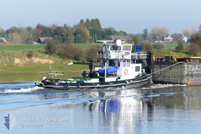
JILL-F
Other Type
Current Trip
MAASBRACHT
| Time Travelled | 1 day |
|---|---|
| Remaining Time | --- |
| Distance Travelled | 119.54 nm |
| Remaining Distance | --- |
| AVG Speed | 6.6 Knots |
| MAX Speed | 9.7 Knots |
| AVG Wind | 8 knots |
| MAX Wind | 12 knots |
| MIN Temp | 5.5°C / 41.9°F |
| MAX Temp | 11.8°C / 53.24°F |
| Draught | 2.3 m |
| Position Received | 10 h, 13 m ago |
Current Position
| Longitude | --- |
|---|---|
| Latitude | --- |
| Status | Under way using engine |
| Speed | 6.3 Knots |
| Course | 195.3° |
| Area | North Sea |
| Station | T-AIS |
| Position Received | 10 h, 13 m ago |
Info
Information
The current position of JILL-F is in North Sea with coordinates 50.79010° / 5.69025° as reported on 2025-12-16 17:49 by AIS to our vessel tracker app. The vessel's current speed is 6.3 Knots
The vessel JILL-F (MMSI: 244690969) is a Other Type It's sailing under the flag of [NL] Netherlands.
In this page you can find informations about the vessels current position, last detected port calls, and current voyage information. If the vessels is not in coverage by AIS you will find the latest position.
The current position of JILL-F is detected by our AIS receivers and we are not responsible for the reliability of the data. The last position was recorded while the vessel was in Coverage by the Ais receivers of our vessel tracking app.
The current draught of JILL-F as reported by AIS is 2.3 meters
Weather
| Temperature | 9.7°C / 49.46°F |
|---|---|
| Wind Speed | 4 knots |
| Direction | 145° SE |
| Pressure | 1013.4 hPa |
| Humidity | 62.9 % |
| Cloud Coverage | 99 % |
Featured Company
Last Port Calls
| Port | Arrival | Departure | Time In Port |
|---|---|---|---|
| 2025-12-14 15:17 | 2025-12-15 11:36 | 20 h | |
| 2025-11-19 11:02 | 2025-11-20 01:51 | 14 h | |
| 2025-11-17 17:02 | 2025-11-19 10:39 | 1 d | |
| 2025-10-31 12:52 | 2025-11-03 11:31 | 2 d | |
| 2025-10-21 18:03 | 2025-10-22 05:01 | 10 h | |
| 2025-10-17 12:16 | 2025-10-17 12:33 | 17 m | |
| 2025-10-14 04:49 | 2025-10-14 05:04 | 14 m | |
| 2025-10-13 11:52 | |||
| 2025-10-09 06:53 | 2025-10-09 08:59 | 2 h |
Most Visited Ports (Last year)
| Port | Arrivals | |
|---|---|---|
| 7 | ||
| 6 | ||
| 3 | ||
| 1 | ||
| 1 | ||
| 1 |
Last Trips
| Origin | Departure | Destination | Arrival | Distance | |
|---|---|---|---|---|---|
| 2025-11-20 02:51 | 2025-12-14 16:17 | 390.56 nm | |||
| 2025-11-19 11:39 | 2025-11-19 12:02 | 1.79 nm | |||
| 2025-11-03 12:31 | 2025-11-17 18:02 | 205.65 nm | |||
| 2025-10-22 07:01 | 2025-10-31 13:52 | 263.06 nm | |||
| 2025-10-17 14:33 | 2025-10-21 20:03 | 115.43 nm | |||
| 2025-10-14 07:04 | 2025-10-17 14:16 | 160.33 nm | |||
| 2025-10-09 10:59 | 2025-10-14 06:49 | 81.07 nm | |||
| 2025-10-09 10:59 | 2025-10-13 13:52 | 77.34 nm | |||
| 2025-09-12 09:18 | 2025-10-09 08:53 | 646.20 nm |
Events
| Time | Event | Details | Position / Dest | Info |
|---|---|---|---|---|
| 2025-12-16 17:49 | OUT of Coverage |
50.79010 / 5.69025
North Sea
|
Speed: 6.3 kn Course: 195.3° |
|
| 2025-12-16 17:49 | START Moving | 0.57 nm, South West of WAOLENWIERT |
50.79094 / 5.69052
MAASBRACHT
|
Speed: 5.9 kn Course: 190.4° |
| 2025-12-16 17:47 | Status Changed | Under way using engine Moored |
50.79326 / 5.69086
MAASBRACHT
|
Speed: 1.5 kn Course: 511° |
| 2025-12-16 17:43 | Status Changed | Moored Under way using engine |
50.79366 / 5.69082
MAASBRACHT
|
Speed: 3.3 kn Course: 189.3° |
| 2025-12-16 17:43 | STOP Moving | 0.47 nm, South West of WAOLENWIERT |
50.79366 / 5.69082
MAASBRACHT
|
Speed: Course: 511° |
| 2025-12-16 17:10 | START Moving | 0.43 nm, West of WAOLENWIERT |
50.79566 / 5.69106
MAASBRACHT
|
Speed: 3.3 kn Course: 189.3° |
| 2025-12-16 17:08 | Status Changed | Under way using engine Moored |
50.79801 / 5.69150
MAASBRACHT
|
Speed: Course: 511° |
| 2025-12-16 16:56 | Status Changed | Moored Under way using engine |
50.79857 / 5.69158
MAASBRACHT
|
Speed: Course: 511° |
| 2025-12-16 16:37 | STOP Moving | 0.41 nm, West of WAOLENWIERT |
50.79857 / 5.69156
MAASBRACHT
|
Speed: 0.1 kn Course: 511° |
| 2025-12-16 13:52 | START Moving | 1.64 nm, South of BARGE TERMINAL BORN |
51.03475 / 5.79872
MAASBRACHT
|
Speed: 3.5 kn Course: 197.8° |