
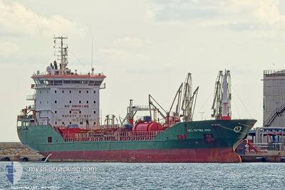
HACI FATMA ANA
Oil/Chemical Tanker
Current Trip
| Trip Time | 4 days |
|---|---|
| Trip Distance | 1293.23 nm |
| AVG Speed | 11 Knop |
| MAX Speed | 14.6 Knop |
| Djupgående | 4.7 m |
| AVG Wind | 13.6 knots |
| MAX Wind | 26 knots |
| MIN Temp | -2.8°C / 26.96°F |
| MAX Temp | 17.4°C / 63.32°F |
| Position mottagen | 14 h, 13 m sen |
Current Position
| Longitud | --- |
|---|---|
| Latitude | --- |
| Status | Moored |
| Fart | |
| Kurs | 21° |
| Område | Adriatic Sea |
| Station | T-AIS |
| Position mottagen | 14 h, 13 m sen |
Info
Information
The current position of HACI FATMA ANA is in Adriatic Sea with coordinates 45.46672° / 12.23368° as reported on 2026-01-05 11:29 by AIS to our vessel tracker app. The vessel's current speed is 0 Knop and is currently inside the port of VENEZIA.
The vessel HACI FATMA ANA (IMO: 9458195, MMSI: 215552000) is a Oil/Chemical Tanker that was built in 2011 ( 15 År gammal ). It's sailing under the flag of [MT] Malta.
In this page you can find informations about the vessels current position, last detected port calls, and current voyage information. If the vessels is not in coverage by AIS you will find the latest position.
The current position of HACI FATMA ANA is detected by our AIS receivers and we are not responsible for the reliability of the data. The last position was recorded while the vessel was in Coverage by the Ais receivers of our vessel tracking app.
The current draught of HACI FATMA ANA as reported by AIS is 4.7 meters
Weather
| Temperature | 1.2°C / 34.16°F |
|---|---|
| Wind Speed | 5 knots |
| Direction | 15° NNE |
| Pressure | 1009.5 hPa |
| Humidity | 68.1 % |
| Cloud Coverage | 100 % |
Featured Company
Most Visited Ports (Last year)
| Port | Arrivals | |
|---|---|---|
| 7 | ||
| 4 | ||
| 3 | ||
| 3 | ||
| 3 | ||
| 3 |
Events
| Tid | Event | Detaljer | Position / Dest | Information |
|---|---|---|---|---|
| 2026-01-05 11:29 | UTANFÖR täckningsområde |
45.46672 / 12.23368
Adriatic Sea
[IT] VENEZIA
|
Fart: Kurs: 330.6° |
|
| 2026-01-05 11:28 | Status ändrad | Moored Under way using engine |
45.46673 / 12.23368
[IT] VENEZIA
|
Fart: Kurs: 21° |
| 2026-01-05 10:42 | STOPPAR förflyttning |
45.46663 / 12.23377
[IT] VENEZIA
|
Fart: 0.3 kn Kurs: 17° |
|
| 2026-01-05 09:59 | ANLÄNDER HAMN |
|
45.41671 / 12.26053
[IT] VENEZIA
|
Fart: 7 kn Kurs: 357.9° |
| 2026-01-05 07:04 | Status ändrad | Under way using engine Default |
45.07094 / 12.87322
TRTUZ>ITPMA
|
Fart: 13.6 kn Kurs: 306° |
| 2026-01-05 06:47 | Status ändrad | Default Under way using engine |
45.02999 / 12.94680
TRTUZ>ITPMA
|
Fart: 4.4 kn Kurs: 244° |
| 2026-01-05 06:38 | Status ändrad | Under way using engine Default |
45.01443 / 12.97690
TRTUZ>ITPMA
|
Fart: Kurs: -1° |
| 2026-01-05 06:38 | STARTAR förflyttning | 21.46 nm, East of PORTO PILA |
45.01443 / 12.97690
TRTUZ>ITPMA
|
Fart: 4.1 kn Kurs: 209° |
| 2026-01-05 05:54 | Status ändrad | Default Under way using engine |
45.01167 / 12.97667
TRTUZ>ITPMA
|
Fart: 1.1 kn Kurs: 34° |
| 2026-01-05 05:54 | STOPPAR förflyttning | 21.43 nm, East of PORTO PILA |
45.01167 / 12.97667
TRTUZ>ITPMA
|
Fart: Kurs: -1° |