
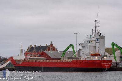
FEED HELGELAND
General Cargo
Current Trip
| Time Travelled | 4 days |
|---|---|
| Remaining Time | --- |
| Distance Travelled | 569.47 nm |
| Remaining Distance | --- |
| AVG Speed | 9.2 Knop |
| MAX Speed | 11.8 Knop |
| AVG Wind | 18.3 knots |
| MAX Wind | 29.3 knots |
| MIN Temp | -7.1°C / 19.22°F |
| MAX Temp | 7.2°C / 44.96°F |
| Djupgående | 6.6 m |
| Position mottagen | 1 m sen |
Current Position
| Longitud | --- |
|---|---|
| Latitude | --- |
| Status | Under way using engine |
| Fart | 6.9 Knop |
| Kurs | 237.9° |
| Område | Norwegian Sea |
| Station | T-AIS |
| Position mottagen | 1 m sen |
Info
Information
The current position of FEED HELGELAND is in Norwegian Sea with coordinates 63.98233° / 8.11587° as reported on 2025-03-18 05:00 by AIS to our vessel tracker app. The vessel's current speed is 6.9 Knop and is heading at the port of CAEN. The estimated time of arrival as calculated by MyShipTracking vessel tracking app is 2025-03-22 18:00 LT
The vessel FEED HELGELAND (IMO: 9163635, MMSI: 257066860) is a General Cargo that was built in 1999 ( 26 År gammal ). It's sailing under the flag of [NO] Norway.
In this page you can find informations about the vessels current position, last detected port calls, and current voyage information. If the vessels is not in coverage by AIS you will find the latest position.
The current position of FEED HELGELAND is detected by our AIS receivers and we are not responsible for the reliability of the data. The last position was recorded while the vessel was in Coverage by the Ais receivers of our vessel tracking app.
The current draught of FEED HELGELAND as reported by AIS is 6.6 meters
Weather
| Temperature | 6.6°C / 43.88°F |
|---|---|
| Wind Speed | 28 knots |
| Direction | 262° W |
| Pressure | 1020.3 hPa |
| Humidity | 83.5 % |
| Cloud Coverage | 100 % |
Featured Company
Last Port Calls
| Port | Arrival | Departure | Time In Port |
|---|---|---|---|
| 2025-03-10 15:31 | 2025-03-13 18:45 | 3 d | |
| 2025-03-04 20:28 | 2025-03-05 21:35 | 1 d | |
| 2025-03-03 05:11 | 2025-03-03 19:27 | 14 h | |
| 2025-02-25 03:23 | 2025-02-28 06:05 | 3 d | |
| 2025-02-13 02:45 | 2025-02-20 20:28 | 7 d | |
| 2025-02-07 05:12 | 2025-02-08 10:52 | 1 d | |
| 2025-02-05 15:22 | 2025-02-06 21:25 | 1 d | |
| 2025-01-28 20:00 | 2025-01-31 14:30 | 2 d | |
| 2025-01-23 07:01 | 2025-01-28 12:23 | 5 d | |
| 2025-01-16 13:23 | 2025-01-17 15:22 | 1 d |
Most Visited Ports (Last year)
| Port | Arrivals | |
|---|---|---|
| 6 | ||
| 3 | ||
| 2 | ||
| 2 | ||
| 2 | ||
| 2 |
Last Trips
| Origin | Departure | Destination | Arrival | Distance | |
|---|---|---|---|---|---|
| 2025-03-05 21:35 | 2025-03-10 15:31 | 1075.57 nm | |||
| 2025-03-03 19:27 | 2025-03-04 20:28 | 92.51 nm | |||
| 2025-02-28 06:05 | 2025-03-03 05:11 | 524.65 nm | |||
| 2025-02-20 20:28 | 2025-02-25 03:23 | 813.35 nm | |||
| 2025-02-08 10:52 | 2025-02-13 02:45 | 1092.36 nm | |||
| 2025-02-06 21:25 | 2025-02-07 05:12 | 86.11 nm | |||
| 2025-01-31 14:30 | 2025-02-05 15:22 | 155.86 nm | |||
| 2025-01-28 12:23 | 2025-01-28 20:00 | 75.45 nm | |||
| 2025-01-17 15:22 | 2025-01-23 07:01 | 1067.23 nm | |||
| 2025-01-11 08:14 | 2025-01-16 13:23 | 852.71 nm |
Events
| Tid | Event | Detaljer | Position / Dest | Information |
|---|---|---|---|---|
| 2025-03-17 06:35 | Djupgående ändrat | 6.6 6.4 |
66.45151 / 11.32459
FRCFR
|
Fart: 9.7 kn Kurs: 215° |
| 2025-03-16 10:37 | Status ändrad | Under way using engine Moored |
68.95355 / 15.60552
FRCFR
|
Fart: 8.4 kn Kurs: 209.5° |
| 2025-03-16 10:31 | STARTAR förflyttning | 10.61 nm, South of VARDHOLMEN |
68.96495 / 15.62094
FRCFR
|
Fart: 4.3 kn Kurs: 219° |
| 2025-03-16 09:33 | Destination ändrad | FRCFR NORSH |
68.96549 / 15.62587
FRCFR
|
Fart: Kurs: 283° |
| 2025-03-16 09:31 | Djupgående ändrat | 6.4 4 |
68.96549 / 15.62590
NORSH
|
Fart: Kurs: 283° |
| 2025-03-16 09:31 | ETA ändrat | 2025/03/22 17:00 2025/03/14 14:00 |
68.96549 / 15.62590
NORSH
|
Fart: Kurs: 283° |
| 2025-03-16 04:47 | Status ändrad | Moored Default |
68.96550 / 15.62584
NORSH
|
Fart: Kurs: -1° |
| 2025-03-16 04:44 | Status ändrad | Default Moored |
68.96550 / 15.62584
NORSH
|
Fart: Kurs: 511° |
| 2025-03-14 14:14 | Status ändrad | Moored Under way using engine |
68.96552 / 15.62584
NORSH
|
Fart: Kurs: 284° |
| 2025-03-14 13:47 | STOPPAR förflyttning | 10.57 nm, South of VARDHOLMEN |
68.96539 / 15.62588
NORSH
|
Fart: 0.2 kn Kurs: 511° |