
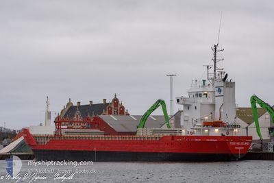
FEED HELGELAND
General Cargo
Current Trip
| Time Travelled | 15 days |
|---|---|
| Remaining Time | 1 day |
| Distance Travelled | 1825.11 nm |
| Remaining Distance | 276.66 nm |
| AVG Speed | 9 Noeuds |
| MAX Speed | 12.4 Noeuds |
| AVG Wind | 12.8 knots |
| MAX Wind | 31.2 knots |
| MIN Temp | -0.8°C / 30.56°F |
| MAX Temp | 12.3°C / 54.14°F |
| Tirant d eau | 3.9 m |
| Position reçue | 3 h, 16 m depuis |
Current Position
| Longitude | -2.66335° |
|---|---|
| Latitude | 49.83470° |
| Etat | Under way using engine |
| Vitesse | 8.5 Noeuds |
| Parcours | 72.4° |
| Zone | English Channel |
| Station | T-AIS |
| Position reçue | 3 h, 16 m depuis |
Info
Information
The current position of FEED HELGELAND is in English Channel with coordinates 49.83470° / -2.66335° as reported on 2024-04-25 00:51 by AIS to our vessel tracker app. The vessel's current speed is 8.5 Noeuds and is heading at the port of ROTTERDAM. The estimated time of arrival as calculated by MyShipTracking vessel tracking app is 2024-04-26 12:27 LT
The vessel FEED HELGELAND (IMO: 9163635, MMSI: 257066860) is a General Cargo that was built in 1999 ( 25 Age ). It's sailing under the flag of [NO] Norway.
In this page you can find informations about the vessels current position, last detected port calls, and current voyage information. If the vessels is not in coverage by AIS you will find the latest position.
The current position of FEED HELGELAND is detected by our AIS receivers and we are not responsible for the reliability of the data. The last position was recorded while the vessel was in Coverage by the Ais receivers of our vessel tracking app.
The current draught of FEED HELGELAND as reported by AIS is 3.9 meters
Weather
| Temperature | 9.6°C / 49.28°F |
|---|---|
| Wind Speed | 14 knots |
| Direction | 201° SSW |
| Pressure | 1009.2 hPa |
| Humidity | 70.1 % |
| Cloud Coverage | 100 % |
Featured Company
Last Port Calls
| Port | Arrival | Departure | Time In Port |
|---|---|---|---|
| 2024-04-05 14:08 | 2024-04-09 12:21 | 3 d | |
| 2024-03-28 06:04 | 2024-03-29 19:33 | 1 d | |
| 2024-03-24 18:21 | 2024-03-26 18:42 | 2 d | |
| 2024-03-20 07:16 | 2024-03-20 21:24 | 14 h | |
| 2024-03-17 14:50 | 2024-03-19 17:57 | 2 d | |
| 2024-03-08 08:25 | 2024-03-10 21:31 | 2 d | |
| 2024-02-28 19:49 | 2024-03-04 12:40 | 4 d | |
| 2024-02-14 23:20 | 2024-02-20 19:09 | 5 d | |
| 2024-02-12 00:36 | 2024-02-14 14:11 | 2 d | |
| 2024-02-05 13:03 | 2024-02-07 00:18 | 1 d |
Last Trips
| Origin | Departure | Destination | Arrival | Distance | |
|---|---|---|---|---|---|
| 2024-03-29 20:33 | 2024-04-05 16:08 | 1113.05 nm | |||
| 2024-03-26 18:42 | 2024-03-28 07:04 | 218.33 nm | |||
| 2024-03-20 22:24 | 2024-03-24 18:21 | 508.02 nm | |||
| 2024-03-19 18:57 | 2024-03-20 08:16 | 126.72 nm | |||
| 2024-03-10 22:31 | 2024-03-17 15:50 | 1324.43 nm | |||
| 2024-03-04 13:40 | 2024-03-08 09:25 | 154.43 nm | |||
| 2024-02-20 20:09 | 2024-02-28 20:49 | 1747.88 nm | |||
| 2024-02-14 15:11 | 2024-02-15 00:20 | 88.81 nm | |||
| 2024-02-07 01:18 | 2024-02-12 01:36 | 1104.27 nm | |||
| 2024-01-31 15:35 | 2024-02-05 14:03 | 550.04 nm |
Events
| Heure | Evenement | Détails | Position/ Destination | Info |
|---|---|---|---|---|
| 2024-04-25 00:58 | Etat Changé | Default Under way using engine |
49.83963 / -2.63846
NLRTM
|
Vitesse: 8.5 kn Parcours: 72.4° |
| 2024-04-25 00:51 | Hors de la zone couverte |
49.83470 / -2.66335
English Channel
NLRTM
|
Vitesse: 8.5 kn Parcours: 72.4° |
|
| 2024-04-25 00:49 | Etat Changé | Under way using engine Default |
49.83334 / -2.66979
NLRTM
|
Vitesse: 8.4 kn Parcours: 71° |
| 2024-04-24 23:58 | Etat Changé | Default Under way using engine |
49.78893 / -2.85656
NLRTM
|
Vitesse: 9.8 kn Parcours: 47.1° |
| 2024-04-24 23:54 | Etat Changé | Under way using engine Default |
49.78002 / -2.87196
NLRTM
|
Vitesse: 9.8 kn Parcours: 41° |
| 2024-04-24 23:02 | Etat Changé | Default Under way using engine |
49.64355 / -2.94191
NLRTM
|
Vitesse: 10.9 kn Parcours: 17.2° |
| 2024-04-24 21:06 | Etat Changé | Under way using engine Default |
49.29042 / -3.06610
NLRTM
|
Vitesse: 11.1 kn Parcours: 12° |
| 2024-04-24 20:50 | Etat Changé | Default Under way using engine |
49.24374 / -3.08141
NLRTM
|
Vitesse: 11.1 kn Parcours: 14° |
| 2024-04-24 20:44 | Changement de zone | Guernsey part of the English Channel French part of the English Channel |
49.22353 / -3.08834
English Channel
NLRTM
|
Vitesse: 11.1 kn Parcours: 14° |
| 2024-04-24 20:08 | Tirant d'eau modifié | 3.9 6 |
49.11504 / -3.12227
NLRTM
|
Vitesse: 11 kn Parcours: 13.1° |