

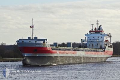
ERIEBORG
General Cargo

Current Trip
| Trip Time | 18 days |
|---|---|
| Trip Distance | 4575.55 nm |
| AVG Speed | 10 Knop |
| MAX Speed | 14.2 Knop |
| Djupgående | 8.3 m |
| AVG Wind | 12 knots |
| MAX Wind | 38 knots |
| MIN Temp | 2.1°C / 35.78°F |
| MAX Temp | 19.9°C / 67.82°F |
| Position mottagen | 1 m sen |
Current Position
| Longitud | --- |
|---|---|
| Latitude | --- |
| Status | Moored |
| Fart | |
| Kurs | 288° |
| Område | North Sea |
| Station | T-AIS |
| Position mottagen | 1 m sen |
Information
The current position of ERIEBORG is in North Sea with coordinates 51.24467° / 4.39167° as reported on 2025-02-04 06:21 by AIS to our vessel tracker app. The vessel's current speed is 0 Knop and is currently inside the port of ANTWERP.
The vessel ERIEBORG (IMO: 9463437, MMSI: 246634000) is a General Cargo that was built in 2009 ( 16 År gammal ). It's sailing under the flag of [NL] Netherlands.
In this page you can find informations about the vessels current position, last detected port calls, and current voyage information. If the vessels is not in coverage by AIS you will find the latest position.
The current position of ERIEBORG is detected by our AIS receivers and we are not responsible for the reliability of the data. The last position was recorded while the vessel was in Coverage by the Ais receivers of our vessel tracking app.
The current draught of ERIEBORG as reported by AIS is 8.3 meters
Weather
| Temperature | 2.7°C / 36.86°F |
|---|---|
| Wind Speed | 5 knots |
| Direction | 189° S |
| Pressure | 1026.6 hPa |
| Humidity | 79.9 % |
| Cloud Coverage | 88 % |


Featured Company
Most Visited Ports (Last year)
| Port | Arrivals | |
|---|---|---|
| 2 | ||
| 2 | ||
| 2 | ||
| 2 | ||
| 2 | ||
| 1 |
Events
| Tid | Event | Detaljer | Position / Dest | Information |
|---|---|---|---|---|
| 2025-02-03 23:00 | Status ändrad | Moored Under way using engine |
51.24467 / 4.39167
[BE] ANTWERP
|
Fart: 0.1 kn Kurs: 287° |
| 2025-02-03 22:43 | STOPPAR förflyttning |
51.24533 / 4.39433
[BE] ANTWERP
|
Fart: 0.3 kn Kurs: 230° |
|
| 2025-02-03 22:03 | STARTAR förflyttning |
51.27617 / 4.33533
[BE] ANTWERP
|
Fart: 3.1 kn Kurs: 139° |
|
| 2025-02-03 21:14 | STOPPAR förflyttning |
51.27850 / 4.33200
[BE] ANTWERP
|
Fart: 0.3 kn Kurs: 137° |
|
| 2025-02-03 20:00 | ANLÄNDER HAMN |
|
51.36550 / 4.22033
[BE] ANTWERP
|
Fart: 8.4 kn Kurs: 154° |
| 2025-02-03 15:40 | Byter havsområde | Dutch part of the North Sea Belgian part of the North Sea |
51.40433 / 3.34633
North Sea
BEANR
|
Fart: 11 kn Kurs: 88° |
| 2025-02-03 10:16 | Byter havsområde | Belgian part of the North Sea French part of the North Sea |
51.32883 / 2.36367
North Sea
BEANR
|
Fart: 4.5 kn Kurs: 64° |
| 2025-02-03 09:11 | Status ändrad | Under way using engine Default |
51.27783 / 2.23283
BEANR
|
Fart: 6.8 kn Kurs: 61° |
| 2025-02-03 09:09 | Status ändrad | Default Under way using engine |
51.27550 / 2.22617
BEANR
|
Fart: 7 kn Kurs: 60° |
| 2025-02-03 06:12 | Byter havsområde | French part of the North Sea French part of the English Channel |
50.99050 / 1.63783
North Sea
BEANR
|
Fart: 12.2 kn Kurs: 51° |