

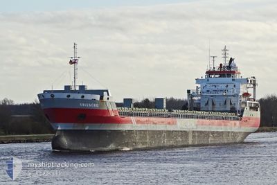
ERIEBORG
General Cargo

Current Trip
| Time Travelled | 8 days |
|---|---|
| Remaining Time | 1 day |
| Distance Travelled | 1996.41 морская миля |
| Remaining Distance | 467.85 морская миля |
| AVG Speed | 9.8 Узлы |
| MAX Speed | 14.2 Узлы |
| AVG Wind | 14.4 knots |
| MAX Wind | 50 knots |
| MIN Temp | 4°C / 39.2°F |
| MAX Temp | 16.4°C / 61.52°F |
| Осадка | 8.1 м |
| Позиция Получена | 1 m тому назад |
Current Position
| Долгота | --- |
|---|---|
| Широта | --- |
| Статус | Under way using engine |
| Скорость | 10.3 Узлы |
| Курс | 29° |
| Район | Baltic Sea |
| Станция | T-AIS |
| Позиция Получена | 1 m тому назад |
Information
The current position of ERIEBORG is in Baltic Sea with coordinates 57.62967° / 17.97700° as reported on 2025-03-27 17:10 by AIS to our vessel tracker app. The vessel's current speed is 10.3 Узлы and is heading at the port of KOKKOLA. The estimated time of arrival as calculated by MyShipTracking vessel tracking app is 2025-03-29 15:57 LT
The vessel ERIEBORG (IMO: 9463437, MMSI: 246634000) is a General Cargo that was built in 2009 ( 16 лет ). It's sailing under the flag of [NL] Netherlands.
In this page you can find informations about the vessels current position, last detected port calls, and current voyage information. If the vessels is not in coverage by AIS you will find the latest position.
The current position of ERIEBORG is detected by our AIS receivers and we are not responsible for the reliability of the data. The last position was recorded while the vessel was in Coverage by the Ais receivers of our vessel tracking app.
The current draught of ERIEBORG as reported by AIS is 8.1 meters
Weather
| Temperature | 4.2°C / 39.56°F |
|---|---|
| Wind Speed | 11 knots |
| Direction | 211° SSW |
| Pressure | 1011.6 hPa |
| Humidity | 91.4 % |
| Cloud Coverage | 82 % |


Featured Company
Last Port Calls
| Port | Arrival | Departure | Time In Port |
|---|---|---|---|
| 2025-03-16 17:44 | 2025-03-19 01:31 | 2 d | |
| 2025-03-10 07:47 | 2025-03-11 21:27 | 1 d | |
| 2025-03-01 12:22 | 2025-03-03 22:23 | 2 d | |
| 2025-02-27 06:31 | 2025-02-27 11:18 | 4 h | |
| 2025-02-07 06:35 | 2025-02-15 08:05 | 8 d | |
| 2025-02-03 21:00 | 2025-02-06 03:42 | 2 d | |
| 2025-01-12 17:39 | 2025-01-15 16:27 | 2 d | |
| 2025-01-04 07:14 |
Last Trips
| Origin | Departure | Destination | Arrival | Distance | |
|---|---|---|---|---|---|
| 2025-03-11 21:27 | 2025-03-16 17:44 | 1218.30 морская миля | |||
| 2025-03-03 22:23 | 2025-03-10 07:47 | 1423.24 морская миля | |||
| 2025-02-27 11:18 | 2025-03-01 12:22 | 161.30 морская миля | |||
| 2025-02-15 08:05 | 2025-02-27 06:31 | 1616.11 морская миля | |||
| 2025-02-06 03:42 | 2025-02-07 06:35 | 268.84 морская миля | |||
| 2025-01-15 16:27 | 2025-02-03 21:00 | 4575.55 морская миля | |||
| 2025-01-04 07:14 | 2025-01-12 17:39 | 1049.13 морская миля |
Events
| Время | Событие | Детали | Позиция / Направление | Информация |
|---|---|---|---|---|
| 2025-03-27 15:51 | Статус изменился | Under way using engine Default |
57.42533 / 17.76867
FI KOK
|
Скорость: 10.7 kn Курс: 27° |
| 2025-03-27 15:46 | Статус изменился | Default Under way using engine |
57.41250 / 17.75683
FI KOK
|
Скорость: 10.5 kn Курс: 21° |
| 2025-03-27 15:39 | Статус изменился | Under way using engine Default |
57.39400 / 17.74283
FI KOK
|
Скорость: 10.5 kn Курс: 21° |
| 2025-03-27 15:30 | Статус изменился | Default Under way using engine |
57.36967 / 17.72517
FI KOK
|
Скорость: 10.5 kn Курс: 22° |
| 2025-03-27 15:21 | Статус изменился | Under way using engine Default |
57.34550 / 17.70750
FI KOK
|
Скорость: 10.6 kn Курс: 21° |
| 2025-03-27 15:18 | Статус изменился | Default Under way using engine |
57.33683 / 17.70117
FI KOK
|
Скорость: 10.6 kn Курс: 21° |
| 2025-03-27 14:58 | Статус изменился | Under way using engine Default |
57.28300 / 17.66300
FI KOK
|
Скорость: 10.4 kn Курс: 22° |
| 2025-03-27 14:58 | В покрытии |
57.28300 / 17.66300
Baltic Sea
FI KOK
|
Скорость: 10.4 kn Курс: 22° |
|
| 2025-03-27 07:10 | Статус изменился | Default Under way using engine |
56.04384 / 16.72617
FI KOK
|
Скорость: 10.6 kn Курс: 60° |
| 2025-03-27 07:09 | Вне покрытия |
56.04267 / 16.72267
Baltic Sea
FI KOK
|
Скорость: 10.6 kn Курс: 60° |