
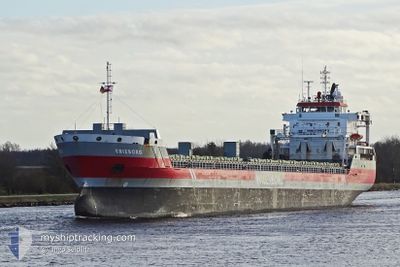
ERIEBORG
General Cargo
Current Trip
| Time Travelled | 3 days |
|---|---|
| Remaining Time | --- |
| Distance Travelled | 742.66 nm |
| Remaining Distance | --- |
| AVG Speed | 9.6 Knopen |
| MAX Speed | 11.5 Knopen |
| AVG Wind | 14.2 knots |
| MAX Wind | 25.8 knots |
| MIN Temp | 12.9°C / 55.22°F |
| MAX Temp | 17°C / 62.6°F |
| Diepgang | 8 M |
| Positie ontvangen | 23 h, 5 m geleden |
Current Position
| Lengtegraad | --- |
|---|---|
| Breedtegraat | --- |
| Status | Under way using engine |
| Snelheid | 9.5 Knopen |
| Koers | 6° |
| Gebied | North Atlantic Ocean |
| Station | T-AIS |
| Positie ontvangen | 23 h, 5 m geleden |
Info
Information
The current position of ERIEBORG is in North Atlantic Ocean with coordinates 39.78933° / -9.84667° as reported on 2025-03-06 05:16 by AIS to our vessel tracker app. The vessel's current speed is 9.5 Knopen and is heading at the port of GREENORE. The estimated time of arrival as calculated by MyShipTracking vessel tracking app is 2025-03-10 06:00 LT
The vessel ERIEBORG (IMO: 9463437, MMSI: 246634000) is a General Cargo that was built in 2009 ( 16 Jaar oud ). It's sailing under the flag of [NL] Netherlands.
In this page you can find informations about the vessels current position, last detected port calls, and current voyage information. If the vessels is not in coverage by AIS you will find the latest position.
The current position of ERIEBORG is detected by our AIS receivers and we are not responsible for the reliability of the data. The last position was recorded while the vessel was in Coverage by the Ais receivers of our vessel tracking app.
The current draught of ERIEBORG as reported by AIS is 8 meters
Weather
| Temperature | 12.8°C / 55.04°F |
|---|---|
| Wind Speed | 19 knots |
| Direction | 168° SSE |
| Pressure | 1005.3 hPa |
| Humidity | 79.4 % |
| Cloud Coverage | 100 % |
Featured Company
Last Port Calls
Last Trips
| Origin | Departure | Destination | Arrival | Distance | |
|---|---|---|---|---|---|
| 2025-02-27 11:18 | 2025-03-01 12:22 | 161.30 nm | |||
| 2025-02-15 08:05 | 2025-02-27 06:31 | 1616.11 nm | |||
| 2025-02-06 03:42 | 2025-02-07 06:35 | 268.84 nm | |||
| 2025-01-15 16:27 | 2025-02-03 21:00 | 4575.55 nm | |||
| 2025-01-04 07:14 | 2025-01-12 17:39 | 1049.13 nm |
Events
| Tijd | Evenement | Details | Positie / Bestemming | Info |
|---|---|---|---|---|
| 2025-03-06 05:24 | Status Changed | Default Under way using engine |
39.80833 / -9.84550
IE GRN
|
Snelheid: 9.5 kn Koers: 6° |
| 2025-03-06 05:16 | Buitenbereik |
39.78933 / -9.84667
North Atlantic Ocean
IE GRN
|
Snelheid: 9.5 kn Koers: 6° |
|
| 2025-03-05 13:19 | Status Changed | Under way using engine Default |
37.32067 / -9.45217
IE GRN
|
Snelheid: 9.5 kn Koers: 343° |
| 2025-03-05 13:07 | Binnenbereik |
37.32333 / -9.45283
North Atlantic Ocean
IE GRN
|
Snelheid: 9.6 kn Koers: 350° |
|
| 2025-03-05 08:00 | Status Changed | Default Under way using engine |
36.68917 / -8.94933
IE GRN
|
Snelheid: 9.7 kn Koers: 288° |
| 2025-03-05 07:52 | Buitenbereik |
36.68367 / -8.92533
North Atlantic Ocean
IE GRN
|
Snelheid: 9.7 kn Koers: 288° |
|
| 2025-03-05 07:01 | Status Changed | Under way using engine Default |
36.64617 / -8.75983
IE GRN
|
Snelheid: 9.9 kn Koers: 287° |
| 2025-03-05 07:00 | Status Changed | Default Under way using engine |
36.64517 / -8.75567
IE GRN
|
Snelheid: 9.8 kn Koers: 285° |
| 2025-03-05 05:42 | Status Changed | Under way using engine Default |
36.59233 / -8.50250
IE GRN
|
Snelheid: 9.6 kn Koers: 288° |
| 2025-03-05 05:40 | Status Changed | Default Under way using engine |
36.59050 / -8.49567
IE GRN
|
Snelheid: 9.5 kn Koers: 287° |