
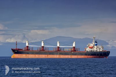
EKATERINA
Bulk Carrier
Current Trip
| Time Travelled | 3 days |
|---|---|
| Remaining Time | 1 day |
| Distance Travelled | 742.80 nm |
| Remaining Distance | 473.63 nm |
| AVG Speed | 10.4 Knop |
| MAX Speed | 12.2 Knop |
| AVG Wind | 5.5 knots |
| MAX Wind | 12 knots |
| MIN Temp | 6°C / 42.8°F |
| MAX Temp | 15.7°C / 60.26°F |
| Djupgående | 5.9 m |
| Position mottagen | 1 m sen |
Current Position
| Longitud | --- |
|---|---|
| Latitude | --- |
| Status | Under way using engine |
| Fart | 1.1 Knop |
| Kurs | 162° |
| Område | Sea of Marmara |
| Station | T-AIS |
| Position mottagen | 1 m sen |
Info
Information
The current position of EKATERINA is in Sea of Marmara with coordinates 40.70764° / 29.00830° as reported on 2025-03-02 15:05 by AIS to our vessel tracker app. The vessel's current speed is 1.1 Knop and is heading at the port of NOVOROSSIYSK. The estimated time of arrival as calculated by MyShipTracking vessel tracking app is 2025-03-04 09:28 LT
The vessel EKATERINA (IMO: 9158458, MMSI: 215776000) is a Bulk Carrier that was built in 2000 ( 25 År gammal ). It's sailing under the flag of [MT] Malta.
In this page you can find informations about the vessels current position, last detected port calls, and current voyage information. If the vessels is not in coverage by AIS you will find the latest position.
The current position of EKATERINA is detected by our AIS receivers and we are not responsible for the reliability of the data. The last position was recorded while the vessel was in Coverage by the Ais receivers of our vessel tracking app.
The current draught of EKATERINA as reported by AIS is 5.9 meters
Weather
| Temperature | 9.5°C / 49.1°F |
|---|---|
| Wind Speed | 10 knots |
| Direction | 11° N |
| Pressure | 1021.4 hPa |
| Humidity | 71.8 % |
| Cloud Coverage | 100 % |
Featured Company
Last Port Calls
| Port | Arrival | Departure | Time In Port |
|---|---|---|---|
| 2025-02-24 01:39 | 2025-02-27 15:01 | 3 d | |
| 2025-02-19 07:37 | 2025-02-19 16:01 | 8 h | |
| 2025-02-13 17:14 | |||
| 2025-02-12 21:57 | 2025-02-12 22:06 | 8 m | |
| 2025-02-12 13:33 | 2025-02-12 17:09 | 3 h | |
| 2025-02-11 13:21 | |||
| 2025-02-08 19:16 | 2025-02-09 04:55 | 9 h | |
| 2025-01-20 16:11 | 2025-01-27 15:23 | 6 d | |
| 2025-01-05 19:36 | 2025-01-05 20:37 | 1 h | |
| 2025-01-05 16:50 | 2025-01-05 18:00 | 1 h |
Most Visited Ports (Last year)
| Port | Arrivals | |
|---|---|---|
| 45 | ||
| 7 | ||
| 2 | ||
| 2 | ||
| 2 | ||
| 2 |
Last Trips
| Origin | Departure | Destination | Arrival | Distance | |
|---|---|---|---|---|---|
| 2025-02-19 16:01 | 2025-02-24 01:39 | 275.42 nm | |||
| 2025-02-13 17:14 | 2025-02-19 07:37 | 1233.24 nm | |||
| 2025-02-12 17:09 | 2025-02-12 21:57 | 24.22 nm | |||
| 2025-02-11 13:21 | 2025-02-12 13:33 | 33.37 nm | |||
| 2025-01-27 15:23 | 2025-02-08 19:16 | 1646.35 nm | |||
| 2025-01-05 20:37 | 2025-01-20 16:11 | 1672.76 nm | |||
| 2025-01-05 18:00 | 2025-01-05 19:36 | 6.08 nm | |||
| 2025-01-05 14:26 | 2025-01-05 16:50 | 16.78 nm | |||
| 2025-01-05 12:18 | 2025-01-05 13:04 | 8.91 nm | |||
| 2025-01-05 05:16 | 2025-01-05 07:45 | 4.79 nm |
Events
| Tid | Event | Detaljer | Position / Dest | Information |
|---|---|---|---|---|
| 2025-03-02 08:29 | STOPPAR förflyttning | 10.9 nm, South West of MALTEPE |
40.74977 / 29.03035
RUNVS
|
Fart: 0.3 kn Kurs: 85° |
| 2025-03-02 02:47 | Status ändrad | Under way using engine Default |
40.72879 / 27.76752
RUNVS
|
Fart: 10.5 kn Kurs: 79° |
| 2025-03-02 02:09 | Status ändrad | Default Under way using engine |
40.70874 / 27.61789
RUNVS
|
Fart: 10.5 kn Kurs: 74.2° |
| 2025-03-02 01:55 | Status ändrad | Under way using engine Default |
40.69652 / 27.56564
RUNVS
|
Fart: 10.9 kn Kurs: 65° |
| 2025-03-02 01:55 | I täckningsområde |
40.69702 / 27.56746
Sea of Marmara
RUNVS
|
Fart: 10.6 kn Kurs: 70.7° |
|
| 2025-03-02 00:16 | Status ändrad | Default Under way using engine |
40.57736 / 27.21471
RUNVS
|
Fart: 10.8 kn Kurs: 66° |
| 2025-03-02 00:11 | Status ändrad | Under way using engine Default |
40.57088 / 27.19544
RUNVS
|
Fart: 10.8 kn Kurs: 67° |
| 2025-03-02 00:11 | UTANFÖR täckningsområde |
40.57088 / 27.19544
Sea of Marmara
RUNVS
|
Fart: 10.8 kn Kurs: 66° |
|
| 2025-03-01 23:52 | I täckningsområde |
40.57088 / 27.19544
Sea of Marmara
RUNVS
|
Fart: 10.8 kn Kurs: 66° |
|
| 2025-03-01 20:51 | UTANFÖR täckningsområde |
40.27282 / 26.54848
Sea of Marmara
RUNVS
|
Fart: 10 kn Kurs: 46.4° |