
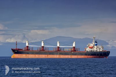
EKATERINA
Bulk Carrier
Current Trip
IN ORDER
| Time Travelled | 11 days |
|---|---|
| Remaining Time | --- |
| Distance Travelled | 1372.55 nm |
| Remaining Distance | --- |
| AVG Speed | 7.6 Knots |
| MAX Speed | 12.9 Knots |
| AVG Wind | 13.4 knots |
| MAX Wind | 32.7 knots |
| MIN Temp | 1°C / 33.8°F |
| MAX Temp | 24.2°C / 75.56°F |
| Dybgang | 6.6 m |
| Position Modtaget | 23 h, 15 m siden |
Current Position
| Longitude | --- |
|---|---|
| Latitude | --- |
| Status | Under way using engine |
| Fart | 5.1 Knots |
| Kurs | 78° |
| Område | Black Sea |
| Station | T-AIS |
| Position Modtaget | 23 h, 15 m siden |
Info
Information
The current position of EKATERINA is in Black Sea with coordinates 42.67250° / 32.26596° as reported on 2024-12-02 19:57 by AIS to our vessel tracker app. The vessel's current speed is 5.1 Knots
The vessel EKATERINA (IMO: 9158458, MMSI: 215776000) is a Bulk Carrier that was built in 2000 ( 24 år gamle ). It's sailing under the flag of [MT] Malta.
In this page you can find informations about the vessels current position, last detected port calls, and current voyage information. If the vessels is not in coverage by AIS you will find the latest position.
The current position of EKATERINA is detected by our AIS receivers and we are not responsible for the reliability of the data. The last position was recorded while the vessel was in Coverage by the Ais receivers of our vessel tracking app.
The current draught of EKATERINA as reported by AIS is 6.6 meters
Weather
| Temperature | 11°C / 51.8°F |
|---|---|
| Wind Speed | 17 knots |
| Direction | 75° ENE |
| Pressure | 1019 hPa |
| Humidity | 80.7 % |
| Cloud Coverage | 74 % |
Featured Company
Last Port Calls
| Port | Arrival | Departure | Time In Port |
|---|---|---|---|
| 2024-11-16 14:29 | 2024-11-22 12:07 | 5 d | |
| 2024-11-10 01:28 | 2024-11-10 02:56 | 1 h | |
| 2024-11-09 05:33 | 2024-11-10 01:16 | 19 h | |
| 2024-11-09 05:23 | 2024-11-09 05:28 | 4 m | |
| 2024-11-09 03:29 | 2024-11-09 05:18 | 1 h | |
| 2024-11-05 21:23 | 2024-11-09 03:13 | 3 d | |
| 2024-10-24 11:32 | 2024-10-29 22:54 | 5 d |
Most Visited Ports (Last year)
| Port | Arrivals | |
|---|---|---|
| 8 | ||
| 3 | ||
| 2 | ||
| 2 | ||
| 2 | ||
| 1 |
Last Trips
| Origin | Departure | Destination | Arrival | Distance | |
|---|---|---|---|---|---|
| 2024-11-10 02:56 | 2024-11-16 14:29 | 1235.60 nm | |||
| 2024-11-10 01:16 | 2024-11-10 01:28 | 1.15 nm | |||
| 2024-11-09 05:28 | 2024-11-09 05:33 | 0.15 nm | |||
| 2024-11-09 05:18 | 2024-11-09 05:23 | 0.36 nm | |||
| 2024-11-09 03:13 | 2024-11-09 03:29 | 0.50 nm | |||
| 2024-10-29 22:54 | 2024-11-05 21:23 | 1609.82 nm | |||
| 2024-09-12 06:28 | 2024-10-24 11:32 | 3874.20 nm |
Events
| Tid | Hændelsen | Detaljer | Position / Dest | Info |
|---|---|---|---|---|
| 2024-12-02 19:57 | Udenfor Dækning |
42.67250 / 32.26596
Black Sea
|
Fart: 5.1 kn Kurs: 78° |
|
| 2024-12-02 19:56 | Status er ændret | Under way using engine Default |
42.67227 / 32.26440
IN ORDER
|
Fart: 5 kn Kurs: 72° |
| 2024-12-02 19:56 | Indenfor Dækning |
42.67227 / 32.26440
Black Sea
|
Fart: 5.1 kn Kurs: 78.1° |
|
| 2024-12-02 18:57 | Status er ændret | Default Under way using engine |
42.65279 / 32.15436
IN ORDER
|
Fart: 4.9 kn Kurs: 74° |
| 2024-12-02 18:48 | Udenfor Dækning |
42.65073 / 32.13975
Black Sea
|
Fart: 4.9 kn Kurs: 81.4° |
|
| 2024-12-02 18:46 | Status er ændret | Under way using engine Default |
42.64983 / 32.13549
IN ORDER
|
Fart: 4.9 kn Kurs: 71° |
| 2024-12-02 18:42 | Indenfor Dækning |
42.64983 / 32.13549
Black Sea
|
Fart: 4.9 kn Kurs: 71.1° |
|
| 2024-12-02 17:09 | Status er ændret | Default Under way using engine |
42.61752 / 31.95268
IN ORDER
|
Fart: 5.1 kn Kurs: 77.3° |
| 2024-12-02 17:00 | Udenfor Dækning |
42.61497 / 31.93845
Black Sea
|
Fart: 5.1 kn Kurs: 77.3° |
|
| 2024-12-02 13:04 | Indenfor Dækning |
42.56060 / 31.52337
Black Sea
IN ORDER
|
Fart: 4.5 kn Kurs: 74.9° |