
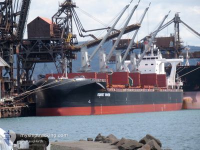
EGRET RIVER
Cargo
Current Trip
SFDS BR
| Time Travelled | 5 days |
|---|---|
| Remaining Time | --- |
| Distance Travelled | 1114.65 nm |
| Remaining Distance | --- |
| AVG Speed | 9.3 Knop |
| MAX Speed | 13 Knop |
| AVG Wind | 8 knots |
| MAX Wind | 17.8 knots |
| MIN Temp | 25.1°C / 77.18°F |
| MAX Temp | 30.9°C / 87.62°F |
| Djupgående | 12.9 m |
| Position mottagen | 1 d sen |
Current Position
| Longitud | 103.52326° |
|---|---|
| Latitude | 1.21662° |
| Status | Under way using engine |
| Fart | 10.4 Knop |
| Kurs | 286.7° |
| Område | Singapore Strait |
| Station | T-AIS |
| Position mottagen | 1 d sen |
Info
Information
The current position of EGRET RIVER is in Singapore Strait with coordinates 1.21662° / 103.52326° as reported on 2024-05-29 09:32 by AIS to our vessel tracker app. The vessel's current speed is 10.4 Knop
The vessel EGRET RIVER (IMO: 9708978, MMSI: 353156000) is a Cargo It's sailing under the flag of [PA] Panama.
In this page you can find informations about the vessels current position, last detected port calls, and current voyage information. If the vessels is not in coverage by AIS you will find the latest position.
The current position of EGRET RIVER is detected by our AIS receivers and we are not responsible for the reliability of the data. The last position was recorded while the vessel was in Coverage by the Ais receivers of our vessel tracking app.
The current draught of EGRET RIVER as reported by AIS is 12.9 meters
Weather
| Temperature | 30°C / 86°F |
|---|---|
| Wind Speed | 10 knots |
| Direction | 254° WSW |
| Pressure | 1006.6 hPa |
| Humidity | 70.3 % |
| Cloud Coverage | 87 % |
Featured Company
Most Visited Ports (Last year)
| Port | Arrivals | |
|---|---|---|
| 1 | ||
| 1 | ||
| 1 | ||
| 1 | ||
| 1 | ||
| 1 |
Last Trips
| Origin | Departure | Destination | Arrival | Distance | |
|---|---|---|---|---|---|
| 2024-04-26 22:24 | 2024-05-24 15:08 | 2778.61 nm | |||
| 2024-03-23 15:29 | 2024-04-25 15:12 | 6174.32 nm | |||
| 2024-03-17 12:57 | 2024-03-19 21:15 | 149.74 nm | |||
| 2024-03-06 07:12 | 2024-03-14 16:14 | 1189.35 nm |
Events
| Tid | Event | Detaljer | Position / Dest | Information |
|---|---|---|---|---|
| 2024-05-29 09:38 | Status ändrad | Default Under way using engine |
1.22095 / 103.50613
SFDS BR
|
Fart: 10.4 kn Kurs: 286.7° |
| 2024-05-29 09:32 | UTANFÖR täckningsområde |
1.21662 / 103.52326
Singapore Strait
|
Fart: 10.4 kn Kurs: 286.7° |
|
| 2024-05-29 09:07 | Byter havsområde | Malaysian part of the Singapore Strait Indonesian part of the Singapore Strait |
1.19783 / 103.59249
Singapore Strait
|
Fart: 10.7 kn Kurs: 285.1° |
| 2024-05-29 08:16 | Byter havsområde | Indonesian part of the Singapore Strait Singaporean part of the Singapore Strait |
1.13655 / 103.73037
Singapore Strait
|
Fart: 10.8 kn Kurs: 278.9° |
| 2024-05-29 06:24 | STARTAR förflyttning | 3.03 nm, South West of TANAH MERAH |
1.28555 / 103.97502
SFDS BR
|
Fart: 3.1 kn Kurs: 210° |
| 2024-05-29 06:12 | Status ändrad | Under way using engine At anchor |
1.28799 / 103.97916
SFDS BR
|
Fart: 0.3 kn Kurs: 261° |
| 2024-05-29 06:02 | Djupgående ändrat | 12.9 12.8 |
1.28822 / 103.97954
SFDS BR
|
Fart: Kurs: 217° |
| 2024-05-29 06:02 | ETA ändrat | 2024/07/03 01:00 2024/05/28 18:45 |
1.28822 / 103.97954
SFDS BR
|
Fart: Kurs: 217° |
| 2024-05-29 05:56 | Destination ändrad | SFDS BR SG SIN PEBG-C |
1.28807 / 103.97952
SFDS BR
|
Fart: 0.1 kn Kurs: 217° |
| 2024-05-29 00:02 | Status ändrad | At anchor Default |
1.28713 / 103.98034
SG SIN PEBG-C
|
Fart: Kurs: 252° |