
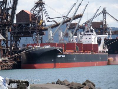
EGRET RIVER
Cargo
Current Trip
| Time Travelled | 19 days |
|---|---|
| Remaining Time | 1 h, 20 mins |
| Distance Travelled | 5229.06 nm |
| Remaining Distance | 19.99 nm |
| AVG Speed | 11.1 Knots |
| MAX Speed | 17.4 Knots |
| AVG Wind | 19.1 knots |
| MAX Wind | 43 knots |
| MIN Temp | 1.3°C / 34.34°F |
| MAX Temp | 15.6°C / 60.08°F |
| Draught | 7 m |
| Position Received | 4 m ago |
Current Position
| Longitude | --- |
|---|---|
| Latitude | --- |
| Status | Under way using engine |
| Speed | 13.1 Knots |
| Course | 346.1° |
| Area | The Coastal Waters of Southeast Alaska and British Columbia |
| Station | T-AIS |
| Position Received | 4 m ago |
Info
Information
The current position of EGRET RIVER is in The Coastal Waters of Southeast Alaska and British Columbia with coordinates 49.09307° / -123.33223° as reported on 2025-12-06 00:30 by AIS to our vessel tracker app. The vessel's current speed is 13.1 Knots and is heading at the port of VANCOUVER. The estimated time of arrival as calculated by MyShipTracking vessel tracking app is 2025-12-05 17:54 LT
The vessel EGRET RIVER (IMO: 9708978, MMSI: 353156000) is a Cargo It's sailing under the flag of [PA] Panama.
In this page you can find informations about the vessels current position, last detected port calls, and current voyage information. If the vessels is not in coverage by AIS you will find the latest position.
The current position of EGRET RIVER is detected by our AIS receivers and we are not responsible for the reliability of the data. The last position was recorded while the vessel was in Coverage by the Ais receivers of our vessel tracking app.
The current draught of EGRET RIVER as reported by AIS is 7 meters
Weather
| Temperature | 10.1°C / 50.18°F |
|---|---|
| Wind Speed | 12 knots |
| Direction | 208° SSW |
| Pressure | 1002.2 hPa |
| Humidity | 85.2 % |
| Cloud Coverage | 100 % |
Featured Company
Last Port Calls
| Port | Arrival | Departure | Time In Port |
|---|---|---|---|
| 2025-11-11 08:18 | 2025-11-16 15:52 | 5 d | |
| 2025-10-13 16:30 | 2025-10-14 14:00 | 21 h | |
| 2025-10-06 10:57 |
Last Trips
| Origin | Departure | Destination | Arrival | Distance | |
|---|---|---|---|---|---|
| 2025-10-14 14:00 | 2025-11-11 08:18 | 4152.97 nm | |||
| 2025-10-06 10:57 | 2025-10-13 16:30 | 999.47 nm |
Events
| Time | Event | Details | Position / Dest | Info |
|---|---|---|---|---|
| 2025-12-06 00:01 | Change Sea Area | Canadian part of the The Coastal Waters of Southeast Alaska and British Columbia United States part of the The Coastal Waters of Southeast Alaska and British Columbia |
49.00348 / -123.25192
The Coastal Waters of Southeast Alaska and British Columbia
CA VAN
|
Speed: 13 kn Course: 313.4° |
| 2025-12-05 22:47 | Change Sea Area | United States part of the The Coastal Waters of Southeast Alaska and British Columbia Canadian part of the The Coastal Waters of Southeast Alaska and British Columbia |
48.79442 / -123.00945
The Coastal Waters of Southeast Alaska and British Columbia
CA VAN
|
Speed: 13.4 kn Course: 21.8° |
| 2025-12-05 22:32 | Change Sea Area | Canadian part of the The Coastal Waters of Southeast Alaska and British Columbia United States part of the The Coastal Waters of Southeast Alaska and British Columbia |
48.75111 / -123.06935
The Coastal Waters of Southeast Alaska and British Columbia
CA VAN
|
Speed: 14.5 kn Course: 54.5° |
| 2025-12-05 20:52 | Change Sea Area | United States part of the The Coastal Waters of Southeast Alaska and British Columbia Canadian part of the The Coastal Waters of Southeast Alaska and British Columbia |
48.46160 / -123.16514
The Coastal Waters of Southeast Alaska and British Columbia
CA VAN
|
Speed: 13.2 kn Course: 353.6° |
| 2025-12-05 18:43 | Change Sea Area | Canadian part of the The Coastal Waters of Southeast Alaska and British Columbia United States part of the The Coastal Waters of Southeast Alaska and British Columbia |
48.22300 / -123.53842
The Coastal Waters of Southeast Alaska and British Columbia
CA VAN
|
Speed: 9.4 kn Course: 82.1° |
| 2025-12-05 16:12 | Status Changed | Under way using engine Default |
48.29395 / -124.15007
CA VAN
|
Speed: 11.6 kn Course: 115° |
| 2025-12-05 16:11 | Status Changed | Default Under way using engine |
48.29596 / -124.15674
CA VAN
|
Speed: 11.8 kn Course: 117.6° |
| 2025-12-05 14:33 | Status Changed | Under way using engine Default |
48.43935 / -124.61000
CA VAN
|
Speed: 13.4 kn Course: 115° |
| 2025-12-05 14:31 | Status Changed | Default Under way using engine |
48.44313 / -124.62195
CA VAN
|
Speed: 13.3 kn Course: 113.9° |
| 2025-12-05 14:23 | Status Changed | Under way using engine Default |
48.45544 / -124.66366
CA VAN
|
Speed: 12.8 kn Course: 113° |