
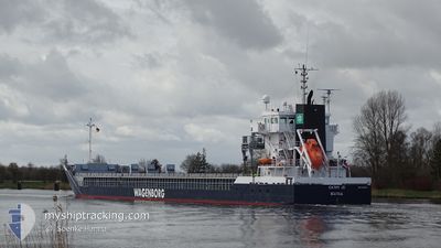
CATHY JO
General Cargo
Current Trip
| Time Travelled | 4 days |
|---|---|
| Remaining Time | 10 h, 48 mins |
| Distance Travelled | 1174.12 nm |
| Remaining Distance | 138.21 nm |
| AVG Speed | 9.6 Knop |
| MAX Speed | 12.7 Knop |
| AVG Wind | 9.7 knots |
| MAX Wind | 22 knots |
| MIN Temp | -4.4°C / 24.08°F |
| MAX Temp | 10.3°C / 50.54°F |
| Djupgående | 6 m |
| Position mottagen | 55 m sen |
Current Position
| Longitud | 4.54587° |
|---|---|
| Latitude | 53.37398° |
| Status | Under way using engine |
| Fart | 12 Knop |
| Kurs | 200.5° |
| Område | North Sea |
| Station | T-AIS |
| Position mottagen | 55 m sen |
Info
Information
The current position of CATHY JO is in North Sea with coordinates 53.37398° / 4.54587° as reported on 2024-04-27 14:52 by AIS to our vessel tracker app. The vessel's current speed is 12 Knop and is heading at the port of TERNEUZEN. The estimated time of arrival as calculated by MyShipTracking vessel tracking app is 2024-04-28 02:36 LT
The vessel CATHY JO (IMO: 9419278, MMSI: 246996000) is a General Cargo that was built in 2008 ( 16 År gammal ). It's sailing under the flag of [NL] Netherlands.
In this page you can find informations about the vessels current position, last detected port calls, and current voyage information. If the vessels is not in coverage by AIS you will find the latest position.
The current position of CATHY JO is detected by our AIS receivers and we are not responsible for the reliability of the data. The last position was recorded while the vessel was in Coverage by the Ais receivers of our vessel tracking app.
The current draught of CATHY JO as reported by AIS is 6 meters
Weather
| Temperature | 9.9°C / 49.82°F |
|---|---|
| Wind Speed | 5 knots |
| Direction | 184° S |
| Pressure | 1005.2 hPa |
| Humidity | 90.8 % |
| Cloud Coverage | 97 % |
Featured Company
Last Port Calls
| Port | Arrival | Departure | Time In Port |
|---|---|---|---|
| 2024-04-09 00:25 | 2024-04-22 21:56 | 13 d | |
| 2024-03-15 09:00 | 2024-03-20 21:41 | 5 d | |
| 2024-03-13 18:19 | 2024-03-13 19:14 | 54 m | |
| 2024-03-08 01:27 | 2024-03-13 11:05 | 5 d | |
| 2024-03-07 18:31 | 2024-03-07 18:54 | 22 m | |
| 2024-03-02 14:42 | 2024-03-05 19:59 | 3 d | |
| 2024-02-26 00:59 | 2024-03-01 05:26 | 4 d | |
| 2024-02-21 15:15 | 2024-02-21 15:19 | 4 m | |
| 2024-02-13 00:47 | 2024-02-19 13:35 | 6 d | |
| 2024-02-07 19:00 | 2024-02-12 12:27 | 4 d |
Most Visited Ports (Last year)
| Port | Arrivals | |
|---|---|---|
| 5 | ||
| 4 | ||
| 3 | ||
| 3 | ||
| 3 | ||
| 3 |
Last Trips
| Origin | Departure | Destination | Arrival | Distance | |
|---|---|---|---|---|---|
| 2024-03-20 22:41 | 2024-04-09 03:25 | 898.52 nm | |||
| 2024-03-13 20:14 | 2024-03-15 10:00 | 386.17 nm | |||
| 2024-03-13 12:05 | 2024-03-13 19:19 | 64.96 nm | |||
| 2024-03-07 19:54 | 2024-03-08 02:27 | 65.86 nm | |||
| 2024-03-05 21:59 | 2024-03-07 19:31 | 449.42 nm | |||
| 2024-03-01 07:26 | 2024-03-02 16:42 | 171.70 nm | |||
| 2024-02-21 16:19 | 2024-02-26 02:59 | 980.53 nm | |||
| 2024-02-19 14:35 | 2024-02-21 16:15 | 425.14 nm | |||
| 2024-02-12 13:27 | 2024-02-13 01:47 | 127.69 nm | |||
| 2024-02-02 18:58 | 2024-02-07 20:00 | 1109.29 nm |
Events
| Tid | Event | Detaljer | Position / Dest | Information |
|---|---|---|---|---|
| 2024-04-27 14:58 | Status ändrad | Default Under way using engine |
53.35500 / 4.53333
NLTNZ
|
Fart: 12 kn Kurs: 200.5° |
| 2024-04-27 11:09 | ETA ändrat | 2025/03/28 03:00 2025/03/28 08:00 |
53.68444 / 5.61703
NLTNZ
|
Fart: 10.5 kn Kurs: 251.4° |
| 2024-04-27 10:57 | Status ändrad | Under way using engine Default |
53.69725 / 5.67310
NLTNZ
|
Fart: 10.5 kn Kurs: 254° |
| 2024-04-27 10:56 | Status ändrad | Default Under way using engine |
53.69814 / 5.67701
NLTNZ
|
Fart: 10.4 kn Kurs: 251.6° |
| 2024-04-27 10:20 | Byter havsområde | Dutch part of the North Sea German part of the North Sea |
53.73472 / 5.84202
North Sea
|
Fart: 10.1 kn Kurs: 250.3° |
| 2024-04-27 10:19 | Status ändrad | Under way using engine Default |
53.73518 / 5.84415
NLTNZ
|
Fart: 10 kn Kurs: 244° |
| 2024-04-27 10:10 | I täckningsområde |
53.73472 / 5.84202
North Sea
|
Fart: 10.1 kn Kurs: 250.3° |
|
| 2024-04-27 06:28 | Status ändrad | Default Under way using engine |
53.90899 / 6.94371
NLTNZ
|
Fart: 12 kn Kurs: 254.8° |
| 2024-04-27 06:22 | UTANFÖR täckningsområde |
53.91369 / 6.97567
North Sea
|
Fart: 12 kn Kurs: 254.8° |
|
| 2024-04-27 06:12 | Status ändrad | Under way using engine Default |
53.92250 / 7.03329
NLTNZ
|
Fart: 12.1 kn Kurs: 255° |