
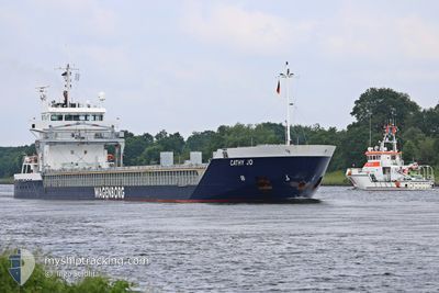
CATHY JO
General Cargo
Current Trip
| Trip Time | 3 days |
|---|---|
| Trip Distance | 425.30 nm |
| AVG Speed | 9.9 Knots |
| MAX Speed | 14.6 Knots |
| Dybgang | 6.7 m |
| AVG Wind | 10.1 knots |
| MAX Wind | 28 knots |
| MIN Temp | -0.3°C / 31.46°F |
| MAX Temp | 8.8°C / 47.84°F |
| Position Modtaget | 2 m siden |
Current Position
| Longitude | --- |
|---|---|
| Latitude | --- |
| Status | Under way using engine |
| Fart | |
| Kurs | 43° |
| Område | Skaggerak |
| Station | T-AIS |
| Position Modtaget | 2 m siden |
Info
Information
The current position of CATHY JO is in Skaggerak with coordinates 59.12592° / 9.61650° as reported on 2024-12-31 10:31 by AIS to our vessel tracker app. The vessel's current speed is 0 Knots and is currently inside the port of PORSGRUNN.
The vessel CATHY JO (IMO: 9419278, MMSI: 246996000) is a General Cargo that was built in 2008 ( 16 år gamle ). It's sailing under the flag of [NL] Netherlands.
In this page you can find informations about the vessels current position, last detected port calls, and current voyage information. If the vessels is not in coverage by AIS you will find the latest position.
The current position of CATHY JO is detected by our AIS receivers and we are not responsible for the reliability of the data. The last position was recorded while the vessel was in Coverage by the Ais receivers of our vessel tracking app.
The current draught of CATHY JO as reported by AIS is 6.7 meters
Weather
| Temperature | -1.5°C / 29.3°F |
|---|---|
| Wind Speed | 1 knots |
| Direction | 354° N |
| Pressure | 1011.8 hPa |
| Humidity | 65.2 % |
| Cloud Coverage | 100 % |
Featured Company
Last Port Calls
| Port | Arrival | Departure | Time In Port |
|---|---|---|---|
| 2024-12-31 07:03 | |||
| 2024-12-27 05:44 | 2024-12-27 20:48 | 15 h | |
| 2024-12-20 22:57 | 2024-12-22 06:13 | 1 d | |
| 2024-12-17 23:53 | 2024-12-18 19:00 | 19 h | |
| 2024-12-16 09:45 | 2024-12-17 09:23 | 23 h | |
| 2024-12-14 06:14 | 2024-12-14 23:11 | 16 h | |
| 2024-12-10 21:59 | 2024-12-13 09:20 | 2 d | |
| 2024-12-04 17:03 | 2024-12-06 14:01 | 1 d | |
| 2024-12-03 06:32 | 2024-12-03 22:52 | 16 h | |
| 2024-11-21 09:55 | 2024-11-29 08:47 | 7 d |
Last Trips
| Origin | Departure | Destination | Arrival | Distance | |
|---|---|---|---|---|---|
| 2024-12-27 21:48 | 2024-12-31 08:03 | 425.30 nm | |||
| 2024-12-22 07:13 | 2024-12-27 06:44 | 442.94 nm | |||
| 2024-12-18 20:00 | 2024-12-20 23:57 | 637.04 nm | |||
| 2024-12-17 10:23 | 2024-12-18 00:53 | 111.68 nm | |||
| 2024-12-15 00:11 | 2024-12-16 10:45 | 299.45 nm | |||
| 2024-12-13 10:20 | 2024-12-14 07:14 | 188.50 nm | |||
| 2024-12-06 16:01 | 2024-12-10 22:59 | 977.74 nm | |||
| 2024-12-04 00:52 | 2024-12-04 19:03 | 204.78 nm | |||
| 2024-11-29 09:47 | 2024-12-03 08:32 | 874.39 nm | |||
| 2024-11-19 07:21 | 2024-11-21 10:55 | 402.82 nm |
Events
| Tid | Hændelsen | Detaljer | Position / Dest | Info |
|---|---|---|---|---|
| 2024-12-31 07:16 | STOP Sejllads |
59.12602 / 9.61627
[NO] PORSGRUNN
|
Fart: 0.3 kn Kurs: 53° |
|
| 2024-12-31 07:03 | Skibe i havn |
|
59.12269 / 9.60751
[NO] PORSGRUNN
|
Fart: 5.2 kn Kurs: 41.4° |
| 2024-12-31 06:45 | START Sejllads | 0.87 nm, South East of PORSGRUNN |
59.10686 / 9.62802
NOHRY
|
Fart: 3.9 kn Kurs: 206° |
| 2024-12-31 06:37 | Status er ændret | Under way using engine At anchor |
59.10999 / 9.62942
NOHRY
|
Fart: 0.4 kn Kurs: 99° |
| 2024-12-29 14:22 | STOP Sejllads | 0.76 nm, South East of PORSGRUNN |
59.10929 / 9.62860
NOHRY
|
Fart: 0.3 kn Kurs: 102° |
| 2024-12-29 14:16 | Status er ændret | At anchor Under way using engine |
59.10860 / 9.62852
NOHRY
|
Fart: 0.8 kn Kurs: 42° |
| 2024-12-29 04:14 | Ændre havområde | Norwegian part of the Skaggerak Danish part of the Skaggerak |
57.67646 / 8.76797
Skaggerak
NOHRY
|
Fart: 10.7 kn Kurs: 30.5° |
| 2024-12-29 01:40 | Fundet i havområde | Danish part of the Skaggerak |
57.29725 / 8.30741
Skaggerak
NOHRY
|
Fart: 10.3 kn Kurs: 35° |
| 2024-12-28 15:50 | Status er ændret | Under way using engine Default |
55.80369 / 6.98748
NOHRY
|
Fart: 10.6 kn Kurs: 359° |
| 2024-12-28 15:45 | Status er ændret | Default Under way using engine |
55.78963 / 6.98839
NOHRY
|
Fart: 10.5 kn Kurs: 357.8° |