

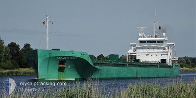
ARKLOW WAVE
Cargo

Current Trip
| Time Travelled | 6 days |
|---|---|
| Remaining Time | --- |
| Distance Travelled | 540.83 nm |
| Remaining Distance | --- |
| AVG Speed | 10.9 Knop |
| MAX Speed | 15.3 Knop |
| AVG Wind | 10 knots |
| MAX Wind | 21 knots |
| MIN Temp | 7.1°C / 44.78°F |
| MAX Temp | 11.2°C / 52.16°F |
| Djupgående | 5.5 m |
| Position mottagen | 2 h, 36 m sen |
Current Position
| Longitud | --- |
|---|---|
| Latitude | --- |
| Status | Under way using engine |
| Fart | 10.3 Knop |
| Kurs | 313° |
| Område | North Atlantic Ocean |
| Station | T-AIS |
| Position mottagen | 2 h, 36 m sen |
Information
The current position of ARKLOW WAVE is in North Atlantic Ocean with coordinates 51.58047° / -10.33508° as reported on 2025-03-29 16:12 by AIS to our vessel tracker app. The vessel's current speed is 10.3 Knop and is heading at the port of AUGHINISH. The estimated time of arrival as calculated by MyShipTracking vessel tracking app is 2025-03-30 02:00 LT
The vessel ARKLOW WAVE (IMO: 9818931, MMSI: 250005382) is a Cargo It's sailing under the flag of [IE] Ireland.
In this page you can find informations about the vessels current position, last detected port calls, and current voyage information. If the vessels is not in coverage by AIS you will find the latest position.
The current position of ARKLOW WAVE is detected by our AIS receivers and we are not responsible for the reliability of the data. The last position was recorded while the vessel was in Coverage by the Ais receivers of our vessel tracking app.
The current draught of ARKLOW WAVE as reported by AIS is 5.5 meters
Weather
| Temperature | 11.5°C / 52.7°F |
|---|---|
| Wind Speed | 20 knots |
| Direction | 268° W |
| Pressure | 1019.4 hPa |
| Humidity | 88.7 % |
| Cloud Coverage | 100 % |


Featured Company
Last Port Calls
| Port | Arrival | Departure | Time In Port |
|---|---|---|---|
| 2025-03-20 07:26 | 2025-03-22 23:03 | 2 d | |
| 2025-03-16 01:56 | 2025-03-17 16:14 | 1 d | |
| 2025-02-28 12:39 | 2025-03-07 04:31 | 6 d | |
| 2025-02-28 12:29 | 2025-02-28 12:38 | 9 m | |
| 2025-02-20 20:39 | 2025-02-21 01:04 | 4 h | |
| 2025-02-16 14:40 | 2025-02-18 17:45 | 2 d | |
| 2025-02-04 22:17 | 2025-02-15 22:44 | 11 d | |
| 2025-01-21 22:47 | 2025-01-26 20:12 | 4 d | |
| 2025-01-16 08:37 | 2025-01-18 02:44 | 1 d | |
| 2025-01-10 01:50 | 2025-01-12 18:20 | 2 d |
Last Trips
| Origin | Departure | Destination | Arrival | Distance | |
|---|---|---|---|---|---|
| 2025-03-17 16:14 | 2025-03-20 07:26 | 612.10 nm | |||
| 2025-03-07 04:31 | 2025-03-16 01:56 | 603.85 nm | |||
| 2025-02-28 12:38 | 2025-02-28 12:39 | 0.01 nm | |||
| 2025-02-21 01:04 | 2025-02-28 12:29 | 1032.91 nm | |||
| 2025-02-18 17:45 | 2025-02-20 20:39 | 520.23 nm | |||
| 2025-02-15 22:44 | 2025-02-16 14:40 | 190.17 nm | |||
| 2025-01-26 20:12 | 2025-02-04 22:17 | 2137.63 nm | |||
| 2025-01-18 02:44 | 2025-01-21 22:47 | 959.80 nm | |||
| 2025-01-12 18:20 | 2025-01-16 08:37 | 748.77 nm | |||
| 2025-01-08 19:59 | 2025-01-10 01:50 | 319.89 nm |
Events
| Tid | Event | Detaljer | Position / Dest | Information |
|---|---|---|---|---|
| 2025-03-29 16:25 | Status ändrad | Default Under way using engine |
51.60465 / -10.37402
AUGHINISH
|
Fart: 10.3 kn Kurs: 313° |
| 2025-03-29 16:12 | UTANFÖR täckningsområde |
51.58047 / -10.33508
North Atlantic Ocean
AUGHINISH
|
Fart: 10.3 kn Kurs: 313° |
|
| 2025-03-29 16:12 | Status ändrad | Under way using engine Default |
51.57918 / -10.33283
AUGHINISH
|
Fart: 10.4 kn Kurs: 314° |
| 2025-03-29 16:04 | Status ändrad | Default Under way using engine |
51.56340 / -10.30665
AUGHINISH
|
Fart: 10.4 kn Kurs: 313.9° |
| 2025-03-29 14:35 | Byter havsområde | Irish part of the North Atlantic Ocean Irish part of the Celtic Sea |
51.41918 / -9.96963
North Atlantic Ocean
AUGHINISH
|
Fart: 10.4 kn Kurs: 304.4° |
| 2025-03-29 14:35 | Status ändrad | Under way using engine Default |
51.41918 / -9.96963
AUGHINISH
|
Fart: 11.1 kn Kurs: 306° |
| 2025-03-29 14:19 | Status ändrad | Default Under way using engine |
51.39210 / -9.91100
AUGHINISH
|
Fart: 11.2 kn Kurs: 307.3° |
| 2025-03-29 14:10 | Status ändrad | Under way using engine Default |
51.37450 / -9.87442
AUGHINISH
|
Fart: 11.1 kn Kurs: 309° |
| 2025-03-29 14:04 | Status ändrad | Default Under way using engine |
51.36285 / -9.85193
AUGHINISH
|
Fart: 11 kn Kurs: 309° |
| 2025-03-29 13:27 | I täckningsområde |
51.29198 / -9.70998
Celtic Sea
AUGHINISH
|
Fart: 11.7 kn Kurs: 308.3° |