
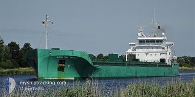
ARKLOW WAVE
Cargo
Current Trip
| Trip Time | 9 days |
|---|---|
| Trip Distance | 669.46 nm |
| AVG Speed | 11 Noeuds |
| MAX Speed | 13.5 Noeuds |
| Tirant d eau | 5.4 m |
| AVG Wind | 11.2 knots |
| MAX Wind | 22.2 knots |
| MIN Temp | 0.5°C / 32.9°F |
| MAX Temp | 9.7°C / 49.46°F |
| Position reçue | 7 d depuis |
Current Position
| Longitude | --- |
|---|---|
| Latitude | --- |
| Etat | At anchor |
| Vitesse | 0.1 Noeuds |
| Parcours | 242° |
| Zone | North Atlantic Ocean |
| Station | T-AIS |
| Position reçue | 7 d depuis |
Info
Information
The current position of ARKLOW WAVE is in North Atlantic Ocean with coordinates 52.59852° / -9.55228° as reported on 2025-12-31 12:04 by AIS to our vessel tracker app. The vessel's current speed is 0.1 Noeuds and is currently inside the port of AUGHINISH.
The vessel ARKLOW WAVE (IMO: 9818931, MMSI: 250005382) is a Cargo It's sailing under the flag of [IE] Ireland.
In this page you can find informations about the vessels current position, last detected port calls, and current voyage information. If the vessels is not in coverage by AIS you will find the latest position.
The current position of ARKLOW WAVE is detected by our AIS receivers and we are not responsible for the reliability of the data. The last position was recorded while the vessel was in Coverage by the Ais receivers of our vessel tracking app.
The current draught of ARKLOW WAVE as reported by AIS is 5.4 meters
Weather
| Temperature | 7.3°C / 45.14°F |
|---|---|
| Wind Speed | 15 knots |
| Direction | 302° WNW |
| Pressure | 1006.9 hPa |
| Humidity | 82.7 % |
| Cloud Coverage | 100 % |
Featured Company
Last Port Calls
| Port | Arrival | Departure | Time In Port |
|---|---|---|---|
| 2026-01-07 03:35 | |||
| 2025-12-24 12:44 | 2025-12-28 16:46 | 4 d | |
| 2025-12-20 13:58 | 2025-12-21 17:47 | 1 d | |
| 2025-12-12 09:29 | 2025-12-15 11:41 | 3 d | |
| 2025-12-04 15:20 | 2025-12-07 14:25 | 2 d | |
| 2025-11-21 13:17 | 2025-11-29 07:27 | 7 d | |
| 2025-11-14 11:26 | 2025-11-14 18:34 | 7 h | |
| 2025-11-08 18:32 | 2025-11-12 12:09 | 3 d | |
| 2025-11-04 19:12 | 2025-11-07 21:00 | 3 d | |
| 2025-11-02 18:03 | 2025-11-03 17:03 | 23 h |
Last Trips
| Origin | Departure | Destination | Arrival | Distance | |
|---|---|---|---|---|---|
| 2025-12-28 16:46 | 2026-01-07 03:35 | 669.46 nm | |||
| 2025-12-21 17:47 | 2025-12-24 12:44 | 621.10 nm | |||
| 2025-12-15 11:41 | 2025-12-20 13:58 | 965.33 nm | |||
| 2025-12-07 14:25 | 2025-12-12 09:29 | 914.22 nm | |||
| 2025-11-29 07:27 | 2025-12-04 15:20 | 726.32 nm | |||
| 2025-11-14 18:34 | 2025-11-21 13:17 | 1673.91 nm | |||
| 2025-11-12 12:09 | 2025-11-14 11:26 | 457.61 nm | |||
| 2025-11-07 21:00 | 2025-11-08 18:32 | 275.98 nm | |||
| 2025-11-03 17:03 | 2025-11-04 19:12 | 317.84 nm | |||
| 2025-10-26 22:51 | 2025-11-02 18:03 | 1358.20 nm |
Events
| Heure | Evenement | Détails | Position/ Destination | Info |
|---|---|---|---|---|
| 2026-01-07 03:35 | Arret |
52.64500 / -9.05667
[IE] AUGHINISH
|
Vitesse: Parcours: -1° |
|
| 2026-01-07 03:35 | Port d'arrivée |
|
52.64500 / -9.05667
[IE] AUGHINISH
|
Vitesse: 3 kn Parcours: -1° |
| 2026-01-07 01:34 | Démarrage | 2.54 nm, South West of CAPPA UPPER |
52.59708 / -9.54728
IEAUG
|
Vitesse: 4.5 kn Parcours: 116° |
| 2025-12-31 12:07 | Etat Changé | Default At anchor |
52.59833 / -9.55166
IEAUG
|
Vitesse: 0.1 kn Parcours: 242° |
| 2025-12-31 12:04 | Etat Changé | At anchor Default |
52.59852 / -9.55228
IEAUG
|
Vitesse: Parcours: -1° |
| 2025-12-31 12:04 | Hors de la zone couverte |
52.59852 / -9.55228
North Atlantic Ocean
|
Vitesse: 0.1 kn Parcours: 36° |
|
| 2025-12-31 11:46 | Dans la zone couverte |
52.59852 / -9.55228
North Atlantic Ocean
|
Vitesse: 0.1 kn Parcours: 36° |
|
| 2025-12-30 22:41 | Arret | 2.61 nm, South West of CAPPA UPPER |
52.59833 / -9.55166
IEAUG
|
Vitesse: Parcours: -1° |
| 2025-12-30 14:22 | Etat Changé | Default Under way using engine |
51.57500 / -10.37333
IEAUG
|
Vitesse: 11.5 kn Parcours: 303° |
| 2025-12-30 14:15 | Hors de la zone couverte |
51.56070 / -10.34473
North Atlantic Ocean
IEAUG
|
Vitesse: 11.5 kn Parcours: 303° |