
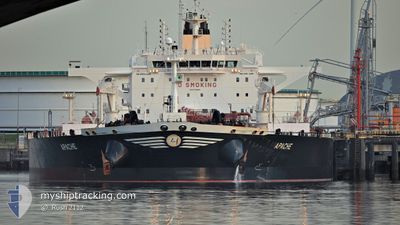
APACHE
Tanker
Current Trip
| Time Travelled | 21 h, 0 mins |
|---|---|
| Remaining Time | 1 day |
| Distance Travelled | 5.06 nm |
| Remaining Distance | 691.95 nm |
| AVG Speed | 6.2 Knop |
| MAX Speed | 9.2 Knop |
| AVG Wind | 6 knots |
| MAX Wind | 10.9 knots |
| MIN Temp | 18.2°C / 64.76°F |
| MAX Temp | 23.9°C / 75.02°F |
| Djupgående | 9.4 m |
| Position mottagen | 1 m sen |
Current Position
| Longitud | 4.93791° |
|---|---|
| Latitude | 43.33371° |
| Status | At anchor |
| Fart | |
| Kurs | 152° |
| Område | Mediterranean Sea - Western Basin |
| Station | T-AIS |
| Position mottagen | 1 m sen |
Info
Information
The current position of APACHE is in Mediterranean Sea - Western Basin with coordinates 43.33371° / 4.93791° as reported on 2024-06-05 07:44 by AIS to our vessel tracker app. The vessel's current speed is 0 Knop and is heading at the port of GIBRALTAR. The estimated time of arrival as calculated by MyShipTracking vessel tracking app is 2024-06-06 23:50 LT
The vessel APACHE (IMO: 9749489, MMSI: 241458000) is a Tanker It's sailing under the flag of [GR] Greece.
In this page you can find informations about the vessels current position, last detected port calls, and current voyage information. If the vessels is not in coverage by AIS you will find the latest position.
The current position of APACHE is detected by our AIS receivers and we are not responsible for the reliability of the data. The last position was recorded while the vessel was in Coverage by the Ais receivers of our vessel tracking app.
The current draught of APACHE as reported by AIS is 9.4 meters
Weather
| Temperature | 18.3°C / 64.94°F |
|---|---|
| Wind Speed | 6 knots |
| Direction | 124° SE |
| Pressure | 1016.1 hPa |
| Humidity | 84.1 % |
| Cloud Coverage | 2 % |
Featured Company
Last Port Calls
| Port | Arrival | Departure | Time In Port |
|---|---|---|---|
| 2024-06-02 16:02 | 2024-06-04 12:46 | 1 d | |
| 2024-04-29 15:26 | 2024-05-01 05:54 | 1 d | |
| 2024-04-25 20:07 | 2024-04-29 12:40 | 3 d |
Most Visited Ports (Last year)
| Port | Arrivals | |
|---|---|---|
| 2 | ||
| 2 | ||
| 1 | ||
| 1 | ||
| 1 | ||
| 1 |
Last Trips
| Origin | Departure | Destination | Arrival | Distance | |
|---|---|---|---|---|---|
| 2024-05-01 05:54 | 2024-06-02 16:02 | 8496.73 nm | |||
| 2024-04-29 12:40 | 2024-04-29 15:26 | 22.41 nm | |||
| 2024-02-24 07:02 | 2024-04-25 20:07 | 14298.86 nm |
Events
| Tid | Event | Detaljer | Position / Dest | Information |
|---|---|---|---|---|
| 2024-06-05 07:44 | Status ändrad | At anchor Default |
43.33371 / 4.93791
GIGIB
|
Fart: Kurs: 154° |
| 2024-06-05 07:32 | Status ändrad | Default At anchor |
43.33378 / 4.93797
GIGIB
|
Fart: Kurs: 155° |
| 2024-06-05 07:26 | Status ändrad | At anchor Default |
43.33378 / 4.93801
GIGIB
|
Fart: Kurs: 154° |
| 2024-06-05 07:20 | Status ändrad | Default At anchor |
43.33378 / 4.93803
GIGIB
|
Fart: Kurs: 155° |
| 2024-06-05 06:47 | Status ändrad | At anchor Default |
43.33361 / 4.93817
GIGIB
|
Fart: Kurs: 157° |
| 2024-06-05 06:14 | Status ändrad | Default At anchor |
43.33378 / 4.93838
GIGIB
|
Fart: Kurs: 161° |
| 2024-06-05 06:05 | Status ändrad | At anchor Default |
43.33373 / 4.93848
GIGIB
|
Fart: Kurs: 163° |
| 2024-06-05 05:56 | Status ändrad | Default At anchor |
43.33371 / 4.93857
GIGIB
|
Fart: Kurs: 165° |
| 2024-06-05 05:53 | Status ändrad | At anchor Default |
43.33375 / 4.93863
GIGIB
|
Fart: Kurs: 166° |
| 2024-06-05 05:08 | Status ändrad | Default At anchor |
43.33378 / 4.93879
GIGIB
|
Fart: Kurs: 168° |