
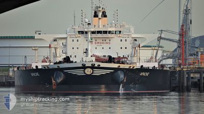
APACHE
Tanker
Current Trip
| Time Travelled | 3 days |
|---|---|
| Remaining Time | 6 h, 7 mins |
| Distance Travelled | 703.63 nm |
| Remaining Distance | 17.63 nm |
| AVG Speed | 10.2 Knots |
| MAX Speed | 13.1 Knots |
| AVG Wind | 13.8 knots |
| MAX Wind | 26 knots |
| MIN Temp | 18.2°C / 64.76°F |
| MAX Temp | 23.9°C / 75.02°F |
| Dybgang | 9.4 m |
| Position Modtaget | Nu |
Current Position
| Longitude | -5.04775° |
|---|---|
| Latitude | 36.18372° |
| Status | Under way using engine |
| Fart | 1.4 Knots |
| Kurs | 147° |
| Område | Alboran Sea |
| Station | T-AIS |
| Position Modtaget | Nu |
Info
Information
The current position of APACHE is in Alboran Sea with coordinates 36.18372° / -5.04775° as reported on 2024-06-08 10:39 by AIS to our vessel tracker app. The vessel's current speed is 1.4 Knots and is heading at the port of GIBRALTAR. The estimated time of arrival as calculated by MyShipTracking vessel tracking app is 2024-06-08 18:47 LT
The vessel APACHE (IMO: 9749489, MMSI: 241458000) is a Tanker It's sailing under the flag of [GR] Greece.
In this page you can find informations about the vessels current position, last detected port calls, and current voyage information. If the vessels is not in coverage by AIS you will find the latest position.
The current position of APACHE is detected by our AIS receivers and we are not responsible for the reliability of the data. The last position was recorded while the vessel was in Coverage by the Ais receivers of our vessel tracking app.
The current draught of APACHE as reported by AIS is 9.4 meters
Weather
| Temperature | 20.2°C / 68.36°F |
|---|---|
| Wind Speed | 21 knots |
| Direction | 260° W |
| Pressure | 1013.8 hPa |
| Humidity | 70.8 % |
| Cloud Coverage | 29 % |
Featured Company
Last Port Calls
| Port | Arrival | Departure | Time In Port |
|---|---|---|---|
| 2024-06-02 16:02 | 2024-06-04 12:46 | 1 d | |
| 2024-04-29 15:26 | 2024-05-01 05:54 | 1 d | |
| 2024-04-25 20:07 | 2024-04-29 12:40 | 3 d |
Most Visited Ports (Last year)
| Port | Arrivals | |
|---|---|---|
| 2 | ||
| 2 | ||
| 1 | ||
| 1 | ||
| 1 | ||
| 1 |
Last Trips
| Origin | Departure | Destination | Arrival | Distance | |
|---|---|---|---|---|---|
| 2024-05-01 05:54 | 2024-06-02 16:02 | 8496.73 nm | |||
| 2024-04-29 12:40 | 2024-04-29 15:26 | 22.41 nm | |||
| 2024-02-24 07:02 | 2024-04-25 20:07 | 14298.86 nm |
Events
| Tid | Hændelsen | Detaljer | Position / Dest | Info |
|---|---|---|---|---|
| 2024-06-08 10:22 | START Sejllads | 14.9 nm, East of GIBRALTAR |
36.18390 / -5.05930
GIGIB
|
Fart: 3.1 kn Kurs: 89° |
| 2024-06-08 08:02 | STOP Sejllads | 14.5 nm, East of GIBRALTAR |
36.15850 / -5.06453
GIGIB
|
Fart: 0.3 kn Kurs: 31° |
| 2024-06-08 07:11 | Ændre havområde | Spanish part of the Alboran Sea Gibraltarian part of the Alboran Sea |
36.14008 / -5.11377
Alboran Sea
GIGIB
|
Fart: 7.6 kn Kurs: 80.4° |
| 2024-06-08 04:47 | Ændre havområde | Gibraltarian part of the Alboran Sea Spanish part of the Alboran Sea |
36.09325 / -4.93760
Alboran Sea
GIGIB
|
Fart: 10.5 kn Kurs: 271.5° |
| 2024-06-08 04:39 | ETA er ændret | 2024/06/08 07:30 2024/06/08 07:00 |
36.09580 / -4.90785
GIGIB
|
Fart: 11.4 kn Kurs: 252.9° |
| 2024-06-08 02:34 | Status er ændret | Under way using engine Default |
36.18711 / -4.39030
GIGIB
|
Fart: 11.9 kn Kurs: 263° |
| 2024-06-08 02:27 | Status er ændret | Default Under way using engine |
36.18995 / -4.36285
GIGIB
|
Fart: 11.8 kn Kurs: 263.5° |
| 2024-06-08 01:32 | Status er ændret | Under way using engine Default |
36.21123 / -4.14862
GIGIB
|
Fart: 11.2 kn Kurs: 262° |
| 2024-06-08 01:19 | Status er ændret | Default Under way using engine |
36.21698 / -4.10056
GIGIB
|
Fart: 10.9 kn Kurs: 261.3° |
| 2024-06-07 23:45 | Status er ændret | Under way using engine Default |
36.25370 / -3.75190
GIGIB
|
Fart: 10.5 kn Kurs: 262° |