
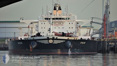
APACHE
Tanker
Current Trip
| Time Travelled | 21 days |
|---|---|
| Remaining Time | --- |
| Distance Travelled | 5832.92 nm |
| Remaining Distance | 1360.45 nm |
| AVG Speed | 12.9 Knopen |
| MAX Speed | 15.7 Knopen |
| AVG Wind | 10 knots |
| MAX Wind | 33 knots |
| MIN Temp | 7.3°C / 45.14°F |
| MAX Temp | 29.6°C / 85.28°F |
| Diepgang | 9.4 M |
| Positie ontvangen | 14 d geleden |
Current Position
| Lengtegraad | -18.50535° |
|---|---|
| Breedtegraat | 18.40986° |
| Status | Under way using engine |
| Snelheid | 15.1 Knopen |
| Koers | 173° |
| Gebied | North Atlantic Ocean |
| Station | T-AIS |
| Positie ontvangen | 14 d geleden |
Info
Information
The current position of APACHE is in North Atlantic Ocean with coordinates 18.40986° / -18.50535° as reported on 2024-05-08 12:24 by AIS to our vessel tracker app. The vessel's current speed is 15.1 Knopen and is heading at the port of LAGOS. The estimated time of arrival as calculated by MyShipTracking vessel tracking app is 2024-05-14 03:00 LT
The vessel APACHE (IMO: 9749489, MMSI: 241458000) is a Tanker It's sailing under the flag of [GR] Greece.
In this page you can find informations about the vessels current position, last detected port calls, and current voyage information. If the vessels is not in coverage by AIS you will find the latest position.
The current position of APACHE is detected by our AIS receivers and we are not responsible for the reliability of the data. The last position was recorded while the vessel was in Coverage by the Ais receivers of our vessel tracking app.
The current draught of APACHE as reported by AIS is 9.4 meters
Weather
| Temperature | 27.5°C / 81.5°F |
|---|---|
| Wind Speed | 9 knots |
| Direction | 274° W |
| Pressure | 1011.5 hPa |
| Humidity | 74.6 % |
| Cloud Coverage | 34 % |
Featured Company
Last Port Calls
| Port | Arrival | Departure | Time In Port |
|---|---|---|---|
| 2024-04-29 14:26 | 2024-05-01 04:54 | 1 d | |
| 2024-04-25 19:07 | 2024-04-29 11:40 | 3 d |
Most Visited Ports (Last year)
| Port | Arrivals | |
|---|---|---|
| 2 | ||
| 2 | ||
| 1 | ||
| 1 | ||
| 1 | ||
| 1 |
Last Trips
| Origin | Departure | Destination | Arrival | Distance | |
|---|---|---|---|---|---|
| 2024-04-29 12:40 | 2024-04-29 15:26 | 22.41 nm | |||
| 2024-02-24 07:02 | 2024-04-25 20:07 | 14298.86 nm |
Events
| Tijd | Evenement | Details | Positie / Bestemming | Info |
|---|---|---|---|---|
| 2024-05-17 10:28 | Start beweging | 16.19 nm, West of ESCRAVOS |
5.52930 / 4.94160
NIGERIA FOR ORDERS
|
Snelheid: 5.4 kn Koers: 260° |
| 2024-05-16 21:32 | Stop beweging | 15.62 nm, West of ESCRAVOS |
5.53371 / 4.95036
NIGERIA FOR ORDERS
|
Snelheid: 0.1 kn Koers: 123° |
| 2024-05-16 20:47 | Start beweging | 17.41 nm, West of ESCRAVOS |
5.50061 / 4.93013
NIGERIA FOR ORDERS
|
Snelheid: 3.6 kn Koers: 31° |
| 2024-05-14 17:34 | Stop beweging | 17.4 nm, South West of ESCRAVOS |
5.49297 / 4.93346
NIGERIA FOR ORDERS
|
Snelheid: Koers: 254° |
| 2024-05-14 16:20 | Start beweging | 16.33 nm, West of ESCRAVOS |
5.53624 / 4.93719
NIGERIA FOR ORDERS
|
Snelheid: 3.1 kn Koers: 151° |
| 2024-05-14 15:36 | Stop beweging | 16.92 nm, West of ESCRAVOS |
5.52402 / 4.93048
NIGERIA FOR ORDERS
|
Snelheid: 0.3 kn Koers: 311° |
| 2024-05-14 11:04 | Start beweging |
5.25449 / 4.77092
NIGERIA FOR ORDERS
|
Snelheid: 5.3 kn Koers: 45° |
|
| 2024-05-14 09:56 | Stop beweging |
5.24872 / 4.76246
NIGERIA FOR ORDERS
|
Snelheid: 0.3 kn Koers: 43° |