
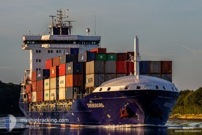
SVENDBORG
Container Ship
Current Trip
| Time Travelled | 6 days |
|---|---|
| Remaining Time | 7 days |
| Distance Travelled | 1461.39 морская миля |
| Remaining Distance | 1989.30 морская миля |
| AVG Speed | 9.9 Узлы |
| MAX Speed | 9.9 Узлы |
| AVG Wind | 11 knots |
| MAX Wind | 22 knots |
| MIN Temp | 16.6°C / 61.88°F |
| MAX Temp | 20.7°C / 69.26°F |
| Осадка | 6.4 м |
| Позиция Получена | 17 h, 15 m тому назад |
Current Position
| Долгота | 10.24609° |
|---|---|
| Широта | 37.65494° |
| Статус | Under way using engine |
| Скорость | 8.8 Узлы |
| Курс | 272.6° |
| Район | Mediterranean Sea - Western Basin |
| Станция | T-AIS |
| Позиция Получена | 17 h, 15 m тому назад |
Info
Information
The current position of SVENDBORG is in Mediterranean Sea - Western Basin with coordinates 37.65494° / 10.24609° as reported on 2024-05-06 15:11 by AIS to our vessel tracker app. The vessel's current speed is 8.8 Узлы and is heading at the port of ROTTERDAM. The estimated time of arrival as calculated by MyShipTracking vessel tracking app is 2024-05-14 22:41 LT
The vessel SVENDBORG (IMO: 9454230, MMSI: 255805594) is a Container Ship that was built in 2011 ( 13 лет ). It's sailing under the flag of [PT] Portugal.
In this page you can find informations about the vessels current position, last detected port calls, and current voyage information. If the vessels is not in coverage by AIS you will find the latest position.
The current position of SVENDBORG is detected by our AIS receivers and we are not responsible for the reliability of the data. The last position was recorded while the vessel was in Coverage by the Ais receivers of our vessel tracking app.
The current draught of SVENDBORG as reported by AIS is 6.4 meters
Weather
| Temperature | 18°C / 64.4°F |
|---|---|
| Wind Speed | 10 knots |
| Direction | 348° NNW |
| Pressure | 1015.5 hPa |
| Humidity | 88.8 % |
| Cloud Coverage | 100 % |
Featured Company
Last Port Calls
| Port | Arrival | Departure | Time In Port |
|---|---|---|---|
| 2024-04-30 07:53 | 2024-04-30 16:00 | 8 h | |
| 2024-04-25 09:07 | 2024-04-26 19:24 | 1 d | |
| 2024-04-21 07:43 | 2024-04-21 19:04 | 11 h | |
| 2024-04-19 04:59 | 2024-04-20 13:28 | 1 d | |
| 2024-04-17 14:54 | 2024-04-18 07:00 | 16 h | |
| 2024-04-13 15:18 | 2024-04-14 07:27 | 16 h | |
| 2024-04-05 01:05 | 2024-04-06 19:21 | 1 d | |
| 2024-03-17 20:00 | 2024-03-18 00:21 | 4 h | |
| 2024-03-01 10:27 | 2024-03-02 18:58 | 1 d | |
| 2024-03-01 04:34 |
Most Visited Ports (Last year)
| Port | Arrivals | |
|---|---|---|
| 15 | ||
| 11 | ||
| 10 | ||
| 10 | ||
| 9 | ||
| 8 |
Last Trips
| Origin | Departure | Destination | Arrival | Distance | |
|---|---|---|---|---|---|
| 2024-04-26 21:24 | 2024-04-30 10:53 | 396.54 морская миля | |||
| 2024-04-21 21:04 | 2024-04-25 11:07 | 1186.16 морская миля | |||
| 2024-04-20 15:28 | 2024-04-21 09:43 | 133.91 морская миля | |||
| 2024-04-18 09:00 | 2024-04-19 06:59 | 75.06 морская миля | |||
| 2024-04-14 09:27 | 2024-04-17 16:54 | 1210.60 морская миля | |||
| 2024-04-06 21:21 | 2024-04-13 17:18 | 1571.62 морская миля | |||
| 2024-03-18 02:21 | 2024-04-05 03:05 | 2249.02 морская миля | |||
| 2024-03-02 19:58 | 2024-03-17 22:00 | 1605.93 морская миля | |||
| 2024-03-01 05:34 | 2024-03-01 11:27 | 71.01 морская миля |
Events
| Время | Событие | Детали | Позиция / Направление | Информация |
|---|---|---|---|---|
| 2024-05-06 15:18 | Статус изменился | Default Under way using engine |
37.65500 / 10.22500
IL ASH >>> NL RTM
|
Скорость: 8.8 kn Курс: 272.6° |
| 2024-05-06 15:11 | Вне покрытия |
37.65494 / 10.24609
Mediterranean Sea - Western Basin
IL ASH >>> NL RTM
|
Скорость: 8.8 kn Курс: 272.6° |
|
| 2024-05-06 15:06 | Статус изменился | Under way using engine Default |
37.65445 / 10.26079
IL ASH >>> NL RTM
|
Скорость: 8 kn Курс: 275° |
| 2024-05-06 15:06 | В покрытии |
37.65445 / 10.26079
Mediterranean Sea - Western Basin
IL ASH >>> NL RTM
|
Скорость: 8.6 kn Курс: 271.5° |
|
| 2024-05-06 13:18 | Статус изменился | Default Under way using engine |
37.63121 / 10.58483
IL ASH >>> NL RTM
|
Скорость: 9 kn Курс: 276.2° |
| 2024-05-06 13:03 | Вне покрытия |
37.62758 / 10.63351
Mediterranean Sea - Western Basin
IL ASH >>> NL RTM
|
Скорость: 9 kn Курс: 276.2° |
|
| 2024-05-06 11:07 | Статус изменился | Under way using engine Default |
37.53002 / 11.16442
IL ASH >>> NL RTM
|
Скорость: 10.3 kn Курс: 290° |
| 2024-05-06 10:46 | Статус изменился | Default Under way using engine |
37.50984 / 11.23618
IL ASH >>> NL RTM
|
Скорость: 10.4 kn Курс: 288.7° |
| 2024-05-06 10:24 | Статус изменился | Under way using engine Default |
37.48948 / 11.31212
IL ASH >>> NL RTM
|
Скорость: 10.3 kn Курс: 288° |
| 2024-05-06 10:20 | Статус изменился | Default Under way using engine |
37.48648 / 11.32347
IL ASH >>> NL RTM
|
Скорость: 10.2 kn Курс: 287.8° |