
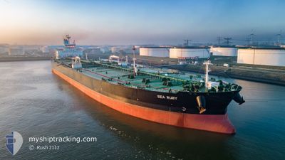
SEA RUBY
Tanker
Current Trip
| Time Travelled | --- |
|---|---|
| Remaining Time | 8 days |
| Distance Travelled | 6640.76 морская миля |
| Remaining Distance | 2044.56 морская миля |
| AVG Speed | 11.3 Узлы |
| MAX Speed | 15.1 Узлы |
| AVG Wind | 10.2 knots |
| MAX Wind | 25 knots |
| MIN Temp | 22.2°C / 71.96°F |
| MAX Temp | 30.8°C / 87.44°F |
| Осадка | 19.5 м |
| Позиция Получена | 1 d тому назад |
Current Position
| Долгота | 104.42100° |
|---|---|
| Широта | 1.36696° |
| Статус | Constrained by her draught |
| Скорость | 9.6 Узлы |
| Курс | 50.4° |
| Район | South China Sea |
| Станция | T-AIS |
| Позиция Получена | 1 d тому назад |
Info
Information
The current position of SEA RUBY is in South China Sea with coordinates 1.36696° / 104.42100° as reported on 2024-09-07 04:50 by AIS to our vessel tracker app. The vessel's current speed is 9.6 Узлы and is heading at the port of NINGBO. The estimated time of arrival as calculated by MyShipTracking vessel tracking app is 2024-09-16 13:59 LT
The vessel SEA RUBY (IMO: 9779616, MMSI: 538007275) is a Tanker It's sailing under the flag of [MH] Marshall Is.
In this page you can find informations about the vessels current position, last detected port calls, and current voyage information. If the vessels is not in coverage by AIS you will find the latest position.
The current position of SEA RUBY is detected by our AIS receivers and we are not responsible for the reliability of the data. The last position was recorded while the vessel was in Coverage by the Ais receivers of our vessel tracking app.
The current draught of SEA RUBY as reported by AIS is 19.5 meters
Weather
| Temperature | 29.5°C / 85.1°F |
|---|---|
| Wind Speed | 10 knots |
| Direction | 219° SW |
| Pressure | 1007.8 hPa |
| Humidity | 70.6 % |
| Cloud Coverage | 95 % |
Featured Company
Last Port Calls
Last Trips
| Origin | Departure | Destination | Arrival | Distance |
|---|
Events
| Время | Событие | Детали | Позиция / Направление | Информация |
|---|---|---|---|---|
| 2024-09-07 04:57 | Статус изменился | Default Constrained by her draught |
1.37853 / 104.43471
CN NBG
|
Скорость: 9.6 kn Курс: 50.4° |
| 2024-09-07 04:50 | Вне покрытия |
1.36696 / 104.42100
South China Sea
CN NBG
|
Скорость: 9.6 kn Курс: 50.4° |
|
| 2024-09-07 04:22 | Изменение морского района | Malaysian part of the South China Sea Malaysian part of the Singapore Strait |
1.31983 / 104.36527
South China Sea
CN NBG
|
Скорость: 9.3 kn Курс: 48.4° |
| 2024-09-07 03:14 | ETA изменился | 2024/09/14 04:00 2024/09/14 01:00 |
1.26703 / 104.20567
CN NBG
|
Скорость: 9.1 kn Курс: 82.4° |
| 2024-09-07 02:53 | Изменение морского района | Malaysian part of the Singapore Strait Indonesian part of the Singapore Strait |
1.26025 / 104.15336
Singapore Strait
CN NBG
|
Скорость: 9.1 kn Курс: 82.1° |
| 2024-09-07 00:41 | Изменение морского района | Indonesian part of the Singapore Strait Singaporean part of the Singapore Strait |
1.18178 / 103.82917
Singapore Strait
CN NBG
|
Скорость: 8 kn Курс: 72.4° |
| 2024-09-07 00:26 | Изменение морского района | Singaporean part of the Singapore Strait Indonesian part of the Singapore Strait |
1.16959 / 103.79836
Singapore Strait
CN NBG
|
Скорость: 9.4 kn Курс: 44.3° |
| 2024-09-06 21:29 | Статус изменился | Constrained by her draught Default |
1.15888 / 103.45110
CN NBG
|
Скорость: 10.8 kn Курс: 121° |
| 2024-09-06 21:25 | Статус изменился | Default Constrained by her draught |
1.16452 / 103.44125
CN NBG
|
Скорость: 11 kn Курс: 120° |
| 2024-09-06 21:18 | Изменение морского района | Indonesian part of the Singapore Strait Indonesian part of the Malacca Strait |
1.17433 / 103.42444
Singapore Strait
CN NBG
|
Скорость: 11 kn Курс: 120° |