
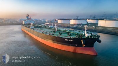
SEA RUBY
Tanker
Current Trip
| Time Travelled | 24 days |
|---|---|
| Remaining Time | 16 h, 22 mins |
| Distance Travelled | 5937.33 nm |
| Remaining Distance | 215.93 nm |
| AVG Speed | 10.8 Knots |
| MAX Speed | 14.3 Knots |
| AVG Wind | 8.2 knots |
| MAX Wind | 19.9 knots |
| MIN Temp | 21.9°C / 71.42°F |
| MAX Temp | 31.6°C / 88.88°F |
| Dybgang | 11 m |
| Position Modtaget | Nu |
Current Position
| Longitude | --- |
|---|---|
| Latitude | --- |
| Status | Under way using engine |
| Fart | 13.1 Knots |
| Kurs | 290° |
| Område | Persian Gulf |
| Station | T-AIS |
| Position Modtaget | Nu |
Info
Information
The current position of SEA RUBY is in Persian Gulf with coordinates 27.39720° / 51.59722° as reported on 2024-10-19 02:07 by AIS to our vessel tracker app. The vessel's current speed is 13.1 Knots and is heading at the port of MINA AL AHMADI. The estimated time of arrival as calculated by MyShipTracking vessel tracking app is 2024-10-19 18:30 LT
The vessel SEA RUBY (IMO: 9779616, MMSI: 538007275) is a Tanker It's sailing under the flag of [MH] Marshall Is.
In this page you can find informations about the vessels current position, last detected port calls, and current voyage information. If the vessels is not in coverage by AIS you will find the latest position.
The current position of SEA RUBY is detected by our AIS receivers and we are not responsible for the reliability of the data. The last position was recorded while the vessel was in Coverage by the Ais receivers of our vessel tracking app.
The current draught of SEA RUBY as reported by AIS is 11 meters
Weather
| Temperature | 30.7°C / 87.26°F |
|---|---|
| Wind Speed | 1 knots |
| Direction | 288° WNW |
| Pressure | 1009.9 hPa |
| Humidity | 55.7 % |
| Cloud Coverage | 7 % |
Featured Company
Last Trips
| Origin | Departure | Destination | Arrival | Distance |
|---|
Events
| Tid | Hændelsen | Detaljer | Position / Dest | Info |
|---|---|---|---|---|
| 2024-10-18 08:35 | Ændre havområde | Iranian part of the Persian Gulf United Arab Emirates part of the Persian Gulf |
26.02040 / 55.24662
Persian Gulf
KW MEA
|
Fart: 12.7 kn Kurs: 270.5° |
| 2024-10-18 06:14 | Status er ændret | Under way using engine Default |
26.08731 / 55.78181
KW MEA
|
Fart: 12.3 kn Kurs: 249° |
| 2024-10-18 05:49 | Status er ændret | Default Under way using engine |
26.12353 / 55.86687
KW MEA
|
Fart: 12.2 kn Kurs: 240.8° |
| 2024-10-18 05:41 | Ændre havområde | United Arab Emirates part of the Persian Gulf Omani part of the Persian Gulf |
26.13730 / 55.89373
Persian Gulf
KW MEA
|
Fart: 11.3 kn Kurs: 239.3° |
| 2024-10-18 05:41 | Status er ændret | Under way using engine Default |
26.13777 / 55.89462
KW MEA
|
Fart: 11.2 kn Kurs: 214° |
| 2024-10-18 05:33 | Indenfor Dækning |
26.13730 / 55.89373
Persian Gulf
KW MEA
|
Fart: 11.3 kn Kurs: 239.3° |
|
| 2024-10-18 03:45 | Status er ændret | Default Under way using engine |
26.45401 / 56.14510
KW MEA
|
Fart: 13.2 kn Kurs: 212.9° |
| 2024-10-18 03:38 | Udenfor Dækning |
26.47549 / 56.16038
Persian Gulf
KW MEA
|
Fart: 13.2 kn Kurs: 212.9° |
|
| 2024-10-18 03:38 | Status er ændret | Under way using engine Default |
26.47610 / 56.16082
KW MEA
|
Fart: 13 kn Kurs: 207° |
| 2024-10-18 03:29 | Status er ændret | Default Under way using engine |
26.50505 / 56.17936
KW MEA
|
Fart: 12.2 kn Kurs: 211.6° |