
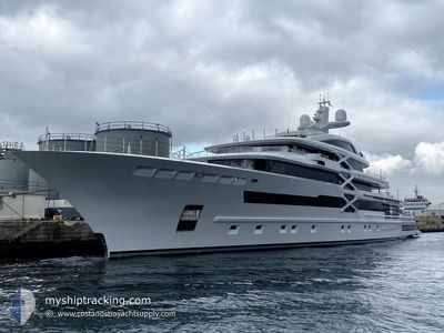
PROJECT-X
Pleasure Craft
Current Trip
PHILLIPSBURG
| Time Travelled | 2 days |
|---|---|
| Remaining Time | --- |
| Distance Travelled | 26.20 морская миля |
| Remaining Distance | --- |
| AVG Speed | 8.6 Узлы |
| MAX Speed | 13 Узлы |
| AVG Wind | 6.1 knots |
| MAX Wind | 8.8 knots |
| MIN Temp | 25°C / 77°F |
| MAX Temp | 26.2°C / 79.16°F |
| Осадка | 5 м |
| Позиция Получена | 11 h, 9 m тому назад |
Current Position
| Долгота | --- |
|---|---|
| Широта | --- |
| Статус | Under way using engine |
| Скорость | 12 Узлы |
| Курс | 187° |
| Район | Caribbean Sea |
| Станция | T-AIS |
| Позиция Получена | 11 h, 9 m тому назад |
Info
Information
The current position of PROJECT-X is in Caribbean Sea with coordinates 17.73508° / -62.84977° as reported on 2025-03-16 23:50 by AIS to our vessel tracker app. The vessel's current speed is 12 Узлы
The vessel PROJECT-X (IMO: 1010727, MMSI: 229063000) is a Pleasure Craft It's sailing under the flag of [MT] Malta.
In this page you can find informations about the vessels current position, last detected port calls, and current voyage information. If the vessels is not in coverage by AIS you will find the latest position.
The current position of PROJECT-X is detected by our AIS receivers and we are not responsible for the reliability of the data. The last position was recorded while the vessel was in Coverage by the Ais receivers of our vessel tracking app.
The current draught of PROJECT-X as reported by AIS is 5 meters
Weather
| Temperature | 26°C / 78.8°F |
|---|---|
| Wind Speed | 7 knots |
| Direction | 343° NNW |
| Pressure | 1015.9 hPa |
| Humidity | 67.2 % |
| Cloud Coverage | --- |
Featured Company
Last Port Calls
| Port | Arrival | Departure | Time In Port |
|---|---|---|---|
| 2025-03-13 17:02 | 2025-03-14 13:25 | 20 h | |
| 2025-02-21 11:02 | 2025-02-28 14:21 | 7 d | |
| 2025-01-12 08:32 | 2025-02-18 14:38 |
Last Trips
| Origin | Departure | Destination | Arrival | Distance | |
|---|---|---|---|---|---|
| 2025-02-28 14:21 | 2025-03-13 17:02 | 19.57 морская миля | |||
| 2025-02-18 14:38 | 2025-02-21 11:02 | 108.78 морская миля | |||
| 2024-12-15 09:33 | 2025-01-12 08:32 | 1084.62 морская миля |
Events
| Время | Событие | Детали | Позиция / Направление | Информация |
|---|---|---|---|---|
| 2025-03-16 23:50 | Вне покрытия |
17.73508 / -62.84977
Caribbean Sea
|
Скорость: 12 kn Курс: 187° |
|
| 2025-03-16 23:10 | Начало движения | 2.2 nm, South East of GUSTAVIA |
17.87141 / -62.82962
PHILLIPSBURG
|
Скорость: 6 kn Курс: 191° |
| 2025-03-16 22:45 | Статус изменился | Under way using engine At anchor |
17.87694 / -62.83178
PHILLIPSBURG
|
Скорость: Курс: 30° |
| 2025-03-16 19:27 | Статус изменился | At anchor Under way using engine |
17.87704 / -62.83235
PHILLIPSBURG
|
Скорость: Курс: 327° |
| 2025-03-16 19:10 | Окончание движения | 1.83 nm, South East of GUSTAVIA |
17.87724 / -62.83221
PHILLIPSBURG
|
Скорость: Курс: 357° |
| 2025-03-16 18:47 | Начало движения | 0.81 nm, South West of GUSTAVIA |
17.89257 / -62.86518
PHILLIPSBURG
|
Скорость: 8 kn Курс: 162° |
| 2025-03-16 18:43 | Статус изменился | Under way using engine At anchor |
17.89490 / -62.86477
PHILLIPSBURG
|
Скорость: 0.2 kn Курс: 13° |
| 2025-03-16 12:09 | В покрытии |
17.89555 / -62.86502
Caribbean Sea
|
Скорость: Курс: 86° |
|
| 2025-03-16 10:57 | Вне покрытия |
17.89545 / -62.86523
Caribbean Sea
|
Скорость: Курс: 11° |
|
| 2025-03-16 10:00 | В покрытии |
17.89542 / -62.86528
Caribbean Sea
|
Скорость: Курс: 203° |