
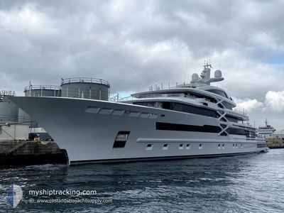
PROJECT-X
Pleasure Craft
Current Trip
| Time Travelled | 2 days |
|---|---|
| Remaining Time | --- |
| Distance Travelled | 4.29 nm |
| Remaining Distance | --- |
| AVG Speed | 8.8 Knots |
| MAX Speed | 10.7 Knots |
| AVG Wind | 9.9 knots |
| MAX Wind | 14 knots |
| MIN Temp | 23.9°C / 75.02°F |
| MAX Temp | 26.4°C / 79.52°F |
| Dybgang | 5 m |
| Position Modtaget | 1 m siden |
Current Position
| Longitude | --- |
|---|---|
| Latitude | --- |
| Status | At anchor |
| Fart | 0.1 Knots |
| Kurs | 142° |
| Område | Caribbean Sea |
| Station | T-AIS |
| Position Modtaget | 1 m siden |
Info
Information
The current position of PROJECT-X is in Caribbean Sea with coordinates 18.02692° / -63.10795° as reported on 2026-01-06 20:58 by AIS to our vessel tracker app. The vessel's current speed is 0.1 Knots
The vessel PROJECT-X (IMO: 1010727, MMSI: 229063000) is a Pleasure Craft It's sailing under the flag of [MT] Malta.
In this page you can find informations about the vessels current position, last detected port calls, and current voyage information. If the vessels is not in coverage by AIS you will find the latest position.
The current position of PROJECT-X is detected by our AIS receivers and we are not responsible for the reliability of the data. The last position was recorded while the vessel was in Coverage by the Ais receivers of our vessel tracking app.
The current draught of PROJECT-X as reported by AIS is 5 meters
Weather
| Temperature | 25.6°C / 78.08°F |
|---|---|
| Wind Speed | 5 knots |
| Direction | 10° N |
| Pressure | 1012.6 hPa |
| Humidity | 69.3 % |
| Cloud Coverage | 70 % |
Featured Company
Last Port Calls
| Port | Arrival | Departure | Time In Port |
|---|---|---|---|
| 2026-01-02 07:04 | 2026-01-04 07:19 | 2 d | |
| 2025-12-18 10:50 | 2025-12-19 11:15 | 1 d | |
| 2025-11-27 07:00 | 2025-11-28 08:20 | 1 d | |
| 2025-11-17 10:21 | 2025-11-24 16:33 | 7 d | |
| 2025-11-17 09:22 |
Last Trips
| Origin | Departure | Destination | Arrival | Distance | |
|---|---|---|---|---|---|
| 2025-12-19 11:15 | 2026-01-02 07:04 | 223.49 nm | |||
| 2025-11-28 08:20 | 2025-12-18 10:50 | 3393.79 nm | |||
| 2025-11-24 16:33 | 2025-11-27 07:00 | 702.02 nm | |||
| 2025-11-17 09:22 | 2025-11-17 10:21 | 6.43 nm |
Events
| Tid | Hændelsen | Detaljer | Position / Dest | Info |
|---|---|---|---|---|
| 2026-01-04 12:25 | Status er ændret | At anchor Moored |
18.02724 / -63.10900
ST MAARTEN
|
Fart: 0.2 kn Kurs: 131° |
| 2026-01-04 11:58 | STOP Sejllads | 1.13 nm, South West of ST MAARTEN |
18.02726 / -63.10885
ST MAARTEN
|
Fart: 0.2 kn Kurs: 131° |
| 2026-01-04 11:31 | Destination er ændret | ST MAARTEN ST MAAL TOWING |
18.01339 / -63.09431
ST MAARTEN
|
Fart: 10.4 kn Kurs: 290.4° |
| 2026-01-04 11:31 | ETA er ændret | 2026/01/02 12:30 2026/01/03 12:30 |
18.01339 / -63.09431
ST MAARTEN
|
Fart: 10.4 kn Kurs: 290.4° |
| 2026-01-04 11:19 | Afsejlet fra sidste havn |
|
18.00870 / -63.05989
ST MAAL TOWING
|
Fart: 6.3 kn Kurs: 249° |
| 2026-01-04 11:16 | Indenfor Dækning |
18.01005 / -63.05282
Caribbean Sea
[SX] PHILIPSBURG
|
Fart: 6.3 kn Kurs: 249.7° |
|
| 2026-01-04 09:06 | Udenfor Dækning |
18.01455 / -63.04611
Caribbean Sea
[SX] PHILIPSBURG
|
Fart: Kurs: 9° |
|
| 2026-01-04 09:06 | Indenfor Dækning |
18.01455 / -63.04611
Caribbean Sea
[SX] PHILIPSBURG
|
Fart: Kurs: 9° |
|
| 2026-01-04 06:12 | Udenfor Dækning |
18.01457 / -63.04611
Caribbean Sea
[SX] PHILIPSBURG
|
Fart: Kurs: 108.2° |
|
| 2026-01-04 06:12 | Indenfor Dækning |
18.01457 / -63.04611
Caribbean Sea
[SX] PHILIPSBURG
|
Fart: Kurs: 108.2° |