

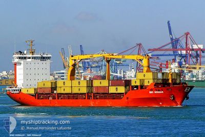
MSC HOGGAR
Container Ship

Current Trip
| Time Travelled | 1 day |
|---|---|
| Remaining Time | 28 mins |
| Distance Travelled | 241.85 морская миля |
| Remaining Distance | 159.17 морская миля |
| AVG Speed | 10.6 Узлы |
| MAX Speed | 13.1 Узлы |
| AVG Wind | 9.7 knots |
| MAX Wind | 28 knots |
| MIN Temp | 2.7°C / 36.86°F |
| MAX Temp | 16.5°C / 61.7°F |
| Осадка | 9.5 м |
| Позиция Получена | 12 h, 48 m тому назад |
Current Position
| Долгота | --- |
|---|---|
| Широта | --- |
| Статус | Under way using engine |
| Скорость | 12 Узлы |
| Курс | 353.9° |
| Район | Black Sea |
| Станция | T-AIS |
| Позиция Получена | 12 h, 48 m тому назад |
Information
The current position of MSC HOGGAR is in Black Sea with coordinates 41.49673° / 29.19250° as reported on 2025-03-17 19:19 by AIS to our vessel tracker app. The vessel's current speed is 12 Узлы and is heading at the port of CONSTANTA. The estimated time of arrival as calculated by MyShipTracking vessel tracking app is 2025-03-18 10:36 LT
The vessel MSC HOGGAR (IMO: 9286449, MMSI: 271000742) is a Container Ship that was built in 2004 ( 21 лет ). It's sailing under the flag of [TR] Turkey.
In this page you can find informations about the vessels current position, last detected port calls, and current voyage information. If the vessels is not in coverage by AIS you will find the latest position.
The current position of MSC HOGGAR is detected by our AIS receivers and we are not responsible for the reliability of the data. The last position was recorded while the vessel was in Coverage by the Ais receivers of our vessel tracking app.
The current draught of MSC HOGGAR as reported by AIS is 9.5 meters
Weather
| Temperature | 2.9°C / 37.22°F |
|---|---|
| Wind Speed | 28 knots |
| Direction | 11° N |
| Pressure | 1022 hPa |
| Humidity | 68.9 % |
| Cloud Coverage | 100 % |


Featured Company
Last Port Calls
| Port | Arrival | Departure | Time In Port |
|---|---|---|---|
| 2025-03-16 07:06 | 2025-03-16 23:18 | 16 h | |
| 2025-03-14 04:34 | 2025-03-15 00:23 | 19 h | |
| 2025-03-10 05:54 | 2025-03-11 04:03 | 22 h | |
| 2025-03-09 00:21 | 2025-03-09 21:51 | 21 h | |
| 2025-03-06 08:07 | 2025-03-07 05:37 | 21 h | |
| 2025-02-27 08:57 | 2025-02-28 19:39 | 1 d | |
| 2025-02-26 13:38 | 2025-02-27 03:05 | 13 h | |
| 2025-02-24 04:11 | 2025-02-24 20:22 | 16 h | |
| 2025-02-20 22:41 | 2025-02-21 22:10 | 23 h | |
| 2025-02-17 07:04 | 2025-02-17 18:30 | 11 h |
Last Trips
| Origin | Departure | Destination | Arrival | Distance | |
|---|---|---|---|---|---|
| 2025-03-15 00:23 | 2025-03-16 07:06 | 276.58 морская миля | |||
| 2025-03-11 04:03 | 2025-03-14 04:34 | 282.26 морская миля | |||
| 2025-03-09 21:51 | 2025-03-10 05:54 | 83.94 морская миля | |||
| 2025-03-07 05:37 | 2025-03-09 00:21 | 249.66 морская миля | |||
| 2025-02-28 19:39 | 2025-03-06 08:07 | 244.26 морская миля | |||
| 2025-02-27 03:05 | 2025-02-27 08:57 | 56.70 морская миля | |||
| 2025-02-24 20:22 | 2025-02-26 13:38 | 274.31 морская миля | |||
| 2025-02-21 22:10 | 2025-02-24 04:11 | 292.76 морская миля | |||
| 2025-02-17 18:30 | 2025-02-20 22:41 | 312.66 морская миля | |||
| 2025-02-15 08:00 | 2025-02-17 07:04 | 519.91 морская миля |
Events
| Время | Событие | Детали | Позиция / Направление | Информация |
|---|---|---|---|---|
| 2025-03-17 19:25 | Статус изменился | Default Under way using engine |
41.51469 / 29.19042
ROCND
|
Скорость: 12 kn Курс: 353.9° |
| 2025-03-17 19:19 | Вне покрытия |
41.49673 / 29.19250
Black Sea
ROCND
|
Скорость: 12 kn Курс: 353.9° |
|
| 2025-03-17 17:58 | Изменение морского района | Turkish part of the Black Sea Turkish part of the Sea of Marmara |
41.23320 / 29.14102
Black Sea
ROCND
|
Скорость: 11.7 kn Курс: 28° |
| 2025-03-17 13:27 | Начало движения | 3.42 nm, West of AMBARLI |
40.94822 / 28.60070
ROCND
|
Скорость: 4.8 kn Курс: 281° |
| 2025-03-17 13:21 | ETA изменился | 2025/03/18 09:30 2025/03/17 23:30 |
40.94675 / 28.60423
ROCND
|
Скорость: 0.2 kn Курс: 306° |
| 2025-03-17 13:21 | Статус изменился | Under way using engine At anchor |
40.94675 / 28.60428
ROCND
|
Скорость: 0.1 kn Курс: 307° |
| 2025-03-17 02:20 | Статус изменился | At anchor Under way using engine |
40.94928 / 28.60184
ROCND
|
Скорость: Курс: 90° |
| 2025-03-17 01:09 | Окончание движения | 3.29 nm, West of AMBARLI |
40.94847 / 28.60366
ROCND
|
Скорость: 0.3 kn Курс: 11° |
| 2025-03-16 22:07 | Статус изменился | Under way using engine Default |
40.89662 / 27.94474
ROCND
|
Скорость: 12.3 kn Курс: 90° |
| 2025-03-16 21:12 | Статус изменился | Default Under way using engine |
40.90047 / 27.69389
ROCND
|
Скорость: 13 kn Курс: 92.6° |