

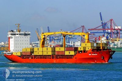
MSC HOGGAR
Container Ship

Current Trip
| Time Travelled | 1 day |
|---|---|
| Remaining Time | 29 mins |
| Distance Travelled | 241.85 nm |
| Remaining Distance | 159.17 nm |
| AVG Speed | 10.6 Knop |
| MAX Speed | 13.1 Knop |
| AVG Wind | 9.7 knots |
| MAX Wind | 28 knots |
| MIN Temp | 2.7°C / 36.86°F |
| MAX Temp | 16.5°C / 61.7°F |
| Djupgående | 9.5 m |
| Position mottagen | 12 h, 48 m sen |
Current Position
| Longitud | --- |
|---|---|
| Latitude | --- |
| Status | Under way using engine |
| Fart | 12 Knop |
| Kurs | 353.9° |
| Område | Black Sea |
| Station | T-AIS |
| Position mottagen | 12 h, 48 m sen |
Information
The current position of MSC HOGGAR is in Black Sea with coordinates 41.49673° / 29.19250° as reported on 2025-03-17 19:19 by AIS to our vessel tracker app. The vessel's current speed is 12 Knop and is heading at the port of CONSTANTA. The estimated time of arrival as calculated by MyShipTracking vessel tracking app is 2025-03-18 10:36 LT
The vessel MSC HOGGAR (IMO: 9286449, MMSI: 271000742) is a Container Ship that was built in 2004 ( 21 År gammal ). It's sailing under the flag of [TR] Turkey.
In this page you can find informations about the vessels current position, last detected port calls, and current voyage information. If the vessels is not in coverage by AIS you will find the latest position.
The current position of MSC HOGGAR is detected by our AIS receivers and we are not responsible for the reliability of the data. The last position was recorded while the vessel was in Coverage by the Ais receivers of our vessel tracking app.
The current draught of MSC HOGGAR as reported by AIS is 9.5 meters
Weather
| Temperature | 2.9°C / 37.22°F |
|---|---|
| Wind Speed | 28 knots |
| Direction | 11° N |
| Pressure | 1022 hPa |
| Humidity | 68.9 % |
| Cloud Coverage | 100 % |


Featured Company
Last Port Calls
| Port | Arrival | Departure | Time In Port |
|---|---|---|---|
| 2025-03-16 07:06 | 2025-03-16 23:18 | 16 h | |
| 2025-03-14 04:34 | 2025-03-15 00:23 | 19 h | |
| 2025-03-10 05:54 | 2025-03-11 04:03 | 22 h | |
| 2025-03-09 00:21 | 2025-03-09 21:51 | 21 h | |
| 2025-03-06 08:07 | 2025-03-07 05:37 | 21 h | |
| 2025-02-27 08:57 | 2025-02-28 19:39 | 1 d | |
| 2025-02-26 13:38 | 2025-02-27 03:05 | 13 h | |
| 2025-02-24 04:11 | 2025-02-24 20:22 | 16 h | |
| 2025-02-20 22:41 | 2025-02-21 22:10 | 23 h | |
| 2025-02-17 07:04 | 2025-02-17 18:30 | 11 h |
Last Trips
| Origin | Departure | Destination | Arrival | Distance | |
|---|---|---|---|---|---|
| 2025-03-15 00:23 | 2025-03-16 07:06 | 276.58 nm | |||
| 2025-03-11 04:03 | 2025-03-14 04:34 | 282.26 nm | |||
| 2025-03-09 21:51 | 2025-03-10 05:54 | 83.94 nm | |||
| 2025-03-07 05:37 | 2025-03-09 00:21 | 249.66 nm | |||
| 2025-02-28 19:39 | 2025-03-06 08:07 | 244.26 nm | |||
| 2025-02-27 03:05 | 2025-02-27 08:57 | 56.70 nm | |||
| 2025-02-24 20:22 | 2025-02-26 13:38 | 274.31 nm | |||
| 2025-02-21 22:10 | 2025-02-24 04:11 | 292.76 nm | |||
| 2025-02-17 18:30 | 2025-02-20 22:41 | 312.66 nm | |||
| 2025-02-15 08:00 | 2025-02-17 07:04 | 519.91 nm |
Events
| Tid | Event | Detaljer | Position / Dest | Information |
|---|---|---|---|---|
| 2025-03-17 19:25 | Status ändrad | Default Under way using engine |
41.51469 / 29.19042
ROCND
|
Fart: 12 kn Kurs: 353.9° |
| 2025-03-17 19:19 | UTANFÖR täckningsområde |
41.49673 / 29.19250
Black Sea
ROCND
|
Fart: 12 kn Kurs: 353.9° |
|
| 2025-03-17 17:58 | Byter havsområde | Turkish part of the Black Sea Turkish part of the Sea of Marmara |
41.23320 / 29.14102
Black Sea
ROCND
|
Fart: 11.7 kn Kurs: 28° |
| 2025-03-17 13:27 | STARTAR förflyttning | 3.42 nm, West of AMBARLI |
40.94822 / 28.60070
ROCND
|
Fart: 4.8 kn Kurs: 281° |
| 2025-03-17 13:21 | ETA ändrat | 2025/03/18 09:30 2025/03/17 23:30 |
40.94675 / 28.60423
ROCND
|
Fart: 0.2 kn Kurs: 306° |
| 2025-03-17 13:21 | Status ändrad | Under way using engine At anchor |
40.94675 / 28.60428
ROCND
|
Fart: 0.1 kn Kurs: 307° |
| 2025-03-17 02:20 | Status ändrad | At anchor Under way using engine |
40.94928 / 28.60184
ROCND
|
Fart: Kurs: 90° |
| 2025-03-17 01:09 | STOPPAR förflyttning | 3.29 nm, West of AMBARLI |
40.94847 / 28.60366
ROCND
|
Fart: 0.3 kn Kurs: 11° |
| 2025-03-16 22:07 | Status ändrad | Under way using engine Default |
40.89662 / 27.94474
ROCND
|
Fart: 12.3 kn Kurs: 90° |
| 2025-03-16 21:12 | Status ändrad | Default Under way using engine |
40.90047 / 27.69389
ROCND
|
Fart: 13 kn Kurs: 92.6° |