
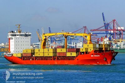
MSC HOGGAR
Container Ship
Current Trip
| Time Travelled | 22 h, 33 mins |
|---|---|
| Remaining Time | 8 h, 22 mins |
| Distance Travelled | 253.80 nm |
| Remaining Distance | 106.76 nm |
| AVG Speed | 11.7 Knots |
| MAX Speed | 12.5 Knots |
| AVG Wind | 16.4 knots |
| MAX Wind | 31 knots |
| MIN Temp | 13.3°C / 55.94°F |
| MAX Temp | 16.8°C / 62.24°F |
| Dybgang | 6.7 m |
| Position Modtaget | 2 h, 24 m siden |
Current Position
| Longitude | --- |
|---|---|
| Latitude | --- |
| Status | Under way using engine |
| Fart | 12.2 Knots |
| Kurs | 224.3° |
| Område | Ionian Sea |
| Station | T-AIS |
| Position Modtaget | 2 h, 24 m siden |
Info
Information
The current position of MSC HOGGAR is in Ionian Sea with coordinates 38.65928° / 17.08949° as reported on 2025-12-06 08:09 by AIS to our vessel tracker app. The vessel's current speed is 12.2 Knots and is heading at the port of AUGUSTA. The estimated time of arrival as calculated by MyShipTracking vessel tracking app is 2025-12-06 19:56 LT
The vessel MSC HOGGAR (IMO: 9286449, MMSI: 271000742) is a Container Ship that was built in 2004 ( 21 år gamle ). It's sailing under the flag of [TR] Turkey.
In this page you can find informations about the vessels current position, last detected port calls, and current voyage information. If the vessels is not in coverage by AIS you will find the latest position.
The current position of MSC HOGGAR is detected by our AIS receivers and we are not responsible for the reliability of the data. The last position was recorded while the vessel was in Coverage by the Ais receivers of our vessel tracking app.
The current draught of MSC HOGGAR as reported by AIS is 6.7 meters
Weather
| Temperature | 16.4°C / 61.52°F |
|---|---|
| Wind Speed | 4 knots |
| Direction | 302° WNW |
| Pressure | 1009.7 hPa |
| Humidity | 60.2 % |
| Cloud Coverage | 89 % |
Featured Company
Last Port Calls
| Port | Arrival | Departure | Time In Port |
|---|---|---|---|
| 2025-12-04 10:31 | 2025-12-05 13:01 | 1 d | |
| 2025-12-01 11:34 | 2025-12-02 22:40 | 1 d | |
| 2025-11-26 05:47 | 2025-11-27 12:56 | 1 d | |
| 2025-11-23 11:37 | 2025-11-24 16:53 | 1 d | |
| 2025-11-22 01:56 | 2025-11-22 21:36 | 19 h | |
| 2025-11-20 05:55 | 2025-11-21 17:20 | 1 d | |
| 2025-11-16 05:55 | 2025-11-17 10:23 | 1 d | |
| 2025-11-14 02:37 | 2025-11-14 20:19 | 17 h | |
| 2025-11-10 20:56 | 2025-11-11 20:44 | 23 h | |
| 2025-11-06 20:06 | 2025-11-08 04:37 | 1 d |
Last Trips
| Origin | Departure | Destination | Arrival | Distance | |
|---|---|---|---|---|---|
| 2025-12-02 22:40 | 2025-12-04 10:31 | 371.62 nm | |||
| 2025-11-27 12:56 | 2025-12-01 11:34 | 438.04 nm | |||
| 2025-11-24 16:53 | 2025-11-26 05:47 | 372.66 nm | |||
| 2025-11-22 21:36 | 2025-11-23 11:37 | 101.93 nm | |||
| 2025-11-21 17:20 | 2025-11-22 01:56 | 86.03 nm | |||
| 2025-11-17 10:23 | 2025-11-20 05:55 | 385.09 nm | |||
| 2025-11-14 20:19 | 2025-11-16 05:55 | 366.55 nm | |||
| 2025-11-11 20:44 | 2025-11-14 02:37 | 641.46 nm | |||
| 2025-11-08 04:37 | 2025-11-10 20:56 | 650.77 nm | |||
| 2025-11-06 08:33 | 2025-11-06 20:06 | 109.02 nm |
Events
| Tid | Hændelsen | Detaljer | Position / Dest | Info |
|---|---|---|---|---|
| 2025-12-06 08:21 | Status er ændret | Default Under way using engine |
38.63034 / 17.05278
ITAUG
|
Fart: 12.2 kn Kurs: 224.3° |
| 2025-12-06 08:09 | Udenfor Dækning |
38.65928 / 17.08949
Ionian Sea
ITAUG
|
Fart: 12.2 kn Kurs: 224.3° |
|
| 2025-12-06 07:32 | Ændre havområde | Italian part of the Ionian Sea Italian part of the Adriatic Sea |
38.75182 / 17.20412
Ionian Sea
ITAUG
|
Fart: 12.4 kn Kurs: 221.2° |
| 2025-12-06 07:32 | Status er ændret | Under way using engine Default |
38.75182 / 17.20412
ITAUG
|
Fart: 12.2 kn Kurs: 222° |
| 2025-12-06 07:16 | Indenfor Dækning |
38.75182 / 17.20412
Ionian Sea
ITAUG
|
Fart: 12.4 kn Kurs: 221.2° |
|
| 2025-12-05 23:07 | Status er ændret | Default Under way using engine |
40.00294 / 18.57388
ITAUG
|
Fart: 12 kn Kurs: 199° |
| 2025-12-05 23:04 | Udenfor Dækning |
40.01143 / 18.57766
Adriatic Sea
ITAUG
|
Fart: 12 kn Kurs: 199° |
|
| 2025-12-05 20:19 | Ændre havområde | Italian part of the Adriatic Sea Albanian part of the Adriatic Sea |
40.55533 / 18.71199
Adriatic Sea
ITAUG
|
Fart: 11.3 kn Kurs: 190° |
| 2025-12-05 20:19 | Status er ændret | Under way using engine Default |
40.55533 / 18.71199
ITAUG
|
Fart: 11 kn Kurs: 190° |
| 2025-12-05 20:19 | Indenfor Dækning |
40.55533 / 18.71199
Adriatic Sea
ITAUG
|
Fart: 11.3 kn Kurs: 190° |