
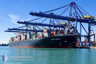
MAERSK GIBRALTAR
Cargo A
Current Trip
| Time Travelled | 2 days |
|---|---|
| Remaining Time | 9 h, 7 mins |
| Distance Travelled | 1203.68 морская миля |
| Remaining Distance | 171.33 морская миля |
| AVG Speed | 16.8 Узлы |
| MAX Speed | 20.4 Узлы |
| AVG Wind | 13.3 knots |
| MAX Wind | 24 knots |
| MIN Temp | 2.4°C / 36.32°F |
| MAX Temp | 15.5°C / 59.9°F |
| Осадка | 11.9 м |
| Позиция Получена | 2 m тому назад |
Current Position
| Долгота | --- |
|---|---|
| Широта | --- |
| Статус | Under way using engine |
| Скорость | 18.5 Узлы |
| Курс | 106.7° |
| Район | North Atlantic Ocean |
| Станция | T-AIS |
| Позиция Получена | 2 m тому назад |
Info
Information
The current position of MAERSK GIBRALTAR is in North Atlantic Ocean with coordinates 36.45515° / -8.85812° as reported on 2025-02-16 19:20 by AIS to our vessel tracker app. The vessel's current speed is 18.5 Узлы and is heading at the port of TANGER MED. The estimated time of arrival as calculated by MyShipTracking vessel tracking app is 2025-02-17 05:29 LT
The vessel MAERSK GIBRALTAR (IMO: 9739692, MMSI: 477636200) is a Cargo A It's sailing under the flag of [HK] Hong Kong.
In this page you can find informations about the vessels current position, last detected port calls, and current voyage information. If the vessels is not in coverage by AIS you will find the latest position.
The current position of MAERSK GIBRALTAR is detected by our AIS receivers and we are not responsible for the reliability of the data. The last position was recorded while the vessel was in Coverage by the Ais receivers of our vessel tracking app.
The current draught of MAERSK GIBRALTAR as reported by AIS is 11.9 meters
Weather
| Temperature | 15.1°C / 59.18°F |
|---|---|
| Wind Speed | 15 knots |
| Direction | 344° NNW |
| Pressure | 1017.9 hPa |
| Humidity | 80.9 % |
| Cloud Coverage | 7 % |
Featured Company
Last Port Calls
| Port | Arrival | Departure | Time In Port |
|---|---|---|---|
| 2025-02-10 16:34 | 2025-02-13 22:49 | 3 d | |
| 2025-02-07 05:27 | 2025-02-08 00:02 | 18 h | |
| 2025-01-30 06:27 | 2025-01-30 19:55 | 13 h | |
| 2025-01-03 01:11 | 2025-01-04 00:23 | 23 h | |
| 2024-12-31 11:35 | 2025-01-01 12:18 | 1 d | |
| 2024-12-26 13:58 | 2024-12-27 21:47 | 1 d | |
| 2024-12-22 07:16 | 2024-12-23 09:44 | 1 d |
Most Visited Ports (Last year)
| Port | Arrivals | |
|---|---|---|
| 6 | ||
| 5 | ||
| 5 | ||
| 5 | ||
| 5 | ||
| 4 |
Last Trips
| Origin | Departure | Destination | Arrival | Distance | |
|---|---|---|---|---|---|
| 2025-02-08 00:02 | 2025-02-10 16:34 | 236.66 морская миля | |||
| 2025-01-30 19:55 | 2025-02-07 05:27 | 1541.25 морская миля | |||
| 2025-01-04 00:23 | 2025-01-30 06:27 | 9881.84 морская миля | |||
| 2025-01-01 12:18 | 2025-01-03 01:11 | 430.76 морская миля | |||
| 2024-12-27 21:47 | 2024-12-31 11:35 | 1067.29 морская миля | |||
| 2024-12-23 09:44 | 2024-12-26 13:58 | 935.96 морская миля | |||
| 2024-11-26 00:47 | 2024-12-22 07:16 | 9165.55 морская миля |
Events
| Время | Событие | Детали | Позиция / Направление | Информация |
|---|---|---|---|---|
| 2025-02-16 19:20 | Статус изменился | Under way using engine Default |
36.45515 / -8.85812
MAPTM
|
Скорость: 18.4 kn Курс: 107° |
| 2025-02-16 19:15 | В покрытии |
36.45515 / -8.85812
North Atlantic Ocean
MAPTM
|
Скорость: 18.5 kn Курс: 106.7° |
|
| 2025-02-16 17:55 | Статус изменился | Default Under way using engine |
36.63126 / -9.34032
MAPTM
|
Скорость: 18.7 kn Курс: 135.7° |
| 2025-02-16 17:49 | Вне покрытия |
36.65410 / -9.36811
North Atlantic Ocean
MAPTM
|
Скорость: 18.7 kn Курс: 135.7° |
|
| 2025-02-16 06:46 | Изменение морского района | Portuguese part of the North Atlantic Ocean French part of the English Channel |
40.01760 / -10.01227
North Atlantic Ocean
MAPTM
|
Скорость: 18.8 kn Курс: 184.6° |
| 2025-02-16 06:44 | В покрытии |
40.01760 / -10.01227
North Atlantic Ocean
MAPTM
|
Скорость: 18.8 kn Курс: 184.6° |
|
| 2025-02-16 06:43 | Статус изменился | Under way using engine Default |
40.03531 / -10.00969
MAPTM
|
Скорость: 18.9 kn Курс: 187° |
| 2025-02-14 18:56 | Статус изменился | Default Under way using engine |
49.31274 / -4.76919
MAPTM
|
Скорость: 16.1 kn Курс: 240.4° |
| 2025-02-14 18:48 | Обнаружено в море | French part of the English Channel |
49.32907 / -4.72457
English Channel
MAPTM
|
Скорость: 16.1 kn Курс: 240.4° |
| 2025-02-14 18:48 | Вне покрытия |
49.32907 / -4.72457
English Channel
MAPTM
|
Скорость: 16.1 kn Курс: 240.4° |