
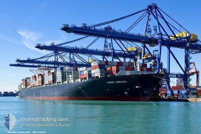
MAERSK GIBRALTAR
Cargo A
Current Trip
| Time Travelled | 3 days |
|---|---|
| Remaining Time | 3 days |
| Distance Travelled | 1352.01 nm |
| Remaining Distance | 1418.88 nm |
| AVG Speed | 17 Knots |
| MAX Speed | 18.5 Knots |
| AVG Wind | 6.6 knots |
| MAX Wind | 12.9 knots |
| MIN Temp | 26.8°C / 80.24°F |
| MAX Temp | 29.2°C / 84.56°F |
| Dybgang | 13.4 m |
| Position Modtaget | 8 d siden |
Current Position
| Longitude | 57.32019° |
|---|---|
| Latitude | 25.32523° |
| Status | Under way using engine |
| Fart | 21.7 Knots |
| Kurs | 110.4° |
| Område | Gulf of Oman |
| Station | T-AIS |
| Position Modtaget | 8 d siden |
Info
Information
The current position of MAERSK GIBRALTAR is in Gulf of Oman with coordinates 25.32523° / 57.32019° as reported on 2024-04-28 11:00 by AIS to our vessel tracker app. The vessel's current speed is 21.7 Knots and is heading at the port of MUNDRA. The estimated time of arrival as calculated by MyShipTracking vessel tracking app is 2024-05-10 16:20 LT
The vessel MAERSK GIBRALTAR (IMO: 9739692, MMSI: 477636200) is a Cargo A It's sailing under the flag of [HK] Hong Kong.
In this page you can find informations about the vessels current position, last detected port calls, and current voyage information. If the vessels is not in coverage by AIS you will find the latest position.
The current position of MAERSK GIBRALTAR is detected by our AIS receivers and we are not responsible for the reliability of the data. The last position was recorded while the vessel was in Coverage by the Ais receivers of our vessel tracking app.
The current draught of MAERSK GIBRALTAR as reported by AIS is 13.4 meters
Weather
| Temperature | 29.2°C / 84.56°F |
|---|---|
| Wind Speed | 3 knots |
| Direction | 33° NNE |
| Pressure | 1012.2 hPa |
| Humidity | 69.5 % |
| Cloud Coverage | 96 % |
Featured Company
Last Port Calls
| Port | Arrival | Departure | Time In Port |
|---|---|---|---|
| 2024-05-03 00:04 | 2024-05-04 00:48 | 1 d | |
| 2024-04-30 02:22 | 2024-04-30 23:39 | 21 h | |
| 2024-04-25 20:20 | 2024-04-27 22:34 | 2 d | |
| 2024-04-23 02:59 | 2024-04-23 17:53 | 14 h | |
| 2024-04-02 02:45 | 2024-04-03 01:07 | 22 h | |
| 2024-03-01 11:12 |
Most Visited Ports (Last year)
| Port | Arrivals | |
|---|---|---|
| 12 | ||
| 10 | ||
| 9 | ||
| 7 | ||
| 7 | ||
| 7 |
Last Trips
| Origin | Departure | Destination | Arrival | Distance | |
|---|---|---|---|---|---|
| 2024-05-01 05:09 | 2024-05-03 05:34 | 433.55 nm | |||
| 2024-04-28 02:34 | 2024-04-30 07:52 | 981.68 nm | |||
| 2024-04-23 21:53 | 2024-04-26 00:20 | 992.91 nm | |||
| 2024-04-03 03:07 | 2024-04-23 06:59 | 9447.73 nm | |||
| 2024-03-01 16:42 | 2024-04-02 04:45 | 10171.98 nm |
Events
| Tid | Hændelsen | Detaljer | Position / Dest | Info |
|---|---|---|---|---|
| 2024-05-04 00:48 | START Sejllads | 0.75 nm, South West of NHAVA SHEVA |
18.94745 / 72.93649
INMUN
|
Fart: 4.6 kn Kurs: 244° |
| 2024-05-04 00:48 | Afsejlet fra sidste havn |
|
18.94745 / 72.93649
INMUN
|
Fart: 0.8 kn Kurs: 239° |
| 2024-05-03 00:21 | STOP Sejllads |
18.94831 / 72.94083
[IN] NHAVA SHEVA
|
Fart: 0.1 kn Kurs: 218° |
|
| 2024-05-03 00:04 | Skibe i havn |
|
18.94904 / 72.94009
[IN] NHAVA SHEVA
|
Fart: 0.5 kn Kurs: 221° |
| 2024-05-02 20:33 | START Sejllads |
18.80747 / 72.50842
INMUN
|
Fart: 7.5 kn Kurs: 2° |
|
| 2024-05-02 19:02 | STOP Sejllads |
18.80667 / 72.49500
INMUN
|
Fart: Kurs: -1° |
|
| 2024-05-02 13:35 | START Sejllads |
18.81500 / 71.61833
INMUN
|
Fart: 6 kn Kurs: 68° |
|
| 2024-05-02 08:47 | STOP Sejllads |
18.83333 / 71.54333
INMUN
|
Fart: Kurs: -1° |
|
| 2024-04-30 23:39 | START Sejllads | 1.97 nm, East of MUNDRA |
22.73617 / 69.72425
INMUN
|
Fart: 6.6 kn Kurs: 175° |
| 2024-04-30 23:39 | Afsejlet fra sidste havn |
|
22.73617 / 69.72425
INMUN
|
Fart: 1.4 kn Kurs: 151° |