

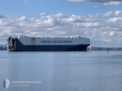
HOEGH TRAPPER
Cargo

Current Trip
| Time Travelled | 1 day |
|---|---|
| Remaining Time | 1 h, 0 mins |
| Distance Travelled | 299.17 морская миля |
| Remaining Distance | 16.92 морская миля |
| AVG Speed | 14.5 Узлы |
| MAX Speed | 16.8 Узлы |
| AVG Wind | 9.1 knots |
| MAX Wind | 23.5 knots |
| MIN Temp | 9.7°C / 49.46°F |
| MAX Temp | 14.7°C / 58.46°F |
| Осадка | 9.3 м |
| Позиция Получена | 10 h, 33 m тому назад |
Current Position
| Долгота | --- |
|---|---|
| Широта | --- |
| Статус | Under way using engine |
| Скорость | 12.2 Узлы |
| Курс | 103.6° |
| Район | Philippine Sea |
| Станция | T-AIS |
| Позиция Получена | 10 h, 33 m тому назад |
Information
The current position of HOEGH TRAPPER is in Philippine Sea with coordinates 34.45987° / 138.21115° as reported on 2025-02-28 02:49 by AIS to our vessel tracker app. The vessel's current speed is 12.2 Узлы and is heading at the port of OMAEZAKI. The estimated time of arrival as calculated by MyShipTracking vessel tracking app is 2025-02-28 23:22 LT
The vessel HOEGH TRAPPER (IMO: 9706918, MMSI: 258872000) is a Cargo It's sailing under the flag of [NO] Norway.
In this page you can find informations about the vessels current position, last detected port calls, and current voyage information. If the vessels is not in coverage by AIS you will find the latest position.
The current position of HOEGH TRAPPER is detected by our AIS receivers and we are not responsible for the reliability of the data. The last position was recorded while the vessel was in Coverage by the Ais receivers of our vessel tracking app.
The current draught of HOEGH TRAPPER as reported by AIS is 9.3 meters
Weather
| Temperature | 13.3°C / 55.94°F |
|---|---|
| Wind Speed | 23 knots |
| Direction | 251° WSW |
| Pressure | 1018.6 hPa |
| Humidity | 70.5 % |
| Cloud Coverage | --- |


Featured Company
Last Port Calls
| Port | Arrival | Departure | Time In Port |
|---|---|---|---|
| 2025-02-26 10:16 | 2025-02-27 18:34 | 1 d | |
| 2025-02-25 08:10 | 2025-02-25 17:41 | 9 h | |
| 2025-02-24 06:41 | 2025-02-24 17:32 | 10 h | |
| 2025-02-22 13:05 | 2025-02-23 17:01 | 1 d | |
| 2025-02-10 10:22 | 2025-02-12 03:14 | 1 d | |
| 2025-01-25 00:34 | 2025-01-27 07:49 | 2 d | |
| 2025-01-13 09:41 | 2025-01-15 02:23 | 1 d | |
| 2025-01-02 15:23 | 2025-01-08 19:10 | 6 d | |
| 2024-12-17 10:00 | 2024-12-18 21:42 | 1 d | |
| 2024-12-14 07:27 | 2024-12-14 19:31 | 12 h |
Most Visited Ports (Last year)
| Port | Arrivals | |
|---|---|---|
| 3 | ||
| 3 | ||
| 3 | ||
| 3 | ||
| 2 | ||
| 2 |
Last Trips
| Origin | Departure | Destination | Arrival | Distance | |
|---|---|---|---|---|---|
| 2025-02-25 17:41 | 2025-02-26 10:16 | 240.66 морская миля | |||
| 2025-02-24 17:32 | 2025-02-25 08:10 | 210.85 морская миля | |||
| 2025-02-23 17:01 | 2025-02-24 06:41 | 175.37 морская миля | |||
| 2025-02-12 03:14 | 2025-02-22 13:05 | 3959.54 морская миля | |||
| 2025-01-27 07:49 | 2025-02-10 10:22 | 1531.28 морская миля | |||
| 2025-01-15 02:23 | 2025-01-25 00:34 | 1428.75 морская миля | |||
| 2025-01-08 19:10 | 2025-01-13 09:41 | 1715.47 морская миля | |||
| 2024-12-18 21:42 | 2025-01-02 15:23 | 4422.60 морская миля | |||
| 2024-12-14 19:31 | 2024-12-17 10:00 | 458.05 морская миля | |||
| 2024-11-25 23:26 | 2024-12-14 07:27 | 6225.61 морская миля |
Events
| Время | Событие | Детали | Позиция / Направление | Информация |
|---|---|---|---|---|
| 2025-02-28 02:53 | Статус изменился | Default Under way using engine |
34.45982 / 138.23061
JP UKB RE>JP OMZ
|
Скорость: 12.2 kn Курс: 103.6° |
| 2025-02-28 02:49 | Статус изменился | Under way using engine Default |
34.45987 / 138.21115
JP UKB RE>JP OMZ
|
Скорость: 12.6 kn Курс: 111° |
| 2025-02-28 02:49 | Вне покрытия |
34.45987 / 138.21115
Philippine Sea
JP UKB RE>JP OMZ
|
Скорость: 12.2 kn Курс: 103.6° |
|
| 2025-02-28 02:41 | Статус изменился | Default Under way using engine |
34.46905 / 138.18280
JP UKB RE>JP OMZ
|
Скорость: 12.6 kn Курс: 89.5° |
| 2025-02-28 01:51 | Статус изменился | Under way using engine Default |
34.38613 / 138.00781
JP UKB RE>JP OMZ
|
Скорость: 15.3 kn Курс: 5° |
| 2025-02-28 01:41 | Статус изменился | Default Under way using engine |
34.34531 / 138.00224
JP UKB RE>JP OMZ
|
Скорость: 14.3 kn Курс: 41.7° |
| 2025-02-28 01:12 | Статус изменился | Under way using engine Default |
34.27276 / 137.89381
JP UKB RE>JP OMZ
|
Скорость: 15.5 kn Курс: 57° |
| 2025-02-28 01:05 | Статус изменился | Default Under way using engine |
34.25623 / 137.86320
JP UKB RE>JP OMZ
|
Скорость: 15.3 kn Курс: 56° |
| 2025-02-28 00:44 | Статус изменился | Under way using engine Default |
34.20697 / 137.76795
JP UKB RE>JP OMZ
|
Скорость: 15.2 kn Курс: 60° |
| 2025-02-28 00:41 | В покрытии |
34.20697 / 137.76795
Philippine Sea
JP UKB RE>JP OMZ
|
Скорость: 15.3 kn Курс: 60.4° |