
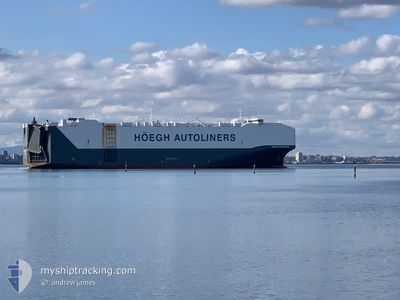
HOEGH TRAPPER
Cargo
Current Trip
| Time Travelled | 7 days |
|---|---|
| Remaining Time | --- |
| Distance Travelled | 972.57 nm |
| Remaining Distance | 62.03 nm |
| AVG Speed | 11.9 Knop |
| MAX Speed | 16.2 Knop |
| AVG Wind | 16.3 knots |
| MAX Wind | 30.7 knots |
| MIN Temp | 22.1°C / 71.78°F |
| MAX Temp | 26.5°C / 79.7°F |
| Djupgående | 8.9 m |
| Position mottagen | 10 m sen |
Current Position
| Longitud | --- |
|---|---|
| Latitude | --- |
| Status | Under way using engine |
| Fart | 2.2 Knop |
| Kurs | 16° |
| Område | Coral Sea |
| Station | T-AIS |
| Position mottagen | 10 m sen |
Information
The current position of HOEGH TRAPPER is in Coral Sea with coordinates -26.65012° / 153.73928° as reported on 2025-02-02 21:32 by AIS to our vessel tracker app. The vessel's current speed is 2.2 Knop and is heading at the port of BRISBANE. The estimated time of arrival as calculated by MyShipTracking vessel tracking app is 2025-01-28 12:30 LT
The vessel HOEGH TRAPPER (IMO: 9706918, MMSI: 258872000) is a Cargo It's sailing under the flag of [NO] Norway.
In this page you can find informations about the vessels current position, last detected port calls, and current voyage information. If the vessels is not in coverage by AIS you will find the latest position.
The current position of HOEGH TRAPPER is detected by our AIS receivers and we are not responsible for the reliability of the data. The last position was recorded while the vessel was in Coverage by the Ais receivers of our vessel tracking app.
The current draught of HOEGH TRAPPER as reported by AIS is 8.9 meters
Weather
| Temperature | 25.7°C / 78.26°F |
|---|---|
| Wind Speed | 19 knots |
| Direction | 106° ESE |
| Pressure | 1013.7 hPa |
| Humidity | 76.6 % |
| Cloud Coverage | 100 % |
Featured Company
Last Port Calls
| Port | Arrival | Departure | Time In Port |
|---|---|---|---|
| 2025-01-24 13:34 | 2025-01-26 20:49 | 2 d | |
| 2025-01-12 22:41 | 2025-01-14 15:23 | 1 d | |
| 2025-01-02 07:23 | 2025-01-08 11:10 | 6 d | |
| 2024-12-17 08:00 | 2024-12-18 19:42 | 1 d | |
| 2024-12-14 05:27 | 2024-12-14 17:31 | 12 h |
Most Visited Ports (Last year)
| Port | Arrivals | |
|---|---|---|
| 3 | ||
| 3 | ||
| 3 | ||
| 2 | ||
| 2 | ||
| 2 |
Last Trips
| Origin | Departure | Destination | Arrival | Distance | |
|---|---|---|---|---|---|
| 2025-01-15 02:23 | 2025-01-25 00:34 | 1428.75 nm | |||
| 2025-01-08 19:10 | 2025-01-13 09:41 | 1715.47 nm | |||
| 2024-12-18 21:42 | 2025-01-02 15:23 | 4422.60 nm | |||
| 2024-12-14 19:31 | 2024-12-17 10:00 | 458.05 nm | |||
| 2024-11-25 23:26 | 2024-12-14 07:27 | 6225.61 nm |
Events
| Tid | Event | Detaljer | Position / Dest | Information |
|---|---|---|---|---|
| 2025-02-02 21:38 | Status ändrad | Default Under way using engine |
-26.65215 / 153.73531
AU PKL>AU BNE
|
Fart: 2.2 kn Kurs: 16° |
| 2025-02-02 21:32 | Status ändrad | Under way using engine Default |
-26.65000 / 153.73948
AU PKL>AU BNE
|
Fart: 2 kn Kurs: 19° |
| 2025-02-02 21:31 | ETA ändrat | 2026/01/28 12:30 2025/01/28 12:30 |
-26.64879 / 153.74194
AU PKL>AU BNE
|
Fart: 2 kn Kurs: 19° |
| 2025-02-02 21:18 | I täckningsområde |
-26.65000 / 153.73948
Coral Sea
|
Fart: 2.6 kn Kurs: 238.2° |
|
| 2025-02-02 07:19 | STOPPAR förflyttning |
-26.54073 / 154.20410
AU PKL>AU BNE
|
Fart: 0.3 kn Kurs: 70° |
|
| 2025-02-01 10:44 | STARTAR förflyttning |
-26.60658 / 153.75413
AU PKL>AU BNE
|
Fart: 4.5 kn Kurs: 55° |
|
| 2025-02-01 01:16 | STOPPAR förflyttning |
-26.50085 / 154.02992
AU PKL>AU BNE
|
Fart: 0.2 kn Kurs: 64° |
|
| 2025-01-31 23:44 | STARTAR förflyttning |
-26.56150 / 153.76630
AU PKL>AU BNE
|
Fart: 5.5 kn Kurs: 53° |
|
| 2025-01-31 13:18 | STOPPAR förflyttning |
-26.37347 / 154.06241
AU PKL>AU BNE
|
Fart: 0.3 kn Kurs: 60° |
|
| 2025-01-31 11:41 | STARTAR förflyttning |
-26.47498 / 153.79565
AU PKL>AU BNE
|
Fart: 3.5 kn Kurs: 45° |