
EASTERN HIGHWAY
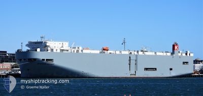
Vehicles Carrier
Current Trip
IN ENR
| Time Travelled | 17 h, 0 mins |
|---|---|
| Remaining Time | --- |
| Distance Travelled | 56.30 морская миля |
| Remaining Distance | --- |
| AVG Speed | 15.9 Узлы |
| MAX Speed | 18.3 Узлы |
| AVG Wind | 12 knots |
| MAX Wind | 13 knots |
| MIN Temp | 28.3°C / 82.94°F |
| MAX Temp | 28.8°C / 83.84°F |
| Осадка | 7.1 м |
| Позиция Получена | 3 d тому назад |
Current Position
| Долгота | --- |
|---|---|
| Широта | --- |
| Статус | Under way using engine |
| Скорость | 15.4 Узлы |
| Курс | 98° |
| Район | Laccadive Sea |
| Станция | T-AIS |
| Позиция Получена | 3 d тому назад |
Info
Information
The current position of EASTERN HIGHWAY is in Laccadive Sea with coordinates 5.73198° / 80.38289° as reported on 2025-03-15 03:35 by AIS to our vessel tracker app. The vessel's current speed is 15.4 Узлы
The vessel EASTERN HIGHWAY (IMO: 9325764, MMSI: 538007611) is a Vehicles Carrier that was built in 2006 ( 19 лет ). It's sailing under the flag of [MH] Marshall Is.
In this page you can find informations about the vessels current position, last detected port calls, and current voyage information. If the vessels is not in coverage by AIS you will find the latest position.
The current position of EASTERN HIGHWAY is detected by our AIS receivers and we are not responsible for the reliability of the data. The last position was recorded while the vessel was in Coverage by the Ais receivers of our vessel tracking app.
The current draught of EASTERN HIGHWAY as reported by AIS is 7.1 meters
Weather
| Temperature | 28.4°C / 83.12°F |
|---|---|
| Wind Speed | 10 knots |
| Direction | 81° E |
| Pressure | 1012.3 hPa |
| Humidity | 73.1 % |
| Cloud Coverage | 19 % |
Featured Company
Last Port Calls
| Port | Arrival | Departure | Time In Port |
|---|---|---|---|
| 2025-03-17 08:07 | 2025-03-17 17:51 | 9 h | |
| 2025-03-07 22:31 | 2025-03-10 03:25 | 2 d | |
| 2025-03-07 08:18 | 2025-03-07 16:42 | 8 h | |
| 2025-03-06 06:21 | 2025-03-06 11:14 | 4 h | |
| 2025-02-25 13:42 | 2025-02-25 23:39 | 9 h | |
| 2025-02-19 05:08 | 2025-02-19 15:45 | 10 h | |
| 2025-02-16 20:13 | 2025-02-17 08:33 | 12 h | |
| 2025-02-15 06:58 | 2025-02-15 21:39 | 14 h | |
| 2025-02-12 06:46 | 2025-02-12 13:12 | 6 h | |
| 2025-02-11 08:09 | 2025-02-11 16:05 | 7 h |
Most Visited Ports (Last year)
| Port | Arrivals | |
|---|---|---|
| 4 | ||
| 4 | ||
| 3 | ||
| 3 | ||
| 2 | ||
| 2 |
Last Trips
| Origin | Departure | Destination | Arrival | Distance | |
|---|---|---|---|---|---|
| 2025-03-10 03:25 | 2025-03-17 08:07 | 2595.84 морская миля | |||
| 2025-03-07 16:42 | 2025-03-07 22:31 | 54.54 морская миля | |||
| 2025-03-06 11:14 | 2025-03-07 08:18 | 300.38 морская миля | |||
| 2025-02-25 23:39 | 2025-03-06 06:21 | 3292.46 морская миля | |||
| 2025-02-19 15:45 | 2025-02-25 13:42 | 2243.13 морская миля | |||
| 2025-02-17 08:33 | 2025-02-19 05:08 | 397.00 морская миля | |||
| 2025-02-15 21:39 | 2025-02-16 20:13 | 402.76 морская миля | |||
| 2025-02-12 13:12 | 2025-02-15 06:58 | 1028.99 морская миля | |||
| 2025-02-11 16:05 | 2025-02-12 06:46 | 186.56 морская миля | |||
| 2025-01-29 00:51 | 2025-02-11 08:09 | 4945.70 морская миля |
Events
| Время | Событие | Детали | Позиция / Направление | Информация |
|---|---|---|---|---|
| 2025-03-17 12:21 | ПОРТ ОТПРАВЛЕНИЯ |
|
13.24942 / 80.35131
IN ENR
|
Скорость: 8.2 kn Курс: 162° |
| 2025-03-17 12:04 | Начало движения |
13.27295 / 80.34127
[IN] ENNORE
|
Скорость: 3.3 kn Курс: 310° |
|
| 2025-03-17 03:12 | Окончание движения |
13.27785 / 80.34126
[IN] ENNORE
|
Скорость: Курс: 87° |
|
| 2025-03-17 02:37 | Порт |
|
13.26375 / 80.34667
[IN] ENNORE
|
Скорость: 7.3 kn Курс: 337° |
| 2025-03-17 01:38 | Начало движения | 5.15 nm, South East of ENNORE |
13.22800 / 80.42436
IN ENR
|
Скорость: 5.9 kn Курс: 240° |
| 2025-03-16 15:38 | Окончание движения | 5.18 nm, East of ENNORE |
13.23456 / 80.42759
IN ENR
|
Скорость: 0.3 kn Курс: 42° |
| 2025-03-15 03:36 | Статус изменился | Default Under way using engine |
5.73179 / 80.38423
IN ENR
|
Скорость: 15.4 kn Курс: 98° |
| 2025-03-15 03:35 | Вне покрытия |
5.73198 / 80.38289
Laccadive Sea
IN ENR
|
Скорость: 15.4 kn Курс: 98° |
|
| 2025-03-15 03:23 | Статус изменился | Under way using engine Default |
5.73951 / 80.33130
IN ENR
|
Скорость: 15.1 kn Курс: 100° |
| 2025-03-15 03:14 | Статус изменился | Default Under way using engine |
5.74588 / 80.29290
IN ENR
|
Скорость: 15.2 kn Курс: 99.5° |