

EASTERN HIGHWAY
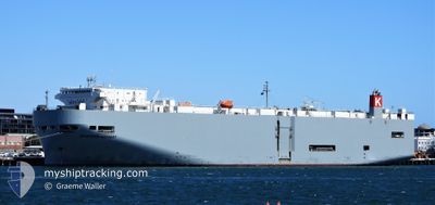
Vehicles Carrier

Current Trip
| Time Travelled | 11 h, 0 mins |
|---|---|
| Remaining Time | --- |
| Distance Travelled | 142.72 nm |
| Remaining Distance | 397.98 nm |
| AVG Speed | 13.9 Knop |
| MAX Speed | 16.1 Knop |
| AVG Wind | 12.6 knots |
| MAX Wind | 14 knots |
| MIN Temp | 6.3°C / 43.34°F |
| MAX Temp | 7.6°C / 45.68°F |
| Djupgående | 7.2 m |
| Position mottagen | 4 d sen |
Current Position
| Longitud | --- |
|---|---|
| Latitude | --- |
| Status | Under way using engine |
| Fart | 7.9 Knop |
| Kurs | 251.7° |
| Område | Yellow Sea |
| Station | T-AIS |
| Position mottagen | 4 d sen |
Information
The current position of EASTERN HIGHWAY is in Yellow Sea with coordinates 37.34994° / 126.51167° as reported on 2025-02-15 13:18 by AIS to our vessel tracker app. The vessel's current speed is 7.9 Knop and is heading at the port of LIANYUNGANG. The estimated time of arrival as calculated by MyShipTracking vessel tracking app is 2025-02-16 12:00 LT
The vessel EASTERN HIGHWAY (IMO: 9325764, MMSI: 538007611) is a Vehicles Carrier that was built in 2006 ( 19 År gammal ). It's sailing under the flag of [MH] Marshall Is.
In this page you can find informations about the vessels current position, last detected port calls, and current voyage information. If the vessels is not in coverage by AIS you will find the latest position.
The current position of EASTERN HIGHWAY is detected by our AIS receivers and we are not responsible for the reliability of the data. The last position was recorded while the vessel was in Coverage by the Ais receivers of our vessel tracking app.
The current draught of EASTERN HIGHWAY as reported by AIS is 7.2 meters
Weather
| Temperature | 7.8°C / 46.04°F |
|---|---|
| Wind Speed | 13 knots |
| Direction | 45° NE |
| Pressure | 1030.2 hPa |
| Humidity | 66.1 % |
| Cloud Coverage | 100 % |


Featured Company
Last Port Calls
| Port | Arrival | Departure | Time In Port |
|---|---|---|---|
| 2025-02-18 21:08 | 2025-02-19 07:45 | 10 h | |
| 2025-02-16 12:13 | 2025-02-17 00:33 | 12 h | |
| 2025-02-14 21:58 | 2025-02-15 12:39 | 14 h | |
| 2025-02-11 21:46 | 2025-02-12 04:12 | 6 h | |
| 2025-02-10 23:09 | 2025-02-11 07:05 | 7 h | |
| 2025-01-25 10:49 | 2025-01-28 13:51 | 3 d | |
| 2025-01-19 10:06 | 2025-01-21 05:17 | 1 d | |
| 2025-01-10 15:13 | 2025-01-12 03:21 | 1 d | |
| 2024-12-29 22:53 | 2025-01-03 14:37 | 4 d | |
| 2024-12-07 23:33 | 2024-12-08 13:20 | 13 h |
Last Trips
| Origin | Departure | Destination | Arrival | Distance | |
|---|---|---|---|---|---|
| 2025-02-17 08:33 | 2025-02-19 05:08 | 397.00 nm | |||
| 2025-02-15 21:39 | 2025-02-16 20:13 | 402.76 nm | |||
| 2025-02-12 13:12 | 2025-02-15 06:58 | 1028.99 nm | |||
| 2025-02-11 16:05 | 2025-02-12 06:46 | 186.56 nm | |||
| 2025-01-29 00:51 | 2025-02-11 08:09 | 4945.70 nm | |||
| 2025-01-21 16:17 | 2025-01-25 21:49 | 709.14 nm | |||
| 2025-01-12 14:21 | 2025-01-19 21:06 | 948.11 nm | |||
| 2025-01-04 00:37 | 2025-01-11 02:13 | 1438.49 nm | |||
| 2024-12-08 20:20 | 2024-12-30 08:53 | 4538.12 nm | |||
| 2024-11-27 11:17 | 2024-12-08 06:33 | 3000.11 nm |
Events
| Tid | Event | Detaljer | Position / Dest | Information |
|---|---|---|---|---|
| 2025-02-19 07:46 | STARTAR förflyttning | 5.19 nm, South East of SHANGHAI |
31.32483 / 121.69393
CN LYG
|
Fart: 5.8 kn Kurs: 95° |
| 2025-02-19 07:45 | AVGÅTT HAMN |
|
31.32483 / 121.69393
CN LYG
|
Fart: 1.3 kn Kurs: 92° |
| 2025-02-18 21:08 | ANLÄNDER HAMN |
|
31.32215 / 121.68183
[CN] SHANGHAI
|
Fart: 0.5 kn Kurs: 124° |
| 2025-02-18 20:29 | STOPPAR förflyttning | 4.59 nm, South East of SHANGHAI |
31.32921 / 121.68343
CN LYG
|
Fart: 0.2 kn Kurs: 121° |
| 2025-02-18 14:29 | STARTAR förflyttning |
31.20595 / 122.59084
CN LYG
|
Fart: 4.9 kn Kurs: 260° |
|
| 2025-02-17 23:09 | STOPPAR förflyttning |
31.20231 / 122.59631
CN LYG
|
Fart: 0.2 kn Kurs: 342° |
|
| 2025-02-17 00:33 | AVGÅTT HAMN |
|
34.74935 / 119.53938
CN LYG
|
Fart: 11.7 kn Kurs: 62° |
| 2025-02-16 23:49 | STARTAR förflyttning |
34.75125 / 119.39522
[CN] LIANYUNGANG
|
Fart: 5.8 kn Kurs: 85° |
|
| 2025-02-16 13:01 | STOPPAR förflyttning |
34.75052 / 119.38634
[CN] LIANYUNGANG
|
Fart: 0.2 kn Kurs: 144° |
|
| 2025-02-16 12:13 | ANLÄNDER HAMN |
|
34.73988 / 119.51553
[CN] LIANYUNGANG
|
Fart: 11.4 kn Kurs: 240° |