
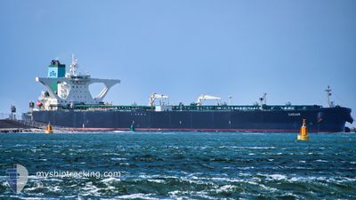
CAESAR
Crude Oil Tanker
Current Trip
MY LINGGI
| Time Travelled | 26 days |
|---|---|
| Remaining Time | --- |
| Distance Travelled | 4961.59 морская миля |
| Remaining Distance | --- |
| AVG Speed | 11.8 Узлы |
| MAX Speed | 20.2 Узлы |
| AVG Wind | 7.7 knots |
| MAX Wind | 21 knots |
| MIN Temp | 24.4°C / 75.92°F |
| MAX Temp | 31.2°C / 88.16°F |
| Осадка | 19.7 м |
| Позиция Получена | 2 d тому назад |
Current Position
| Долгота | 77.35240° |
|---|---|
| Широта | 7.51218° |
| Статус | Under way using engine |
| Скорость | 12.4 Узлы |
| Курс | 127° |
| Район | Laccadive Sea |
| Станция | T-AIS |
| Позиция Получена | 2 d тому назад |
Info
Information
The current position of CAESAR is in Laccadive Sea with coordinates 7.51218° / 77.35240° as reported on 2024-05-03 08:05 by AIS to our vessel tracker app. The vessel's current speed is 12.4 Узлы
The vessel CAESAR (IMO: 9389265, MMSI: 249838000) is a Crude Oil Tanker that was built in 2009 ( 15 лет ). It's sailing under the flag of [MT] Malta.
In this page you can find informations about the vessels current position, last detected port calls, and current voyage information. If the vessels is not in coverage by AIS you will find the latest position.
The current position of CAESAR is detected by our AIS receivers and we are not responsible for the reliability of the data. The last position was recorded while the vessel was in Coverage by the Ais receivers of our vessel tracking app.
The current draught of CAESAR as reported by AIS is 19.7 meters
Weather
| Temperature | 29.8°C / 85.64°F |
|---|---|
| Wind Speed | 2 knots |
| Direction | 351° N |
| Pressure | 1009.9 hPa |
| Humidity | 69.8 % |
| Cloud Coverage | 100 % |
Featured Company
Last Port Calls
| Port | Arrival | Departure | Time In Port |
|---|---|---|---|
| 2024-04-08 09:05 | 2024-04-09 03:24 | 18 h |
Most Visited Ports (Last year)
| Port | Arrivals | |
|---|---|---|
| 1 |
Last Trips
| Origin | Departure | Destination | Arrival | Distance |
|---|
Events
| Время | Событие | Детали | Позиция / Направление | Информация |
|---|---|---|---|---|
| 2024-05-03 08:19 | Статус изменился | Default Under way using engine |
7.48265 / 77.39020
MY LINGGI
|
Скорость: 12.4 kn Курс: 127° |
| 2024-05-03 08:05 | Вне покрытия |
7.51218 / 77.35240
Laccadive Sea
MY LINGGI
|
Скорость: 12.4 kn Курс: 127° |
|
| 2024-05-03 07:13 | ETA изменился | 2024/05/08 20:00 2024/05/08 15:00 |
7.62477 / 77.20645
MY LINGGI
|
Скорость: 12.4 kn Курс: 134° |
| 2024-05-03 04:25 | ETA изменился | 2024/05/08 15:00 2024/05/08 14:00 |
7.99248 / 76.76293
MY LINGGI
|
Скорость: 12.3 kn Курс: 128° |
| 2024-05-03 04:01 | Статус изменился | Under way using engine Default |
8.04698 / 76.69622
MY LINGGI
|
Скорость: 12.7 kn Курс: 128° |
| 2024-05-03 03:53 | Статус изменился | Default Under way using engine |
8.06478 / 76.67395
MY LINGGI
|
Скорость: 12.7 kn Курс: 129° |
| 2024-05-03 03:39 | Статус изменился | Under way using engine Default |
8.09450 / 76.63702
MY LINGGI
|
Скорость: 12.5 kn Курс: 127° |
| 2024-05-03 03:23 | Статус изменился | Default Under way using engine |
8.13110 / 76.58995
MY LINGGI
|
Скорость: 12.5 kn Курс: 127° |
| 2024-05-03 03:12 | Статус изменился | Under way using engine Default |
8.15278 / 76.56177
MY LINGGI
|
Скорость: 12.5 kn Курс: 131° |
| 2024-05-03 02:38 | Изменение морского района | Indian part of the Laccadive Sea Iranian part of the Gulf of Oman |
8.23340 / 76.47168
Laccadive Sea
MY LINGGI
|
Скорость: 12.6 kn Курс: 131° |