
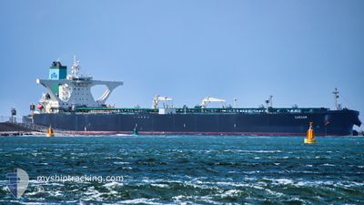
CAESAR
Crude Oil Tanker
Current Trip
ULSAN,SOUTH KOREA
| Time Travelled | 20 days |
|---|---|
| Remaining Time | --- |
| Distance Travelled | 5577.34 nm |
| Remaining Distance | --- |
| AVG Speed | 10.4 Knots |
| MAX Speed | 13.4 Knots |
| AVG Wind | 13.7 knots |
| MAX Wind | 31 knots |
| MIN Temp | 17.9°C / 64.22°F |
| MAX Temp | 28.4°C / 83.12°F |
| Dybgang | 20.4 m |
| Position Modtaget | 7 d siden |
Current Position
| Longitude | --- |
|---|---|
| Latitude | --- |
| Status | Constrained by her draught |
| Fart | 8.2 Knots |
| Kurs | 84° |
| Område | Singapore Strait |
| Station | T-AIS |
| Position Modtaget | 7 d siden |
Info
Information
The current position of CAESAR is in Singapore Strait with coordinates 1.26020° / 104.21620° as reported on 2026-01-02 20:13 by AIS to our vessel tracker app. The vessel's current speed is 8.2 Knots
The vessel CAESAR (IMO: 9389265, MMSI: 249838000) is a Crude Oil Tanker that was built in 2009 ( 17 år gamle ). It's sailing under the flag of [MT] Malta.
In this page you can find informations about the vessels current position, last detected port calls, and current voyage information. If the vessels is not in coverage by AIS you will find the latest position.
The current position of CAESAR is detected by our AIS receivers and we are not responsible for the reliability of the data. The last position was recorded while the vessel was in Coverage by the Ais receivers of our vessel tracking app.
The current draught of CAESAR as reported by AIS is 20.4 meters
Weather
| Temperature | 17.6°C / 63.68°F |
|---|---|
| Wind Speed | 8 knots |
| Direction | 40° NE |
| Pressure | 1020.6 hPa |
| Humidity | 60.9 % |
| Cloud Coverage | --- |
Featured Company
Last Port Calls
| Port | Arrival | Departure | Time In Port |
|---|---|---|---|
| 2025-12-18 06:48 | 2025-12-20 16:08 | 2 d |
Most Visited Ports (Last year)
| Port | Arrivals | |
|---|---|---|
| 2 | ||
| 1 | ||
| 1 | ||
| 1 |
Last Trips
| Origin | Departure | Destination | Arrival | Distance |
|---|
Events
| Tid | Hændelsen | Detaljer | Position / Dest | Info |
|---|---|---|---|---|
| 2026-01-09 23:31 | START Sejllads |
24.56093 / 123.43767
ULSAN,SOUTH KOREA
|
Fart: 5.1 kn Kurs: 61° |
|
| 2026-01-02 20:20 | Status er ændret | Default Constrained by her draught |
1.26170 / 104.23206
ULSAN,SOUTH KOREA
|
Fart: 8.2 kn Kurs: 84° |
| 2026-01-02 20:13 | Fundet i havområde | Malaysian part of the Singapore Strait |
1.26020 / 104.21620
Singapore Strait
ULSAN,SOUTH KOREA
|
Fart: 8.2 kn Kurs: 84° |
| 2026-01-02 20:13 | Status er ændret | Constrained by her draught Default |
1.26020 / 104.21620
ULSAN,SOUTH KOREA
|
Fart: 8.1 kn Kurs: 84° |
| 2026-01-02 20:13 | Udenfor Dækning |
1.26020 / 104.21620
Singapore Strait
ULSAN,SOUTH KOREA
|
Fart: 8.2 kn Kurs: 84° |
|
| 2026-01-02 20:00 | Status er ændret | Default Constrained by her draught |
1.25738 / 104.18653
ULSAN,SOUTH KOREA
|
Fart: 8.6 kn Kurs: 84° |
| 2026-01-02 19:55 | Status er ændret | Constrained by her draught Default |
1.25610 / 104.17415
ULSAN,SOUTH KOREA
|
Fart: 8.8 kn Kurs: 84° |
| 2026-01-02 19:53 | Status er ændret | Default Constrained by her draught |
1.25547 / 104.16811
ULSAN,SOUTH KOREA
|
Fart: 9.5 kn Kurs: 84° |
| 2026-01-02 19:35 | Status er ændret | Constrained by her draught Default |
1.24983 / 104.12228
ULSAN,SOUTH KOREA
|
Fart: 9.2 kn Kurs: 77° |
| 2026-01-02 19:29 | Status er ændret | Default Constrained by her draught |
1.24627 / 104.10578
ULSAN,SOUTH KOREA
|
Fart: 5.7 kn Kurs: 90° |