
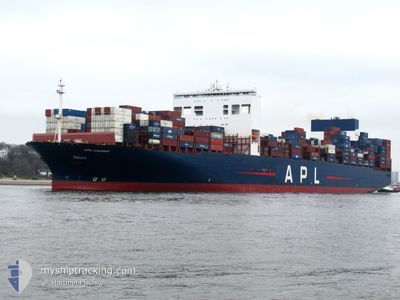
APL CHANGI
Container Ship
Current Trip
| Time Travelled | 4 days |
|---|---|
| Remaining Time | --- |
| Distance Travelled | 2158.14 морская миля |
| Remaining Distance | --- |
| AVG Speed | 15.3 Узлы |
| MAX Speed | 20.9 Узлы |
| AVG Wind | 5 knots |
| MAX Wind | 15.4 knots |
| MIN Temp | 27.2°C / 80.96°F |
| MAX Temp | 32.1°C / 89.78°F |
| Осадка | 16.4 м |
| Позиция Получена | 4 d тому назад |
Current Position
| Долгота | 103.45498° |
|---|---|
| Широта | 1.22393° |
| Статус | Under way using engine |
| Скорость | 16.9 Узлы |
| Курс | 281.9° |
| Район | Malacca Strait |
| Станция | T-AIS |
| Позиция Получена | 4 d тому назад |
Info
Information
The current position of APL CHANGI is in Malacca Strait with coordinates 1.22393° / 103.45498° as reported on 2024-05-07 20:55 by AIS to our vessel tracker app. The vessel's current speed is 16.9 Узлы and is heading at the port of TANGER MED. The estimated time of arrival as calculated by MyShipTracking vessel tracking app is 2024-05-31 12:00 LT
The vessel APL CHANGI (IMO: 9631981, MMSI: 566882000) is a Container Ship that was built in 2013 ( 11 лет ). It's sailing under the flag of [SG] Singapore.
In this page you can find informations about the vessels current position, last detected port calls, and current voyage information. If the vessels is not in coverage by AIS you will find the latest position.
The current position of APL CHANGI is detected by our AIS receivers and we are not responsible for the reliability of the data. The last position was recorded while the vessel was in Coverage by the Ais receivers of our vessel tracking app.
The current draught of APL CHANGI as reported by AIS is 16.4 meters
Weather
| Temperature | 27.9°C / 82.22°F |
|---|---|
| Wind Speed | 14 knots |
| Direction | 109° ESE |
| Pressure | 1011.2 hPa |
| Humidity | 84 % |
| Cloud Coverage | 92 % |
Featured Company
Last Port Calls
| Port | Arrival | Departure | Time In Port |
|---|---|---|---|
| 2024-05-06 14:20 | 2024-05-07 18:05 | 1 d | |
| 2024-05-02 01:12 | 2024-05-02 23:20 | 22 h | |
| 2024-04-27 19:01 | 2024-04-29 20:20 | 2 d | |
| 2024-04-17 19:45 | 2024-04-20 03:40 | 2 d | |
| 2024-03-20 19:57 | 2024-03-22 02:43 | 1 d | |
| 2024-03-16 02:23 | 2024-03-18 02:39 | 2 d | |
| 2024-03-11 04:38 | 2024-03-13 12:44 | 2 d | |
| 2024-03-07 18:27 | 2024-03-09 22:22 | 2 d | |
| 2024-03-05 03:50 | 2024-03-07 06:01 | 2 d |
Most Visited Ports (Last year)
| Port | Arrivals | |
|---|---|---|
| 7 | ||
| 5 | ||
| 4 | ||
| 4 | ||
| 4 | ||
| 4 |
Last Trips
| Origin | Departure | Destination | Arrival | Distance | |
|---|---|---|---|---|---|
| 2024-05-03 07:20 | 2024-05-06 22:20 | 1478.05 морская миля | |||
| 2024-04-30 04:20 | 2024-05-02 09:12 | 822.59 морская миля | |||
| 2024-04-20 11:40 | 2024-04-28 03:01 | 2488.96 морская миля | |||
| 2024-03-22 03:43 | 2024-04-18 03:45 | 11741.49 морская миля | |||
| 2024-03-18 03:39 | 2024-03-20 20:57 | 1070.98 морская миля | |||
| 2024-03-13 13:44 | 2024-03-16 03:23 | 984.80 морская миля | |||
| 2024-03-09 23:22 | 2024-03-11 05:38 | 430.64 морская миля | |||
| 2024-03-07 07:01 | 2024-03-07 19:27 | 166.08 морская миля | |||
| 2024-02-05 16:23 | 2024-03-05 04:50 | 12029.00 морская миля |
Events
| Время | Событие | Детали | Позиция / Направление | Информация |
|---|---|---|---|---|
| 2024-05-07 21:00 | Статус изменился | Default Under way using engine |
1.22760 / 103.43510
MAPTM
|
Скорость: 16.9 kn Курс: 281.9° |
| 2024-05-07 20:55 | Изменение морского района | Malaysian part of the Malacca Strait Malaysian part of the Singapore Strait |
1.22393 / 103.45498
Malacca Strait
MAPTM
|
Скорость: 16.9 kn Курс: 281.9° |
| 2024-05-07 20:55 | Вне покрытия |
1.22393 / 103.45498
Malacca Strait
MAPTM
|
Скорость: 16.9 kn Курс: 281.9° |
|
| 2024-05-07 20:20 | Изменение морского района | Malaysian part of the Singapore Strait Indonesian part of the Singapore Strait |
1.20553 / 103.59281
Singapore Strait
MAPTM
|
Скорость: 12.8 kn Курс: 300.2° |
| 2024-05-07 19:43 | Изменение морского района | Indonesian part of the Singapore Strait Singaporean part of the Singapore Strait |
1.15653 / 103.70231
Singapore Strait
MAPTM
|
Скорость: 11.3 kn Курс: 293.6° |
| 2024-05-07 18:12 | Начало движения | 2.22 nm, East of BUKOM ISLAND |
1.25000 / 103.78794
MAPTM
|
Скорость: 3.2 kn Курс: 241° |
| 2024-05-07 18:05 | ПОРТ ОТПРАВЛЕНИЯ |
|
1.25236 / 103.78939
MAPTM
|
Скорость: 1.1 kn Курс: 291° |
| 2024-05-07 17:43 | Статус изменился | Under way using engine Moored |
1.25918 / 103.78809
[SG] SINGAPORE
|
Скорость: Курс: 32° |
| 2024-05-07 16:15 | Осадка изменилась | 16.4 16.3 |
1.25912 / 103.78812
[SG] SINGAPORE
|
Скорость: Курс: 32° |
| 2024-05-07 12:04 | Осадка изменилась | 16.3 15.1 |
1.25919 / 103.78817
[SG] SINGAPORE
|
Скорость: Курс: 32° |