

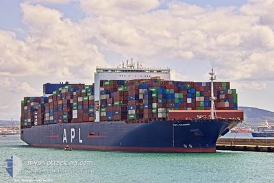
APL CHANGI
Container Ship

Current Trip
| Trip Time | 10 days |
|---|---|
| Trip Distance | 2521.70 nm |
| AVG Speed | 15.1 Knots |
| MAX Speed | 20.2 Knots |
| Draught | 11.5 m |
| AVG Wind | 10.1 knots |
| MAX Wind | 24.8 knots |
| MIN Temp | 9.2°C / 48.56°F |
| MAX Temp | 28.2°C / 82.76°F |
| Position Received | 9 d ago |
Current Position
| Longitude | --- |
|---|---|
| Latitude | --- |
| Status | Under way using engine |
| Speed | 16.6 Knots |
| Course | 51.6° |
| Area | South China Sea |
| Station | T-AIS |
| Position Received | 9 d ago |
Information
The current position of APL CHANGI is in South China Sea with coordinates 1.34699° / 104.38802° as reported on 2025-03-05 13:23 by AIS to our vessel tracker app. The vessel's current speed is 16.6 Knots and is currently inside the port of YANGSHAN.
The vessel APL CHANGI (IMO: 9631981, MMSI: 566882000) is a Container Ship that was built in 2013 ( 12 years old ). It's sailing under the flag of [SG] Singapore.
In this page you can find informations about the vessels current position, last detected port calls, and current voyage information. If the vessels is not in coverage by AIS you will find the latest position.
The current position of APL CHANGI is detected by our AIS receivers and we are not responsible for the reliability of the data. The last position was recorded while the vessel was in Coverage by the Ais receivers of our vessel tracking app.
The current draught of APL CHANGI as reported by AIS is 11.5 meters
Weather
| Temperature | 8.9°C / 48.02°F |
|---|---|
| Wind Speed | 19 knots |
| Direction | 6° N |
| Pressure | 1019.9 hPa |
| Humidity | 91.7 % |
| Cloud Coverage | 100 % |


Featured Company
Last Port Calls
| Port | Arrival | Departure | Time In Port |
|---|---|---|---|
| 2025-03-15 00:10 | |||
| 2025-03-02 22:57 | 2025-03-04 23:21 | 2 d | |
| 2025-02-02 01:33 | 2025-02-03 08:39 | 1 d | |
| 2025-01-23 16:14 | 2025-01-24 20:45 | 1 d | |
| 2025-01-18 05:33 | 2025-01-19 15:04 | 1 d | |
| 2025-01-13 03:43 | 2025-01-15 17:20 | 2 d | |
| 2025-01-08 21:20 | 2025-01-11 13:21 | 2 d | |
| 2025-01-05 02:31 | 2025-01-05 21:59 | 19 h |
Most Visited Ports (Last year)
| Port | Arrivals | |
|---|---|---|
| 5 | ||
| 4 | ||
| 4 | ||
| 4 | ||
| 3 | ||
| 3 |
Last Trips
| Origin | Departure | Destination | Arrival | Distance | |
|---|---|---|---|---|---|
| 2025-03-05 07:21 | 2025-03-15 08:10 | 2521.70 nm | |||
| 2025-02-03 09:39 | 2025-03-03 06:57 | 10693.90 nm | |||
| 2025-01-24 21:45 | 2025-02-02 02:33 | 1895.80 nm | |||
| 2025-01-19 16:04 | 2025-01-23 17:14 | 1136.02 nm | |||
| 2025-01-15 18:20 | 2025-01-18 06:33 | 986.21 nm | |||
| 2025-01-11 14:21 | 2025-01-13 04:43 | 560.95 nm | |||
| 2025-01-05 22:59 | 2025-01-08 22:20 | 1208.70 nm | |||
| 2024-12-11 13:56 | 2025-01-05 03:31 | 10777.19 nm |
Events
| Time | Event | Details | Position / Dest | Info |
|---|---|---|---|---|
| 2025-03-15 00:10 | STOP Moving |
30.62959 / 122.05045
[CN] YANGSHAN
|
Speed: 0.3 kn Course: 128° |
|
| 2025-03-15 00:10 | PORT ARRIVAL |
|
30.62959 / 122.05045
[CN] YANGSHAN
|
Speed: 0.9 kn Course: 125° |
| 2025-03-14 11:50 | START Moving | 14 nm, South East of NINGBO |
29.77606 / 122.03307
CNNGB
|
Speed: 8.7 kn Course: 70° |
| 2025-03-12 13:09 | STOP Moving | 13.29 nm, South East of NINGBO |
29.78015 / 122.01812
CNNGB
|
Speed: Course: 227° |
| 2025-03-12 08:57 | START Moving |
29.71440 / 122.54636
CNNGB
|
Speed: 4.6 kn Course: 265° |
|
| 2025-03-11 19:51 | STOP Moving |
29.71318 / 122.55058
CNNGB
|
Speed: 0.2 kn Course: 354° |
|
| 2025-03-11 15:40 | START Moving |
29.72207 / 123.02112
CNNGB
|
Speed: 5.6 kn Course: 250° |
|
| 2025-03-11 14:08 | STOP Moving |
29.70746 / 123.03948
CNNGB
|
Speed: Course: 192° |
|
| 2025-03-11 10:27 | START Moving |
29.65807 / 123.02363
CNNGB
|
Speed: 3.7 kn Course: 55° |
|
| 2025-03-11 09:00 | STOP Moving |
29.65157 / 123.02741
CNNGB
|
Speed: Course: 240° |