
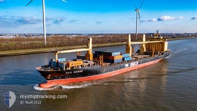
RED CEDAR
General Cargo
Current Trip
| Time Travelled | 3 days |
|---|---|
| Remaining Time | --- |
| Distance Travelled | 1144.30 nm |
| Remaining Distance | --- |
| AVG Speed | 15.2 Knopen |
| MAX Speed | 16.7 Knopen |
| AVG Wind | 17.8 knots |
| MAX Wind | 22.8 knots |
| MIN Temp | 13.1°C / 55.58°F |
| MAX Temp | 19.7°C / 67.46°F |
| Diepgang | 11.3 M |
| Positie ontvangen | 16 h, 17 m geleden |
Current Position
| Lengtegraad | -15.27396° |
|---|---|
| Breedtegraat | 27.51723° |
| Status | Under way using engine |
| Snelheid | 16.1 Knopen |
| Koers | 198.6° |
| Gebied | North Atlantic Ocean |
| Station | T-AIS |
| Positie ontvangen | 16 h, 17 m geleden |
Info
Information
The current position of RED CEDAR is in North Atlantic Ocean with coordinates 27.51723° / -15.27396° as reported on 2024-04-30 23:43 by AIS to our vessel tracker app. The vessel's current speed is 16.1 Knopen and is heading at the port of WALVIS BAY. The estimated time of arrival as calculated by MyShipTracking vessel tracking app is 2024-05-12 03:00 LT
The vessel RED CEDAR (IMO: 9231092, MMSI: 538090070) is a General Cargo that was built in 2001 ( 23 Jaar oud ). It's sailing under the flag of [MH] Marshall Is.
In this page you can find informations about the vessels current position, last detected port calls, and current voyage information. If the vessels is not in coverage by AIS you will find the latest position.
The current position of RED CEDAR is detected by our AIS receivers and we are not responsible for the reliability of the data. The last position was recorded while the vessel was in Coverage by the Ais receivers of our vessel tracking app.
The current draught of RED CEDAR as reported by AIS is 11.3 meters
Weather
| Temperature | 18.9°C / 66.02°F |
|---|---|
| Wind Speed | 18 knots |
| Direction | 43° NE |
| Pressure | 1016.7 hPa |
| Humidity | 78.6 % |
| Cloud Coverage | 70 % |
Featured Company
Last Port Calls
| Port | Arrival | Departure | Time In Port |
|---|---|---|---|
| 2024-04-27 13:21 | 2024-04-28 14:02 | 1 d | |
| 2024-04-18 20:38 | 2024-04-23 17:17 | 4 d | |
| 2024-04-09 18:24 | 2024-04-17 12:52 | 7 d | |
| 2024-04-04 14:14 | 2024-04-08 19:26 | 4 d | |
| 2024-04-01 03:46 | 2024-04-01 16:43 | 12 h | |
| 2024-03-12 21:40 | 2024-03-14 06:51 | 1 d | |
| 2024-03-08 14:24 | 2024-03-09 16:04 | 1 d | |
| 2024-03-06 07:41 |
Most Visited Ports (Last year)
| Port | Arrivals | |
|---|---|---|
| 6 | ||
| 6 | ||
| 4 | ||
| 3 | ||
| 3 | ||
| 3 |
Last Trips
| Origin | Departure | Destination | Arrival | Distance | |
|---|---|---|---|---|---|
| 2024-04-23 19:17 | 2024-04-27 14:21 | 1013.52 nm | |||
| 2024-04-17 14:52 | 2024-04-18 22:38 | 404.73 nm | |||
| 2024-04-08 21:26 | 2024-04-09 20:24 | 314.94 nm | |||
| 2024-04-01 18:43 | 2024-04-04 16:14 | 910.88 nm | |||
| 2024-03-14 08:51 | 2024-04-01 05:46 | 4799.51 nm | |||
| 2024-03-09 18:04 | 2024-03-12 23:40 | 743.16 nm | |||
| 2024-03-06 09:41 | 2024-03-08 16:24 | 801.60 nm |
Events
| Tijd | Evenement | Details | Positie / Bestemming | Info |
|---|---|---|---|---|
| 2024-04-30 23:50 | Status Changed | Default Under way using engine |
27.48754 / -15.28563
WALVIS BAY
|
Snelheid: 16.1 kn Koers: 198.6° |
| 2024-04-30 23:43 | Buitenbereik |
27.51723 / -15.27396
North Atlantic Ocean
WALVIS BAY
|
Snelheid: 16.1 kn Koers: 198.6° |
|
| 2024-04-30 19:01 | Status Changed | Under way using engine Default |
28.69793 / -14.78534
WALVIS BAY
|
Snelheid: 15.5 kn Koers: 197° |
| 2024-04-30 18:50 | Status Changed | Default Under way using engine |
28.74351 / -14.76986
WALVIS BAY
|
Snelheid: 15.6 kn Koers: 197.4° |
| 2024-04-30 18:50 | Status Changed | Under way using engine Default |
28.74635 / -14.76891
WALVIS BAY
|
Snelheid: 15.7 kn Koers: 196° |
| 2024-04-30 18:50 | Binnenbereik |
28.74635 / -14.76891
North Atlantic Ocean
WALVIS BAY
|
Snelheid: 15.6 kn Koers: 197.4° |
|
| 2024-04-30 18:50 | Gevonden in zee | Spanish (Canary Islands) part of the North Atlantic Ocean |
28.74635 / -14.76891
North Atlantic Ocean
WALVIS BAY
|
Snelheid: 15.6 kn Koers: 197.4° |
| 2024-04-28 23:04 | Status Changed | Default Under way using engine |
39.53876 / -10.59511
WALVIS BAY
|
Snelheid: 15.6 kn Koers: 203.1° |
| 2024-04-28 22:50 | Buitenbereik |
39.61010 / -10.55740
North Atlantic Ocean
WALVIS BAY
|
Snelheid: 15.6 kn Koers: 203.1° |
|
| 2024-04-28 19:16 | Status Changed | Under way using engine Default |
40.36998 / -9.91050
WALVIS BAY
|
Snelheid: 14.8 kn Koers: 241° |