
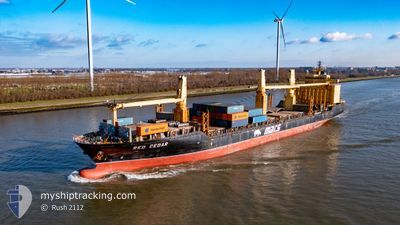
RED CEDAR
General Cargo
Current Trip
| Trip Time | 19 h, 47 mins |
|---|---|
| Trip Distance | 211.74 nm |
| AVG Speed | 9.4 Knots |
| MAX Speed | 16.1 Knots |
| Dybgang | 8.8 m |
| AVG Wind | 4.7 knots |
| MAX Wind | 20 knots |
| MIN Temp | 5.4°C / 41.72°F |
| MAX Temp | 12.1°C / 53.78°F |
| Position Modtaget | 2 m siden |
Current Position
| Longitude | --- |
|---|---|
| Latitude | --- |
| Status | Moored |
| Fart | |
| Kurs | 313° |
| Område | Balearic Sea |
| Station | T-AIS |
| Position Modtaget | 2 m siden |
Info
Information
The current position of RED CEDAR is in Balearic Sea with coordinates 41.35818° / 2.17084° as reported on 2025-03-18 01:33 by AIS to our vessel tracker app. The vessel's current speed is 0 Knots and is currently inside the port of BARCELONA.
The vessel RED CEDAR (IMO: 9231092, MMSI: 538090070) is a General Cargo that was built in 2001 ( 24 år gamle ). It's sailing under the flag of [MH] Marshall Is.
In this page you can find informations about the vessels current position, last detected port calls, and current voyage information. If the vessels is not in coverage by AIS you will find the latest position.
The current position of RED CEDAR is detected by our AIS receivers and we are not responsible for the reliability of the data. The last position was recorded while the vessel was in Coverage by the Ais receivers of our vessel tracking app.
The current draught of RED CEDAR as reported by AIS is 8.8 meters
Weather
| Temperature | 11.2°C / 52.16°F |
|---|---|
| Wind Speed | 3 knots |
| Direction | 21° NNE |
| Pressure | 1018 hPa |
| Humidity | 70 % |
| Cloud Coverage | 62 % |
Featured Company
Last Port Calls
| Port | Arrival | Departure | Time In Port |
|---|---|---|---|
| 2025-03-17 23:32 | |||
| 2025-03-15 16:12 | 2025-03-17 03:45 | 1 d | |
| 2025-03-14 00:20 | 2025-03-15 02:25 | 1 d | |
| 2025-03-08 08:33 | 2025-03-08 15:17 | 6 h | |
| 2025-03-05 22:19 | 2025-03-07 16:08 | 1 d | |
| 2025-03-04 13:58 | 2025-03-05 08:46 | 18 h | |
| 2025-03-02 17:53 | 2025-03-03 01:22 | 7 h | |
| 2025-02-25 15:41 | 2025-03-01 21:09 | 4 d | |
| 2025-02-22 14:36 | 2025-02-23 22:08 | 1 d | |
| 2025-02-20 12:00 | 2025-02-20 20:45 | 8 h |
Most Visited Ports (Last year)
| Port | Arrivals | |
|---|---|---|
| 58 | ||
| 35 | ||
| 3 | ||
| 2 | ||
| 2 | ||
| 2 |
Last Trips
| Origin | Departure | Destination | Arrival | Distance | |
|---|---|---|---|---|---|
| 2025-03-17 03:45 | 2025-03-17 23:32 | 211.74 nm | |||
| 2025-03-15 02:25 | 2025-03-15 16:12 | 188.91 nm | |||
| 2025-03-08 15:17 | 2025-03-14 00:20 | 16.53 nm | |||
| 2025-03-07 16:08 | 2025-03-08 08:33 | 188.59 nm | |||
| 2025-03-05 08:46 | 2025-03-05 22:19 | 191.36 nm | |||
| 2025-03-03 01:22 | 2025-03-04 13:58 | 6.72 nm | |||
| 2025-03-01 21:09 | 2025-03-02 17:53 | 209.14 nm | |||
| 2025-02-23 22:08 | 2025-02-25 15:41 | 188.95 nm | |||
| 2025-02-20 20:45 | 2025-02-22 14:36 | 3.25 nm | |||
| 2025-02-19 19:22 | 2025-02-20 12:00 | 206.39 nm |
Events
| Tid | Hændelsen | Detaljer | Position / Dest | Info |
|---|---|---|---|---|
| 2025-03-18 01:15 | Status er ændret | Moored Default |
41.35818 / 2.17087
[ES] BARCELONA
|
Fart: Kurs: 313° |
| 2025-03-18 01:12 | Status er ændret | Default Moored |
41.35820 / 2.17089
[ES] BARCELONA
|
Fart: Kurs: 313° |
| 2025-03-17 23:05 | Status er ændret | Moored Under way using engine |
41.35827 / 2.17094
[ES] BARCELONA
|
Fart: 0.3 kn Kurs: 312° |
| 2025-03-17 23:03 | STOP Sejllads |
41.35821 / 2.17110
[ES] BARCELONA
|
Fart: 0.3 kn Kurs: 310° |
|
| 2025-03-17 22:32 | Skibe i havn |
|
41.31371 / 2.17118
[ES] BARCELONA
|
Fart: 9.9 kn Kurs: 339.8° |
| 2025-03-17 19:42 | START Sejllads | 12.4 nm, South East of BARCELONA |
41.19321 / 2.36074
ESBCN
|
Fart: 4.2 kn Kurs: 116° |
| 2025-03-17 19:39 | STOP Sejllads | 12.29 nm, South East of BARCELONA |
41.19398 / 2.35844
ESBCN
|
Fart: 0.3 kn Kurs: 89° |
| 2025-03-17 11:02 | Ændre havområde | Spanish part of the Balearic Sea Spanish part of the Mediterranean Sea - Western Basin |
41.80979 / 3.27061
Balearic Sea
ESBCN
|
Fart: 15.8 kn Kurs: 228.2° |
| 2025-03-17 09:43 | ETA er ændret | 2025/03/17 15:00 2025/03/17 16:00 |
42.07252 / 3.55619
ESBCN
|
Fart: 15.4 kn Kurs: 227° |
| 2025-03-17 09:28 | Fundet i havområde | Spanish part of the Mediterranean Sea - Western Basin |
42.11527 / 3.61120
Mediterranean Sea - Western Basin
ESBCN
|
Fart: 15.6 kn Kurs: 223.6° |