
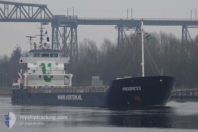
PROGRESS
General Cargo
Current Trip
| Time Travelled | 5 days |
|---|---|
| Remaining Time | 1 h, 30 mins |
| Distance Travelled | 1311.27 nm |
| Remaining Distance | 20.40 nm |
| AVG Speed | 8.9 Knopen |
| MAX Speed | 11.2 Knopen |
| AVG Wind | 12.6 knots |
| MAX Wind | 24 knots |
| MIN Temp | 3.8°C / 38.84°F |
| MAX Temp | 15.1°C / 59.18°F |
| Diepgang | 6.1 M |
| Positie ontvangen | 1 m geleden |
Current Position
| Lengtegraad | --- |
|---|---|
| Breedtegraat | --- |
| Status | Under way using engine |
| Snelheid | 8.9 Knopen |
| Koers | 333.6° |
| Gebied | Inner Seas off the West Coast of Scotland |
| Station | T-AIS |
| Positie ontvangen | 1 m geleden |
Info
Information
The current position of PROGRESS is in Inner Seas off the West Coast of Scotland with coordinates 54.73421° / -5.38848° as reported on 2026-01-04 15:33 by AIS to our vessel tracker app. The vessel's current speed is 8.9 Knopen and is heading at the port of BELFAST. The estimated time of arrival as calculated by MyShipTracking vessel tracking app is 2026-01-04 17:04 LT
The vessel PROGRESS (IMO: 9371828, MMSI: 246303000) is a General Cargo that was built in 2009 ( 17 Jaar oud ). It's sailing under the flag of [NL] Netherlands.
In this page you can find informations about the vessels current position, last detected port calls, and current voyage information. If the vessels is not in coverage by AIS you will find the latest position.
The current position of PROGRESS is detected by our AIS receivers and we are not responsible for the reliability of the data. The last position was recorded while the vessel was in Coverage by the Ais receivers of our vessel tracking app.
The current draught of PROGRESS as reported by AIS is 6.1 meters
Weather
| Temperature | 4.8°C / 40.64°F |
|---|---|
| Wind Speed | 20 knots |
| Direction | 321° NW |
| Pressure | 1011.7 hPa |
| Humidity | 73.8 % |
| Cloud Coverage | 100 % |
Featured Company
Last Port Calls
| Port | Arrival | Departure | Time In Port |
|---|---|---|---|
| 2025-12-29 11:06 | 2025-12-29 17:28 | 6 h | |
| 2025-12-18 11:30 | 2025-12-19 21:10 | 1 d | |
| 2025-12-15 12:54 | 2025-12-17 03:34 | 1 d | |
| 2025-11-28 14:53 | 2025-11-28 16:07 | 1 h | |
| 2025-11-24 10:26 | 2025-11-24 11:52 | 1 h | |
| 2025-11-22 16:39 | 2025-11-23 11:32 | 18 h | |
| 2025-11-20 22:30 | 2025-11-22 02:09 | 1 d | |
| 2025-11-09 23:30 | 2025-11-11 15:32 | 1 d | |
| 2025-11-06 15:27 | 2025-11-09 00:24 | 2 d |
Last Trips
| Origin | Departure | Destination | Arrival | Distance | |
|---|---|---|---|---|---|
| 2025-12-19 21:10 | 2025-12-29 11:06 | 2018.33 nm | |||
| 2025-12-17 03:34 | 2025-12-18 11:30 | 265.51 nm | |||
| 2025-11-28 16:07 | 2025-12-15 12:54 | 3331.18 nm | |||
| 2025-11-24 11:52 | 2025-11-28 14:53 | 20.08 nm | |||
| 2025-11-23 11:32 | 2025-11-24 10:26 | 80.63 nm | |||
| 2025-11-22 02:09 | 2025-11-22 16:39 | 148.04 nm | |||
| 2025-11-11 15:32 | 2025-11-20 22:30 | 1179.07 nm | |||
| 2025-11-09 00:24 | 2025-11-09 23:30 | 231.19 nm | |||
| 2025-10-31 06:19 | 2025-11-06 15:27 | 882.27 nm |
Events
| Tijd | Evenement | Details | Positie / Bestemming | Info |
|---|---|---|---|---|
| 2026-01-04 15:00 | ETA Changed | 2026/01/04 17:00 2026/01/04 19:00 |
54.65628 / -5.32306
GBBEL
|
Snelheid: 10.7 kn Koers: 334.3° |
| 2026-01-04 13:58 | Wijzig zee gebeid | United Kingdom part of the Inner Seas off the West Coast of Scotland United Kingdom part of the Irish Sea and St. George's Channel |
54.48203 / -5.24900
Inner Seas off the West Coast of Scotland
GBBEL
|
Snelheid: 10.2 kn Koers: 354° |
| 2026-01-04 11:16 | Status Changed | Under way using engine Default |
54.05069 / -5.19674
GBBEL
|
Snelheid: 9.6 kn Koers: 1° |
| 2026-01-04 11:15 | Binnenbereik |
54.05069 / -5.19674
Irish Sea and St. George's Channel
GBBEL
|
Snelheid: 9.6 kn Koers: 1.1° |
|
| 2026-01-04 06:51 | Status Changed | Default Under way using engine |
53.28957 / -5.26911
GBBEL
|
Snelheid: 10.4 kn Koers: 11.7° |
| 2026-01-04 06:45 | Status Changed | Under way using engine Default |
53.27421 / -5.27379
GBBEL
|
Snelheid: 10.4 kn Koers: 11° |
| 2026-01-04 06:45 | Buitenbereik |
53.27421 / -5.27379
Irish Sea and St. George's Channel
GBBEL
|
Snelheid: 10.4 kn Koers: 11.7° |
|
| 2026-01-04 06:43 | Status Changed | Default Under way using engine |
53.26663 / -5.27644
GBBEL
|
Snelheid: 10.1 kn Koers: 11.9° |
| 2026-01-04 06:29 | Status Changed | Under way using engine Default |
53.22955 / -5.29025
GBBEL
|
Snelheid: 10 kn Koers: 13° |
| 2026-01-04 06:27 | Status Changed | Default Under way using engine |
53.22227 / -5.29297
GBBEL
|
Snelheid: 10.1 kn Koers: 12.4° |