
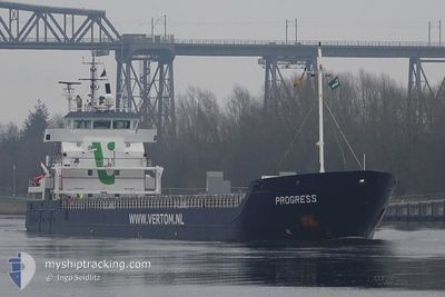
PROGRESS
General Cargo
Current Trip
| Time Travelled | 3 days |
|---|---|
| Remaining Time | 7 days |
| Distance Travelled | 545.84 nm |
| Remaining Distance | 1856.05 nm |
| AVG Speed | 9 Noeuds |
| MAX Speed | 12 Noeuds |
| AVG Wind | 7.8 knots |
| MAX Wind | 13 knots |
| MIN Temp | 6.8°C / 44.24°F |
| MAX Temp | 13°C / 55.4°F |
| Tirant d eau | 6.6 m |
| Position reçue | 20 h, 22 m depuis |
Current Position
| Longitude | --- |
|---|---|
| Latitude | --- |
| Etat | Under way using engine |
| Vitesse | 8.5 Noeuds |
| Parcours | 205.9° |
| Zone | Celtic Sea |
| Station | T-AIS |
| Position reçue | 20 h, 22 m depuis |
Information
The current position of PROGRESS is in Celtic Sea with coordinates 48.45461° / -6.10643° as reported on 2025-03-26 23:15 by AIS to our vessel tracker app. The vessel's current speed is 8.5 Noeuds and is heading at the port of NAPOLI. The estimated time of arrival as calculated by MyShipTracking vessel tracking app is 2025-04-04 06:26 LT
The vessel PROGRESS (IMO: 9371828, MMSI: 246303000) is a General Cargo that was built in 2009 ( 16 Age ). It's sailing under the flag of [NL] Netherlands.
In this page you can find informations about the vessels current position, last detected port calls, and current voyage information. If the vessels is not in coverage by AIS you will find the latest position.
The current position of PROGRESS is detected by our AIS receivers and we are not responsible for the reliability of the data. The last position was recorded while the vessel was in Coverage by the Ais receivers of our vessel tracking app.
The current draught of PROGRESS as reported by AIS is 6.6 meters
Weather
| Temperature | 12.7°C / 54.86°F |
|---|---|
| Wind Speed | 6 knots |
| Direction | 31° NNE |
| Pressure | 1021.9 hPa |
| Humidity | 78.3 % |
| Cloud Coverage | --- |
Featured Company
Last Port Calls
| Port | Arrival | Departure | Time In Port |
|---|---|---|---|
| 2025-03-22 23:40 | 2025-03-24 18:37 | 1 d | |
| 2025-03-20 22:21 | 2025-03-21 19:24 | 21 h | |
| 2025-03-17 12:22 | 2025-03-18 21:31 | 1 d | |
| 2025-03-14 10:37 | 2025-03-16 18:08 | 2 d | |
| 2025-03-09 12:34 | 2025-03-11 22:13 | 2 d | |
| 2025-03-09 04:57 | 2025-03-09 05:01 | 3 m | |
| 2025-02-26 07:07 | 2025-03-07 06:01 | 8 d | |
| 2025-02-19 13:09 | 2025-02-19 17:41 | 4 h | |
| 2025-02-08 05:16 | 2025-02-09 17:50 | 1 d | |
| 2025-02-03 15:42 | 2025-02-05 09:53 | 1 d |
Last Trips
| Origin | Departure | Destination | Arrival | Distance | |
|---|---|---|---|---|---|
| 2025-03-21 19:24 | 2025-03-23 00:40 | 207.62 nm | |||
| 2025-03-18 22:31 | 2025-03-20 22:21 | 375.53 nm | |||
| 2025-03-16 19:08 | 2025-03-17 13:22 | 170.89 nm | |||
| 2025-03-11 23:13 | 2025-03-14 11:37 | 595.92 nm | |||
| 2025-03-09 06:01 | 2025-03-09 13:34 | 81.40 nm | |||
| 2025-03-07 06:01 | 2025-03-09 05:57 | 451.94 nm | |||
| 2025-02-19 18:41 | 2025-02-26 07:07 | 1363.29 nm | |||
| 2025-02-09 20:50 | 2025-02-19 14:09 | 2065.93 nm | |||
| 2025-02-05 12:53 | 2025-02-08 08:16 | 11.03 nm | |||
| 2025-01-31 09:25 | 2025-02-03 18:42 | 747.35 nm |
Events
| Heure | Evenement | Détails | Position/ Destination | Info |
|---|---|---|---|---|
| 2025-03-26 23:17 | Etat Changé | Default Under way using engine |
48.44959 / -6.11018
ITNAP
|
Vitesse: 8.5 kn Parcours: 205.9° |
| 2025-03-26 23:15 | Hors de la zone couverte |
48.45461 / -6.10643
Celtic Sea
ITNAP
|
Vitesse: 8.5 kn Parcours: 205.9° |
|
| 2025-03-26 23:07 | Etat Changé | Under way using engine Default |
48.47125 / -6.09383
ITNAP
|
Vitesse: 8.6 kn Parcours: 204° |
| 2025-03-26 22:50 | Etat Changé | Default Under way using engine |
48.50827 / -6.06761
ITNAP
|
Vitesse: 8.9 kn Parcours: 206.2° |
| 2025-03-26 22:46 | Etat Changé | Under way using engine Default |
48.51763 / -6.06076
ITNAP
|
Vitesse: 8.9 kn Parcours: 206° |
| 2025-03-26 22:36 | Etat Changé | Default Under way using engine |
48.54047 / -6.04410
ITNAP
|
Vitesse: 9.1 kn Parcours: 206.6° |
| 2025-03-26 22:27 | Etat Changé | Under way using engine Default |
48.56193 / -6.02806
ITNAP
|
Vitesse: 9.3 kn Parcours: 205° |
| 2025-03-26 22:16 | Dans la zone couverte |
48.55893 / -6.03032
Celtic Sea
ITNAP
|
Vitesse: 9.1 kn Parcours: 206.6° |
|
| 2025-03-26 21:28 | Etat Changé | Default Under way using engine |
48.70061 / -5.92831
ITNAP
|
Vitesse: 10 kn Parcours: 206.3° |
| 2025-03-26 21:20 | Hors de la zone couverte |
48.72165 / -5.91270
Celtic Sea
ITNAP
|
Vitesse: 10 kn Parcours: 206.3° |