
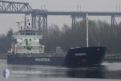
PROGRESS
General Cargo
Current Trip
FRMRS
| Time Travelled | 21 h, 16 mins |
|---|---|
| Remaining Time | --- |
| Distance Travelled | 190.81 nm |
| Remaining Distance | --- |
| AVG Speed | 10.1 Knots |
| MAX Speed | 13.4 Knots |
| AVG Wind | 16.3 knots |
| MAX Wind | 24.6 knots |
| MIN Temp | 3.6°C / 38.48°F |
| MAX Temp | 7.6°C / 45.68°F |
| Dybgang | 6.4 m |
| Position Modtaget | Nu |
Current Position
| Longitude | --- |
|---|---|
| Latitude | --- |
| Status | Under way using engine |
| Fart | 8.4 Knots |
| Kurs | 201.8° |
| Område | North Sea |
| Station | T-AIS |
| Position Modtaget | Nu |
Info
Information
The current position of PROGRESS is in North Sea with coordinates 53.43960° / 4.59553° as reported on 2026-02-23 17:08 by AIS to our vessel tracker app. The vessel's current speed is 8.4 Knots
The vessel PROGRESS (IMO: 9371828, MMSI: 246303000) is a General Cargo that was built in 2009 ( 17 år gamle ). It's sailing under the flag of [NL] Netherlands.
In this page you can find informations about the vessels current position, last detected port calls, and current voyage information. If the vessels is not in coverage by AIS you will find the latest position.
The current position of PROGRESS is detected by our AIS receivers and we are not responsible for the reliability of the data. The last position was recorded while the vessel was in Coverage by the Ais receivers of our vessel tracking app.
The current draught of PROGRESS as reported by AIS is 6.4 meters
Weather
| Temperature | 7.5°C / 45.5°F |
|---|---|
| Wind Speed | 19 knots |
| Direction | 265° W |
| Pressure | 1010.4 hPa |
| Humidity | 86.4 % |
| Cloud Coverage | 100 % |
Featured Company
Last Port Calls
| Port | Arrival | Departure | Time In Port |
|---|---|---|---|
| 2026-02-21 22:29 | 2026-02-22 20:53 | 22 h | |
| 2026-02-17 19:39 | 2026-02-19 09:45 | 1 d | |
| 2026-02-15 09:27 | 2026-02-16 08:07 | 22 h | |
| 2026-02-01 13:52 | 2026-02-09 20:33 | 8 d | |
| 2026-01-18 12:09 | 2026-01-19 16:35 | 1 d | |
| 2026-01-14 10:41 | 2026-01-14 11:18 | 36 m | |
| 2026-01-12 20:01 | 2026-01-14 09:12 | 1 d | |
| 2026-01-07 20:04 | 2026-01-09 22:04 | 2 d | |
| 2026-01-04 17:45 | 2026-01-06 07:33 | 1 d | |
| 2025-12-29 11:06 | 2025-12-29 17:28 | 6 h |
Last Trips
| Origin | Departure | Destination | Arrival | Distance | |
|---|---|---|---|---|---|
| 2026-02-19 09:45 | 2026-02-21 22:29 | 420.88 nm | |||
| 2026-02-16 08:07 | 2026-02-17 19:39 | 280.19 nm | |||
| 2026-02-09 20:33 | 2026-02-15 09:27 | 179.55 nm | |||
| 2026-01-19 16:35 | 2026-02-01 13:52 | 704.01 nm | |||
| 2026-01-14 11:18 | 2026-01-18 12:09 | 306.79 nm | |||
| 2026-01-14 09:12 | 2026-01-14 10:41 | 10.10 nm | |||
| 2026-01-09 22:04 | 2026-01-12 20:01 | 554.85 nm | |||
| 2026-01-06 07:33 | 2026-01-07 20:04 | 294.97 nm | |||
| 2025-12-29 17:28 | 2026-01-04 17:45 | 1332.08 nm | |||
| 2025-12-19 21:10 | 2025-12-29 11:06 | 2018.33 nm |
Events
| Tid | Hændelsen | Detaljer | Position / Dest | Info |
|---|---|---|---|---|
| 2026-02-23 10:57 | Ændre havområde | Dutch part of the North Sea German part of the North Sea |
53.74437 / 5.88383
North Sea
|
Fart: 7.5 kn Kurs: 251° |
| 2026-02-23 10:57 | Status er ændret | Under way using engine Default |
53.74437 / 5.88383
FRMRS
|
Fart: 7.3 kn Kurs: 252° |
| 2026-02-23 10:49 | Indenfor Dækning |
53.74437 / 5.88383
North Sea
|
Fart: 7.5 kn Kurs: 251° |
|
| 2026-02-23 06:50 | Status er ændret | Default Under way using engine |
53.91167 / 6.83500
FRMRS
|
Fart: 9.8 kn Kurs: 256.9° |
| 2026-02-23 06:47 | Udenfor Dækning |
53.91499 / 6.85265
North Sea
|
Fart: 9.8 kn Kurs: 256.9° |
|
| 2026-02-23 06:08 | Status er ændret | Under way using engine Default |
53.93956 / 7.02435
FRMRS
|
Fart: 9.6 kn Kurs: 257° |
| 2026-02-23 05:42 | Status er ændret | Default Under way using engine |
53.95500 / 7.14333
FRMRS
|
Fart: 9.6 kn Kurs: 256.9° |
| 2026-02-23 05:37 | Status er ændret | Under way using engine Default |
53.95952 / 7.16546
FRMRS
|
Fart: 9.6 kn Kurs: 256° |
| 2026-02-23 05:18 | Status er ændret | Default Under way using engine |
53.97093 / 7.24679
FRMRS
|
Fart: 9.5 kn Kurs: 256.3° |
| 2026-02-23 05:15 | Status er ændret | Under way using engine Default |
53.97310 / 7.26216
FRMRS
|
Fart: 9.4 kn Kurs: 257° |