
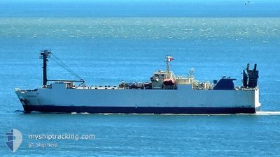
MINDORO
Vehicles Carrier
Current Trip
| Time Travelled | 5 days |
|---|---|
| Remaining Time | 1 h, 45 mins |
| Distance Travelled | 1096.74 nm |
| Remaining Distance | 14.73 nm |
| AVG Speed | 10.9 Knopen |
| MAX Speed | 13.5 Knopen |
| AVG Wind | 12.6 knots |
| MAX Wind | 31.7 knots |
| MIN Temp | 16.8°C / 62.24°F |
| MAX Temp | 27.5°C / 81.5°F |
| Diepgang | 6.2 M |
| Positie ontvangen | 9 m geleden |
Current Position
| Lengtegraad | 121.14376° |
|---|---|
| Breedtegraat | 25.27989° |
| Status | Under way using engine |
| Snelheid | 8.5 Knopen |
| Koers | 292.4° |
| Gebied | South China Sea |
| Station | T-AIS |
| Positie ontvangen | 9 m geleden |
Info
Information
The current position of MINDORO is in South China Sea with coordinates 25.27989° / 121.14376° as reported on 2024-05-01 13:38 by AIS to our vessel tracker app. The vessel's current speed is 8.5 Knopen and is heading at the port of TAIPEI. The estimated time of arrival as calculated by MyShipTracking vessel tracking app is 2024-05-01 15:33 LT
The vessel MINDORO (IMO: 9310795, MMSI: 351287000) is a Vehicles Carrier that was built in 2004 ( 20 Jaar oud ). It's sailing under the flag of [PA] Panama.
In this page you can find informations about the vessels current position, last detected port calls, and current voyage information. If the vessels is not in coverage by AIS you will find the latest position.
The current position of MINDORO is detected by our AIS receivers and we are not responsible for the reliability of the data. The last position was recorded while the vessel was in Coverage by the Ais receivers of our vessel tracking app.
The current draught of MINDORO as reported by AIS is 6.2 meters
Weather
| Temperature | 20.8°C / 69.44°F |
|---|---|
| Wind Speed | 21 knots |
| Direction | 67° ENE |
| Pressure | 1013.5 hPa |
| Humidity | 90.4 % |
| Cloud Coverage | 100 % |
Featured Company
Last Port Calls
| Port | Arrival | Departure | Time In Port |
|---|---|---|---|
| 2024-04-25 22:32 | 2024-04-26 09:17 | 10 h | |
| 2024-04-22 22:19 | 2024-04-23 07:08 | 8 h | |
| 2024-04-19 19:47 | 2024-04-20 05:08 | 9 h | |
| 2024-04-14 03:50 | 2024-04-15 10:14 | 1 d | |
| 2024-04-07 19:30 | 2024-04-08 12:13 | 16 h | |
| 2024-04-03 15:27 | 2024-04-04 05:39 | 14 h | |
| 2024-03-28 08:26 | 2024-03-30 07:47 | 1 d | |
| 2024-03-25 22:58 | 2024-03-27 01:11 | 1 d | |
| 2024-03-24 00:59 | 2024-03-24 06:56 | 5 h | |
| 2024-03-17 13:25 | 2024-03-18 07:48 | 18 h |
Last Trips
| Origin | Departure | Destination | Arrival | Distance | |
|---|---|---|---|---|---|
| 2024-04-23 16:08 | 2024-04-26 07:32 | 368.54 nm | |||
| 2024-04-20 14:08 | 2024-04-23 07:19 | 617.62 nm | |||
| 2024-04-15 18:14 | 2024-04-20 04:47 | 1330.70 nm | |||
| 2024-04-08 19:13 | 2024-04-14 11:50 | 1200.66 nm | |||
| 2024-04-04 13:39 | 2024-04-08 02:30 | 925.57 nm | |||
| 2024-03-30 16:47 | 2024-04-03 23:27 | 1207.02 nm | |||
| 2024-03-27 10:11 | 2024-03-28 17:26 | 364.23 nm | |||
| 2024-03-24 15:56 | 2024-03-26 07:58 | 385.76 nm | |||
| 2024-03-18 14:48 | 2024-03-24 09:59 | 1646.68 nm | |||
| 2024-03-12 17:14 | 2024-03-17 20:25 | 877.78 nm |
Events
| Tijd | Evenement | Details | Positie / Bestemming | Info |
|---|---|---|---|---|
| 2024-05-01 13:40 | Status Changed | Default Under way using engine |
25.28167 / 121.13834
TW TPE
|
Snelheid: 8.5 kn Koers: 292.4° |
| 2024-05-01 13:27 | Status Changed | Under way using engine Default |
25.26848 / 121.17020
TW TPE
|
Snelheid: 8 kn Koers: 297° |
| 2024-05-01 13:22 | Status Changed | Default Under way using engine |
25.26333 / 121.18166
TW TPE
|
Snelheid: 8.6 kn Koers: 282.4° |
| 2024-05-01 13:17 | Status Changed | Under way using engine Default |
25.25934 / 121.19555
TW TPE
|
Snelheid: 4 kn Koers: -1° |
| 2024-05-01 13:17 | Binnenbereik |
25.25934 / 121.19555
South China Sea
|
Snelheid: 8.6 kn Koers: 282.4° |
|
| 2024-05-01 13:05 | Start beweging | 8.84 nm, North West of LINKOU |
25.25833 / 121.21333
TW TPE
|
Snelheid: 4 kn Koers: -1° |
| 2024-05-01 09:13 | Stop beweging | 13.52 nm, North West of LINKOU |
25.30333 / 121.13333
TW TPE
|
Snelheid: Koers: -1° |
| 2024-05-01 01:21 | Status Changed | Default Under way using engine |
25.23234 / 121.13937
TW TPE
|
Snelheid: 1.3 kn Koers: 283° |
| 2024-05-01 01:13 | Status Changed | Under way using engine Default |
25.23428 / 121.13731
TW TPE
|
Snelheid: 1.2 kn Koers: 269° |
| 2024-05-01 01:13 | Buitenbereik |
25.23428 / 121.13731
South China Sea
|
Snelheid: 1.3 kn Koers: 140.9° |