
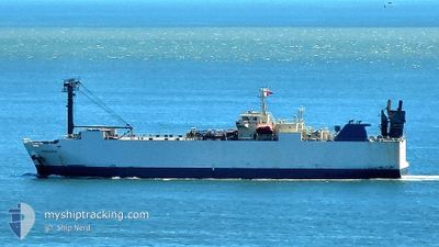
MINDORO
Vehicles Carrier
Current Trip
| Time Travelled | 5 days |
|---|---|
| Remaining Time | --- |
| Distance Travelled | 1105.43 nm |
| Remaining Distance | --- |
| AVG Speed | 10.9 Knop |
| MAX Speed | 13.5 Knop |
| AVG Wind | 12.8 knots |
| MAX Wind | 31.7 knots |
| MIN Temp | 16.8°C / 62.24°F |
| MAX Temp | 27.5°C / 81.5°F |
| Djupgående | 6.2 m |
| Position mottagen | 1 m sen |
Current Position
| Longitud | 121.14449° |
|---|---|
| Latitude | 25.28465° |
| Status | Under way using engine |
| Fart | 2.3 Knop |
| Kurs | 86° |
| Område | South China Sea |
| Station | T-AIS |
| Position mottagen | 1 m sen |
Info
Information
The current position of MINDORO is in South China Sea with coordinates 25.28465° / 121.14449° as reported on 2024-05-01 17:18 by AIS to our vessel tracker app. The vessel's current speed is 2.3 Knop
The vessel MINDORO (IMO: 9310795, MMSI: 351287000) is a Vehicles Carrier that was built in 2004 ( 20 År gammal ). It's sailing under the flag of [PA] Panama.
In this page you can find informations about the vessels current position, last detected port calls, and current voyage information. If the vessels is not in coverage by AIS you will find the latest position.
The current position of MINDORO is detected by our AIS receivers and we are not responsible for the reliability of the data. The last position was recorded while the vessel was in Coverage by the Ais receivers of our vessel tracking app.
The current draught of MINDORO as reported by AIS is 6.2 meters
Weather
| Temperature | 21.3°C / 70.34°F |
|---|---|
| Wind Speed | 19 knots |
| Direction | 60° ENE |
| Pressure | 1012.6 hPa |
| Humidity | 87.3 % |
| Cloud Coverage | 100 % |
Featured Company
Last Port Calls
| Port | Arrival | Departure | Time In Port |
|---|---|---|---|
| 2024-04-25 22:32 | 2024-04-26 09:17 | 10 h | |
| 2024-04-22 22:19 | 2024-04-23 07:08 | 8 h | |
| 2024-04-19 19:47 | 2024-04-20 05:08 | 9 h | |
| 2024-04-14 03:50 | 2024-04-15 10:14 | 1 d | |
| 2024-04-07 19:30 | 2024-04-08 12:13 | 16 h | |
| 2024-04-03 15:27 | 2024-04-04 05:39 | 14 h | |
| 2024-03-28 08:26 | 2024-03-30 07:47 | 1 d | |
| 2024-03-25 22:58 | 2024-03-27 01:11 | 1 d | |
| 2024-03-24 00:59 | 2024-03-24 06:56 | 5 h | |
| 2024-03-17 13:25 | 2024-03-18 07:48 | 18 h |
Last Trips
| Origin | Departure | Destination | Arrival | Distance | |
|---|---|---|---|---|---|
| 2024-04-23 16:08 | 2024-04-26 07:32 | 368.54 nm | |||
| 2024-04-20 14:08 | 2024-04-23 07:19 | 617.62 nm | |||
| 2024-04-15 18:14 | 2024-04-20 04:47 | 1330.70 nm | |||
| 2024-04-08 19:13 | 2024-04-14 11:50 | 1200.66 nm | |||
| 2024-04-04 13:39 | 2024-04-08 02:30 | 925.57 nm | |||
| 2024-03-30 16:47 | 2024-04-03 23:27 | 1207.02 nm | |||
| 2024-03-27 10:11 | 2024-03-28 17:26 | 364.23 nm | |||
| 2024-03-24 15:56 | 2024-03-26 07:58 | 385.76 nm | |||
| 2024-03-18 14:48 | 2024-03-24 09:59 | 1646.68 nm | |||
| 2024-03-12 17:14 | 2024-03-17 20:25 | 877.78 nm |
Events
| Tid | Event | Detaljer | Position / Dest | Information |
|---|---|---|---|---|
| 2024-05-01 17:18 | Status ändrad | Under way using engine Default |
25.28469 / 121.14437
TW TPE
|
Fart: 7 kn Kurs: 92° |
| 2024-05-01 16:43 | STARTAR förflyttning | 15.22 nm, North West of LINKOU |
25.28667 / 121.07166
TW TPE
|
Fart: 6 kn Kurs: 93° |
| 2024-05-01 16:31 | Status ändrad | Default Under way using engine |
25.28500 / 121.06333
TW TPE
|
Fart: 1.5 kn Kurs: 328° |
| 2024-05-01 16:18 | Status ändrad | Under way using engine Default |
25.28602 / 121.07169
TW TPE
|
Fart: 1 kn Kurs: -1° |
| 2024-05-01 15:37 | Status ändrad | Default Under way using engine |
25.28833 / 121.08833
TW TPE
|
Fart: 1.1 kn Kurs: 326° |
| 2024-05-01 15:12 | Status ändrad | Under way using engine Default |
25.29122 / 121.09775
TW TPE
|
Fart: Kurs: -1° |
| 2024-05-01 15:12 | I täckningsområde |
25.29122 / 121.09775
South China Sea
|
Fart: 0.9 kn Kurs: 254.9° |
|
| 2024-05-01 13:59 | STOPPAR förflyttning | 13.81 nm, North West of LINKOU |
25.29500 / 121.11500
TW TPE
|
Fart: Kurs: -1° |
| 2024-05-01 13:40 | Status ändrad | Default Under way using engine |
25.28167 / 121.13834
TW TPE
|
Fart: 8.5 kn Kurs: 292.4° |
| 2024-05-01 13:38 | UTANFÖR täckningsområde |
25.27989 / 121.14376
South China Sea
|
Fart: 8.5 kn Kurs: 292.4° |